Alaskan Adventure: Days 81 – 85. Three nights at Whitehorse and one night each at Watson Lake and Dease Lake. The first day in Whitehorse was the bus and train ride to Skagway and back (covered in the previous post). The second day in Whitehorse Becky went to get her nails done and to a laundromat while I rode with Mike and Amy to visit the fish ladder and the “Yukon Wildlife Preserve.” The afternoon was spent doing grocery shopping, pressure washing the RV and tow car, and changing the oil in the RV. Leaving Whitehorse on the 23rd, we drove east and retraced our drive back to Watson Lake via the Alaskan Highway (Watson Lake is where we had visited the Signpost Forest previously). Then the next day we drove south to the town of Dease Lake via a different road called the Stewart-Cassiar Highway. Lots of driving but the roads gradually improve a bit going south where there are more people, better maintenance, and less permafrost. The scenery along the highway was beautiful.

We were back to Whitehorse where we had stayed on the early part of our trip up into Alaska. The city gets it’s name from the White Horse Rapids on the Yukon River.

$249 dollars (Canadian dollars) for a gas fill-up for the 55 gallon tank on the RV was not uncommon.

The starry night sky from our campsite at Whitehorse.

Salmon runs are incredibly important to most northern communities.
The White Horse rapids (that the gold rush miners had to navigate in their hand-made boats) have been replaced with a hydroelectric dam. The dam provides power and the “World’s Longest Wooden Fish Ladder” provides a way for returning salmon to continue upstream around the dam.

Mike pondering a portion of the fish ladder from the viewing platform.

Path of the Yukon River from Bering Sea to Dawson City and Whitehorse, Yukon.

2,000 miles, without eating, all swimming upstream. I cannot wrap my brain around that…
Imagine if a salmon moves upstream one foot upstream for every tail flip-it, would take over 10 Million tail flips to go 2,000 miles…
It would take a person walking 20 miles a day, without any breaks (into a raging headwind and without eating) over 3 months to walk that far… how fish can do that is beyond me.

Another map showing the Yukon River 2,000 mile salmon spawning route from the Bering Sea to Whitehorse.
For a sense of that; the drive from Indianapolis to Los Angeles, California is about 2,000 miles.
After the visiting the fish ladder and a breakfast of crepes at the hard to find “Crêperie La Petite Maison” in Whitehorse, we went on a guided tour at the cleverly named “Yukon Wildlife Preserve”. The next group of photos is from the Preserve visit.


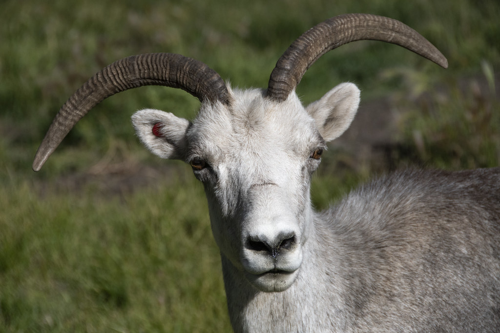


The Lynx was cool but hard to photograph through fencing.


That’s it for Whitehorse. The next morning we headed southeast on the Alaskan Highway to cross from Yukon back into British Columbia and the town of Watson Lake.
Passing through Teslin, Yukon and crossing the Nisutlin Bay Bridge. We had camped here at the Yukon Motel & Restaurant on the way up the Alaskan Highway.
Just a video of driving the Alaskan Highway.
We needed to get gas in Watson Lake before heading south the next morning on the Stewart-Cassier Highway. Here’s a video of driving through Watson Lake past the Signpost Forest for a sense of how crazy many signposts are there. There is not much to this town but they work hard to make it a tourist destination.


Picture of a roadside map where we stopped at “Rabid Grizzly”. Highway 37 is what we were traveling south on when we left Watson Lake. The highway is usually called the “Stewart-Cassiar Highway”. The gray portion of the map at the top is Yukon Territory, the tan colored is British Colombia, and the White is Alaska. Skagway, Carcross, and Whitehorse are at the top left.

Screenshot from my phone showing generally where we were now and a bunch of other gray dots showing places we had been and were planning to go. The lowest gray dot below where we were currently located at Dease Lake is Prince George. Prince George is where the group trip would end. We still had quite a way to go.

Colorful rock cut along the way. There was a pull-off area where we took a break here.


Dease Lake from the campground dock. Back in 1837, Robert Campbell established a Hudson’s Bay Trading Post on this lake. At that time is was not welcome because it created fur trading competition with the local native communities.

Stacked rocks on the shore of Dease Lake.

The hand drawn map of Dease Lake Waters Edge Campground is “rustic” like the campsites. This campground provided a spot to pull in and stay the night but that’s it. No electric, no water, no sewer, no showers. This is “off grid” camping (there was a pit toilet). To be fair, this is the only campground, at the biggest town around. We ran the generator in the morning to make coffee but we did fine with battery power for everything else that night.

There is one gas station in the town of Dease Lake (population 200’ish). The gas pumps are covered in stickers from Stewart-Cassiar Highway travelers. Apparently this is a really popular “thing” slapping stickers on stuff everywhere. Many of the stickers are custom made for people’s ‘trip of a lifetime’. Big Foot seemed to be a popular theme.
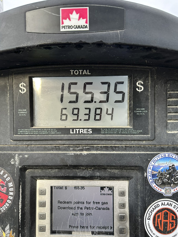
Leaving Dease Lake in the morning we filled up with possibly the most expensive gas on the trip. That translates right at $9.00 a gallon in Canadian dollars, or $6.42 in US dollars.
Next stop is the towns of Stewart, British Colombia and Hyder, Alaska.
Favorite Bible verse for today: Psalm 16:11
“You will make known to me the path of life; In Your presence is fullness of joy; In Your right hand there are pleasures forever.”

