Alaskan Adventure: Days 79 & 80. The Klondike Highway out of Dawson, 219 miles to Carmacks was mostly paved but very rugged. Because we were still so far north the roads are less maintained and built on frozen ground. Sort of sad that we were now headed south toward the end of the trip. After a one night stay in Carmacks we continued south arrive back in Whitehorse where we had stayed on our way “up” to Alaska. I only have photos of the day from Dawson City to Carmacks. The main things I remember about the leg from Carmacks to Whitehorse were that the roads continued to improve a bit as we went further south, and driving past Lake Laberge. Lake Laberge figures heavily in “The Cremation of Sam McGee” by Robert Service.
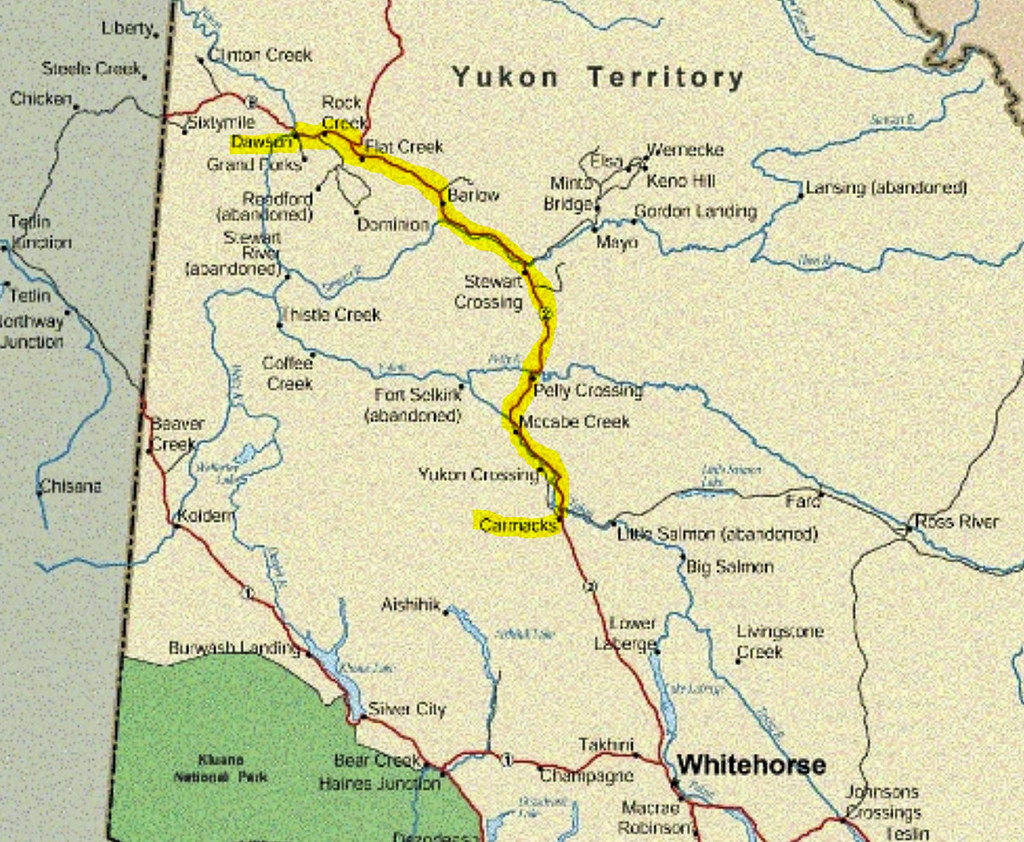
Our drive from Dawson City to Carmacks is highlighted in yellow. (the other red road from Whitehorse to Beaver Creek) is the Alaskan Highway that we came up on at the beginning of the trip.

We pulled out of Dawson City and didn’t get very far when Becky said “didn’t we need to get gas before we left”? So we turned around and went back to this gas station. $236 (Canadian) for 107 Liters (28 gallons). Walk in and tell the cashier how much and that’s what they charge. They have no idea what is on the pump. Very trusting. The old gas pumps are from back in the days when attendants pumped gas and made change for cash payments. Thanks to Starlink they can now run a credit card. That’s about $8.40/gallon Canadian or $6.00/gallon US.

Stunningly beautiful mountainscapes. Absolute wilderness seemed to stretch forever.

Beautiful mountains and a cool lenticular cloud

Panorama of the Tintina Trench area. It is impossible to describe the beautiful landscapes along the drive.

I had never heard of the Tintina Trench that runs generally along the route we were traveling. Two sections of earth, 620 miles long, have slide 270 miles along this faultline/trench.

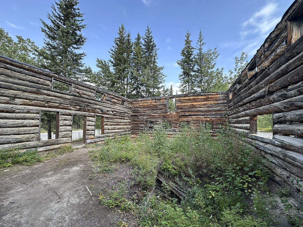

Remains of an old Roadhouse on the Overland Trail. Roadhouses amounted to civilization and safety for early travelers. Roadhouses were an interesting part of the trip. Imagining travelers on foot or dogsleds, then early trucks and automobiles brought some of the history to life. People were a lot tougher back then.
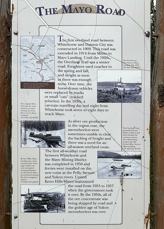
We stopped for a break at Steward Crossing. This sign explains that the first road from Whitehorse to Dawson City was completed in 1902. It was called “The Overland Trail” and was only a “winter road” until the 1920’s. Throughout Alaska and Yukon that was a familiar comment even today-that getting around on frozen ground is more practical than the muddy summer months.

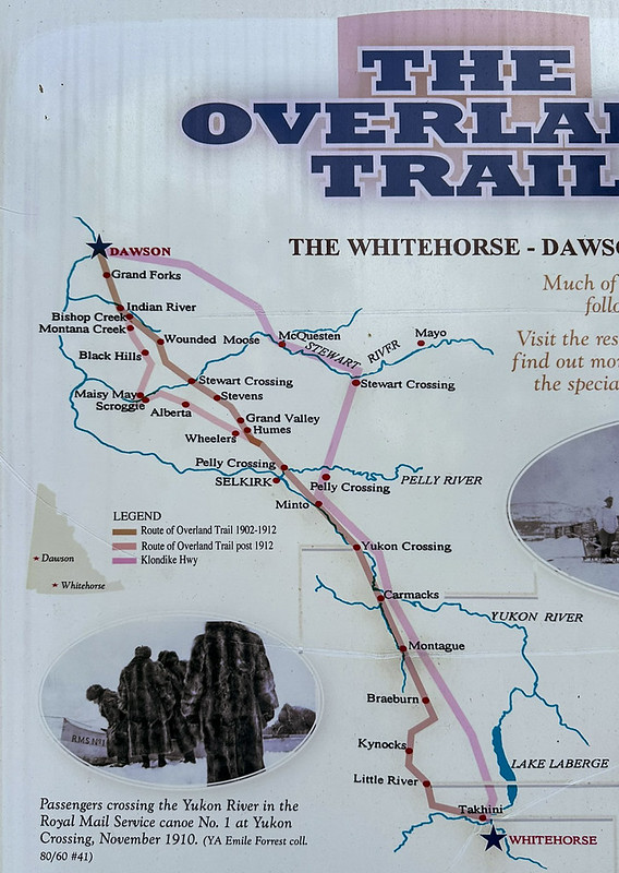
More on the Overland Trail and how the path of the trail changed over time.

Overlook at Pelly Crossing.
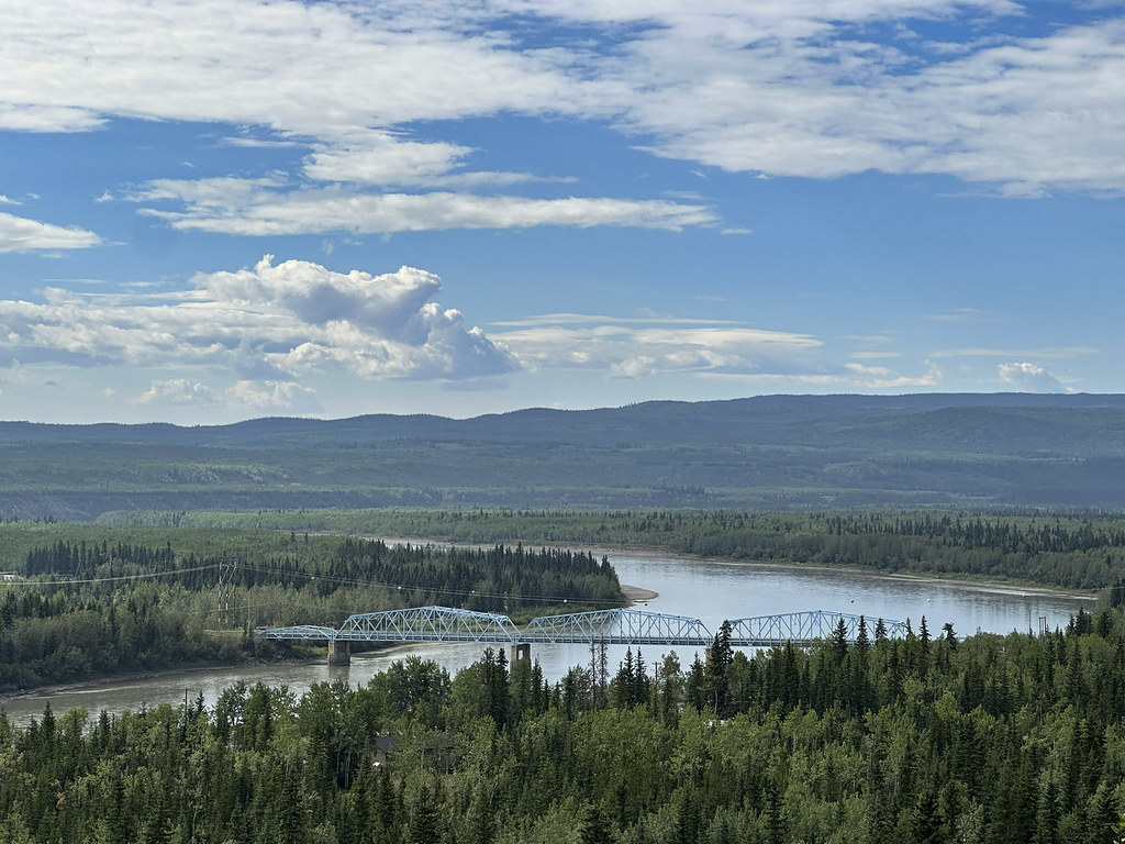
The bridge at Pelly Crossing (crossing the Pelly River).
Example of driving the Klondike Highway (the old Overland Trail) where bad pavement turns into rough gravel. We slow way down in the RV but Alaskan drivers speed right on by… By “pavement” I don’t mean asphalt. Much of what looks like asphalt is very compacted and smooth graded oiled gravel.
Example of “road construction” seems more like road “destruction”. The relatively smooth oiled gravel road is being ripped up with a spike-toothed harrow followed by a disc harrow to break up the road and remake it-hopefully smoother.

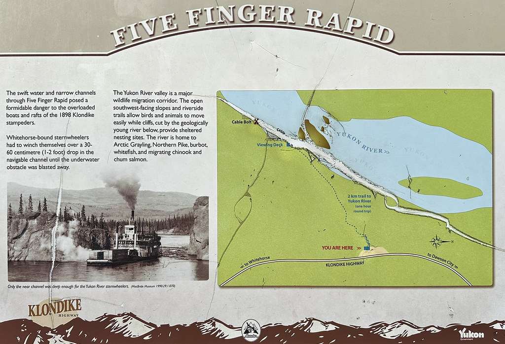
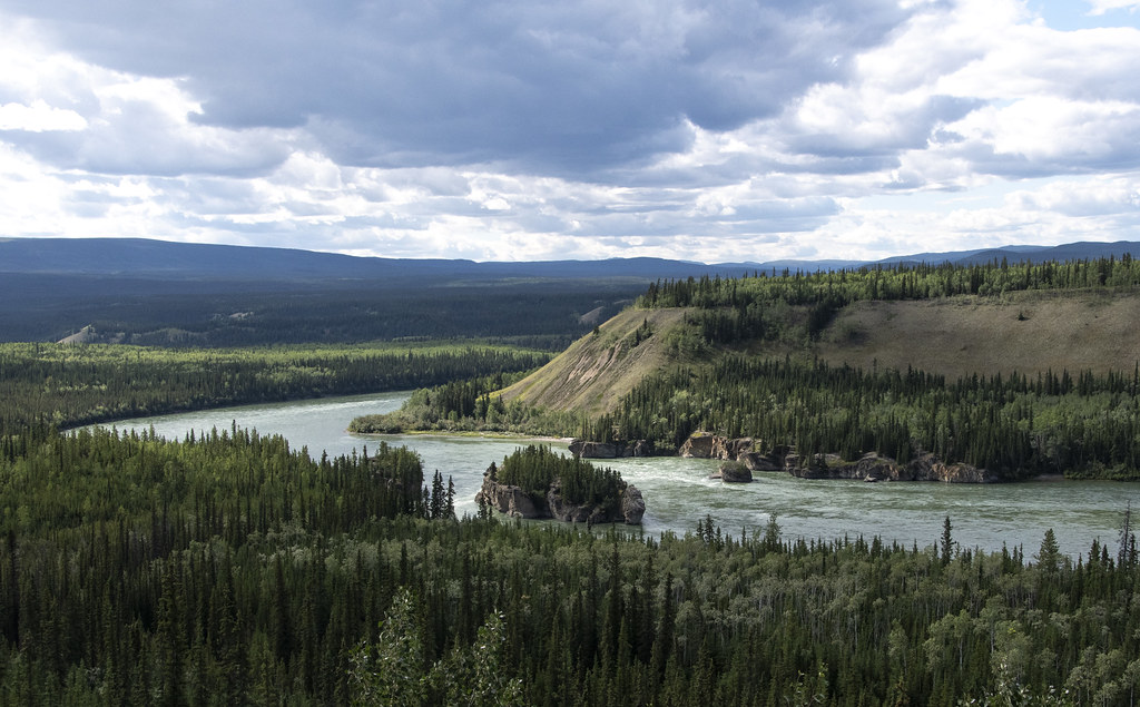
Five Fingers Rapids on the Yukon River was a difficult obstacle for early river travelers.

Closeup of Five Fingers Rapids. The water really shoots through here and was probably more exciting before some of it was blasted away to make river boat travel easier.

This map of glaciation as we neared Carmacks was a reminder of our visit to Beringia Centre early on the trip when we were first in Whitehorse.
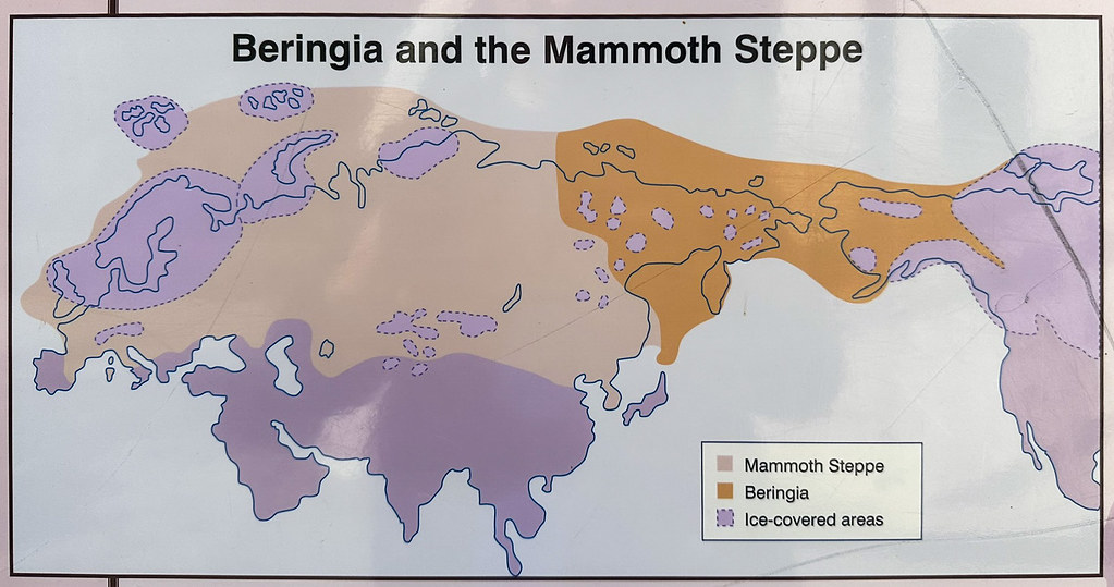
The orange showing area that was dry ground not covered in ice when oceans were lower and ice covered the purple areas.

Our campsite at Carmacks was right alongside the Yukon River. That’s the Yukon River Bridge.

Nice rainbow after some sprinkles passed over.

There was supposed to be Northern Lights visible the night we were in Carmacks. It was cloudy when I got up to look. I don’t know if the green in this pic is from Northern Lights above the clouds or not? (I like to imagine it is).
The next day we traveled 115 miles to Whitehorse. No pictures. We were looking forward to not driving on bad roads and staying in one spot for three nights. The RV and the tow car were covered in mud. The Whitehorse RV Park had an RV wash area and an area to change oil; both badly needed and accomplished. The next morning we took a bus and train to visit Skagway (Alaska) which will be the next post.

