Dawson City, “The City of Gold” – August 15-18

Alaskan Adventure: Days 76-79. An incredible city, with an incredible history.

Before the Klondike Gold Rush began in August 1896, Dawson City did not exist as a town; the site along the Yukon River, at the confluence of the Klondike River, was primarily a seasonal salmon-drying and fishing camp used by the Indigenous Trʼondëk Hwëchʼin First Nation (full time population-zero). By winter of that same year, about 500 gold seekers were settling into the town that Prospector Joe Ladue and merchant Arthur Harper staked out on the river mudflats. For the next 2 years the fledgling city would explode to 17,000 people at it’s height.

Below is a 1901 picture of a Hotel, Photography Studio, and Hardware store on 3rd Avenue. The photo below that is their condition today. Built on frozen ground (permafrost) the footings have settled down into the old mucky river mud.

Day 76_Dawson City_DAD4291
Day 76_Dawson City_DAD4289

The 3rd Avenue Hotel, Photography Studio, and Hardware Store today.

Day 76_Dawson City_DAD4292
Day 76_Dawson City_DAD4293

Other old buildings around town.

Day 76_Dawson City_DAD4286
Day 76_Dawson City_DAD4285

The old Post Office has been completely rebuilt and is beautiful inside.

Day 76_Dawson City_DAD4275
Day 76_Dawson City_DAD4272

Saint Andrews is still standing but just barely. Sad to see these historic places crumbling but at the same time it gives visitors a chance to feel the history of this place.

Day 76_Dawson City_DAD4276
Day 76_Dawson CityUntitled_Panorama-1

Saint Andrews today.

Day 76_Dawson City_DAD4295
Day 76_Dawson CityIMG_1735

The streets throughout Dawson City remain dirt (and mud the morning we first visited was rainy), but much of the wooden sidewalks are replaced and many buildings are new or restored to fit the character of Old Dawson City.

The scar on the mountainside seen on the photos above and below is a landmark feature of Dawson City. It is at the north end of the city which is also where the ferry operates so it is very prominent while waiting to cross the river and at the landing on the Dawson City side. The locals call it “Moosehide Slide”. It is known as Ëdhä Dädhëcha by the local Tr’ondëk Hwëch’in First Nation, meaning “Weathered Moosehide Hanging”.
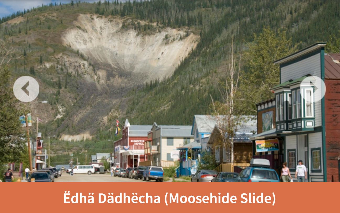
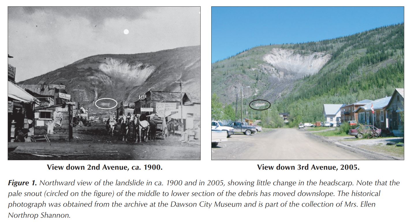
Interesting photos about 100 years apart of the landslide. Also interesting that in 1900 ALL the trees had been cut down for the town, the sternwheeler ships, and fuel for winter heating.
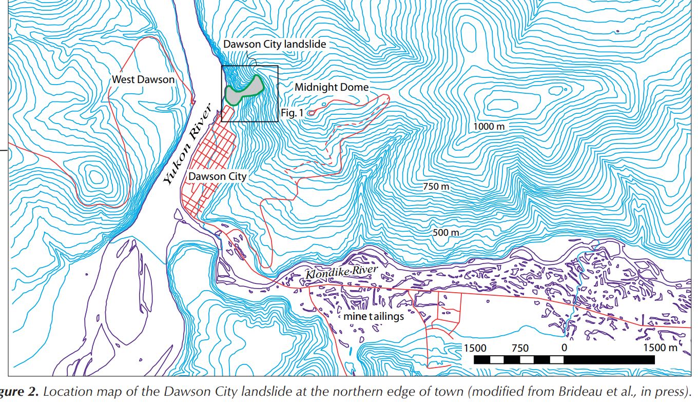
Red line on the West Dawson side of the Yukon River is the Top of the World Highway ending at the ferry landing on the west side. The Klondike River originally ran on the south side of the valley. Gold dredge mining and mine tailings moved the river to the north side of the valley. The two screenshots above were found at this website: https://emrlibrary.gov.yk.ca/ygs/yeg/2006/2006_p123-138.pdf

Day 76_Dawson CityIMG_1767

Dawson City illustration 1903, before dike along the river and before gold dredges in the Klondike River Valley.

Since 1898 there have been 22 recorded floods of Dawson City. The floods typically occur in the spring with high meltwater during ice breakup. 1979 was one of the worst. The city tried but failed to keep the water out with a sandbag dike along the Yukon and Klondike rivers. Following that flood a permanent 2 meter high dike was built along the river. The top of the dike is a walking path.

Day 76_Dawson CityIMG_1736

Inside the Red Feather Saloon

Day 76_Dawson CityIMG_1784

Old photo of the Red Feather Saloon.

Day 76_Dawson CityIMG_1734

Inside the British North America Bank.
Day 76_Dawson CityIMG_1746
Day 76_Dawson CityIMG_1744

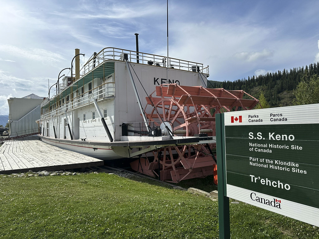
It’s hard to tell in the photos but the S.S. Keno is placed on top of the dike between the Yukon River and Front Street.

Day 76_Dawson CityIMG_1733

This Sternwheeler was built in Whitehorse in 1922. It was primarily used to haul silver-lead concentrate and had only a 2′ deep draft to navigate shallow rivers. It was retired in 1951.

Day 76_Dawson CityIMG_1843
Day 76_Dawson CityIMG_1842

We learned that the reason the ferry was so busy on the Friday we arrived was because of people arriving to participate in the Dawson City Annual Discovery Day Parade and other festivities.

Day 76_Dawson CityIMG_1738

Robert Service lived and wrote much of his prose (he did not want it called poetry) in Dawson City. We visited his cabin which still remains.

Day 76_Dawson CityIMG_1750
Day 76_Dawson CityIMG_1758

Robert Service cabin.

Day 76_Dawson CityIMG_1749
Day 76_Dawson CityIMG_1751

Inside the cabin.

Day 76_Dawson City_DAD4283

View looking down into Dawson City from the uppermost street on the mountainside. The Robert Service cabin is up on that street.

Day 76_Dawson City_DAD4279
Day 76_Dawson City_DAD4280

The old cemetery, with wooden headstones, is also up on the mountainside street.

Day 76_Dawson CityIMG_1790

A Dawson City tragedy in 1918. The Lynn Canal is a natural glacially carved fjord (not a manmade canal). It is over 2,000 feet deep; the deepest in North America except for Greenland. Becky and I were on a cruise ship to Juneau in 2018 and on a tour boat just weeks ago when we sailed from Haines to Juneau and back on the Lynn Canal…

Day 76_Dawson CityIMG_1783
Day 76_Dawson CityIMG_1777
Day 76_Dawson CityIMG_1780
Day 76_Dawson CityIMG_1782
Day 76_Dawson CityIMG_1775
Day 76_Dawson CityIMG_1773
Day 76_Dawson CityIMG_1776
Day 76_Dawson CityIMG_1772
Day 76_Dawson CityIMG_1770

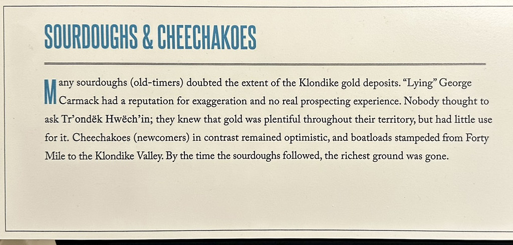
Dawson City Museum had lots of info on gold rush days and early days in Dawson City.
Day 76_Dawson CityIMG_1771
Day 76_Dawson CityIMG_1769
Day 76_Dawson CityIMG_1768

Interesting food choices.

Day 76_Dawson CityIMG_1789

Shave and a haircut, two bits…

Day 76_Dawson CityIMG_1838

Jack London’s Cabin. We visited the Jack London Museum.

Day 76_Dawson CityUntitled_Panorama-7

Inside one half of Jack London’s cabin. The other half of the cabin is in Jack London Square in Oakland, California. London had carved “Jack London, miner author, Jan. 27, 1898” into the back wall logs of his cabin in 1898. There is a fascinating story about this cabin that you can read about here: https://jacklondonmuseum.ca/wp-content/uploads/2016/12/Jack-London-Cabin-updated-Dec-5-ks.pdf

Day 76_Dawson CityIMG_1830
Day 76_Dawson CityIMG_1831
Day 76_Dawson CityIMG_1832

List of books by Jack London and some local history on his famous “Call of the Wild” book and the dog “Buck”.

Day 76_Dawson CityIMG_1833

Historic incident that inspired the Jack London book “The Unexpected”

Day 76_Dawson CityIMG_1836

Another historic incident that was included in Jack London’s boo “The League of Old Men”

Day 76_Dawson CityIMG_1837
Day 76_Dawson CityIMG_1835
Day 76_Dawson CityIMG_1834

Couple of paintings I liked at the Jack London Museum. They are both of his cabin and food cache.

Day 76_Dawson CityIMG_1826
Day 76_Dawson CityIMG_1825

We ate dinner with Mike and Amy at Sourdough Joe’s. The fish was delicious and we somehow didn’t get rained on.

Day 76_Dawson CityIMG_1824
Day 76_Dawson CityIMG_1823

Sourdough Joe’s menu has interesting early days history of Dawson City. Here’s a link to a Park’s Canada website with lots of early history of the early gold rush days: http://parkscanadahistory.com/series/chs/26/chs26-1g.htm

Individual miners quickly exhausted the surface gold. In only a few years their individual claims were bought up by large corporations. The corporations funded huge dredging machines that could only be profitable with large tracts of land processing tons of gold bearing gravel.

Day 76_Dawson CityIMG_1828

Model of a gold dredge in the Dawson City Visitors Center

Day 76_Dawson CityUntitled_Panorama-5

The real thing. We toured Historic Gold Dredge No.4; the largest wooden-hulled bucket-line gold dredge in North America.

Day 76_Dawson CityIMG_1792
Day 76_Dawson CityIMG_1803

Our tour guide describing how the dredge worked and some of the steel pieces used to “stratify” or separate the gold from the gravel the dredge brought up. The fiber mat is the last step. The heavy gold would settle into the mat and be collected from there.

Day 76_Dawson CityIMG_1802

Buckets of Gold

Day 76_Dawson CityIMG_1812
Day 76_Dawson CityIMG_1805
Day 76_Dawson CityIMG_1804
Day 76_Dawson CityIMG_1793

Huge direct current electric motors drove all the machinery.

Day 76_Dawson CityIMG_1795
Day 76_Dawson CityIMG_1794

Huge gears made intense screeching and grinding noise. No grease or oil was used because gold is strongly attracted to grease and oil. Gold flakes coated in oil would float or attach to bubbles and not settle by gravity to be captured. The noise from the gravel and metal working through the dredge could be heard constantly from miles away. Most dredge workers were deaf or very nearly deaf.

Day 76_Dawson CityIMG_1801

View looking into the “trommel”. One of the last stages of gravel/gold separation. The gravel that was dredged up has already been washed and the big rocks removed. The wet washdown gravel and sand was fed into this trommel which had water being sprayed into it by the pipe in the center. The heavy gold bits washed down out of the trommel while the rocks got fed out the back of the dredge.
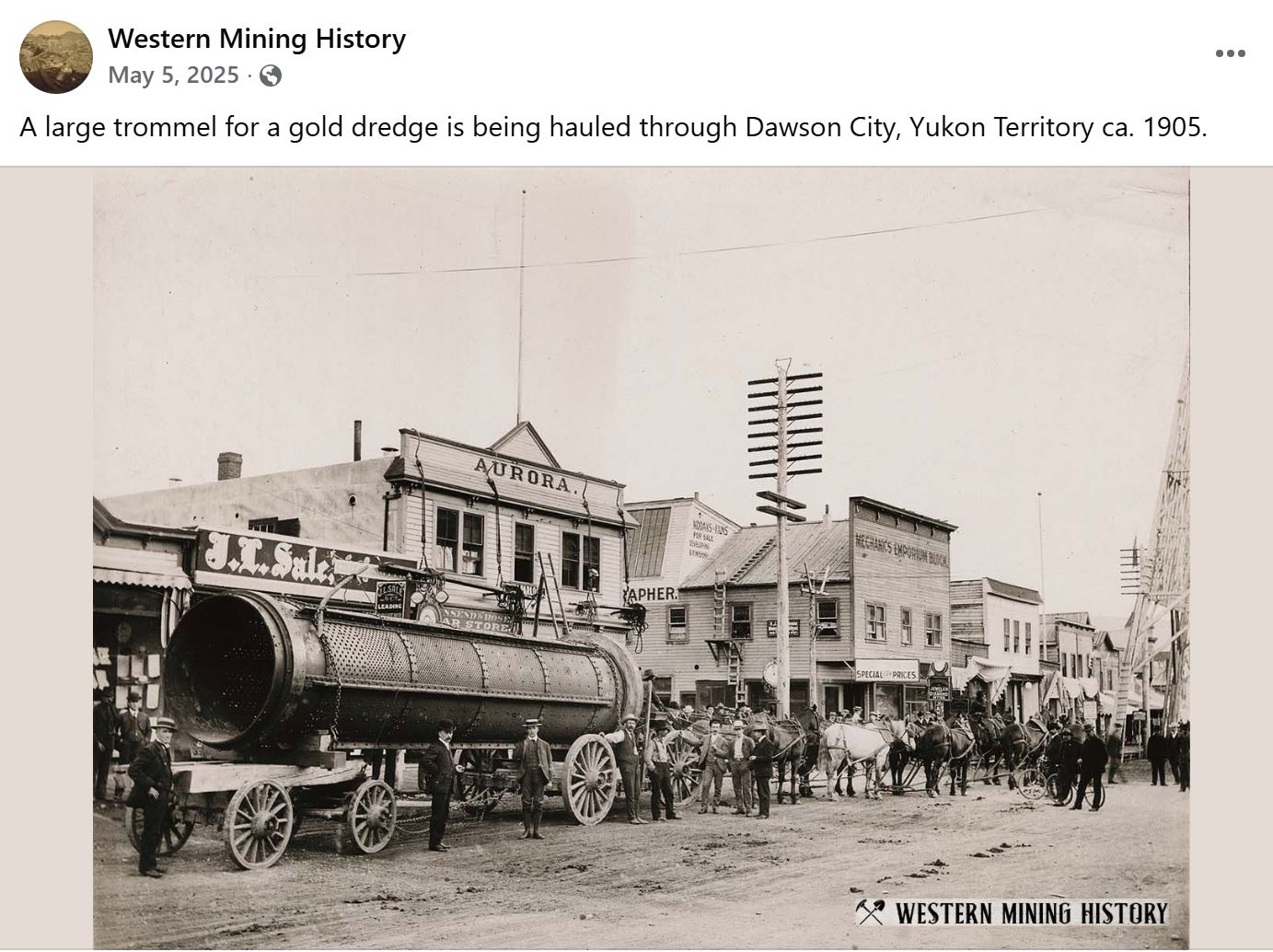
A better view of a gold trommel in Dawson City

Day 76_Dawson CityIMG_1797
Day 76_Dawson CityIMG_1796

This is the “front” end of the dredge, where the chain of buckets dig down to the bedrock where gold has settled. The “Control Room” with rows of levers control the movements of the dredge. The Control Room is the only place on the dredge with heat. The dredges ran continuously 24/7. Only stopping to clean out the gold from the fiber mats.

Day 76_Dawson CityIMG_1761

Our RV tour included a trip to “Diamond Tooth Gerties Gambling Hall”. Canada’s oldest licensed gambling hall. Gertie was a real historical person from gold rush days with a diamond mounted between her front teeth.

Day 76_Dawson CityIMG_1760
Day 76_Dawson CityIMG_1762

Wintertime mural painting of miners crossing a mountain pass and Dea (blue t-shirt and pants) from our group on stage with the cancan girls.

Day 77_Dawson CityUntitled_Panorama-2

Mike and Amy drove us up the “Dome Road” in their truck, to the “Midnight Dome Viewpoint”. The viewpoint overlooks the Yukon River, Dawson City, and the Klondike River Valley which flows into the Yukon from the left in this view.

Day 76_Dawson CityIMG_1765

Tourists

Day 77_Dawson CityUntitled_Panorama-1

A view that includes more of the Klondike River Valley extending to the left. It is hard to appreciate how much gold mining, especially gold dredging, has destroyed the valleys. The “Gold Dredge No. 4 Historic Site” is up the valley on the far left of photo.

Day 77_Dawson City_DAD4333

Photo zoomed in from the Midnight Dome Viewpoint. Mounds of gravel dredge tailings in what was the Klondike River Valley in the foreground. The washout from dredging operations up the Bonanza Creek Valley in upper left.

Day 77_Dawson CityDredging Dawson Creek

This is a screenshot from Google Maps of the Klondike Valley leading into the Yukon River at Dawson City. The serpentine mounds of gravel left from dredging operations cover the valley. The tour guide described dredging as “turning the valley upside down”. Most of the gold settles as far down as it can go which is at the bottom of all the sand and gravel of the creek/river. The goal of the big dredge buckets was to go down to “bedrock”. The buckets teeth were replaced frequently as they gouged out the bedrock to get the gold that had settled down there.

Day 77_Dawson CityUntitled_Panorama-4

View at sunset looking the other direction on Midnight Dome Viewpoint was beautiful.

Favorite Bible verse of the day: Hebrews 11:3

“By faith we understand that the worlds were prepared by the word of God, so that what is seen was not made out of things which are visible.”

Watson Lake to Teslin to Whitehorse, Yukon Territory – July 3-6

Alaskan Adventure: Days 33-36. We have been driving every day since starting on the Alaskan Highway in Dawson Creek. It was nice to finally stop for 3 nights in Whitehorse. It was also really wonderful to have sunshine and no mosquitoes!

Day 33 Watson Lake to Teslin _DAD7474
Day 33 Watson Lake to Teslin _DAD7475
Day 33 Watson Lake to Teslin _DAD7483

We stopped for a hike to see some waterfalls at Rancheria Falls Recreation Area. Did not hike because the wood boardwalk was broke down and… mosquitoes. Took a pic of flowers and went on.

Day 33 Watson Lake to Teslin _DAD7489

Views along the Alaskan Highway are beautiful.

Day 33 Watson Lake to Teslin Untitled_Panorama-2

View from our campsite in Teslin, YT. There were several great things about this stop. It stopped raining and the sun came out, and there were only a few mosquitoes around! Much more enjoyable to be outside. This campground was called Teslin Motel & RV Park situated along the Teslin Lake and Nisutlin Bay. This looks like a lake but it’s the bay of the Nisutlin River as it levels and widens out into a big delta coming into Teslin Lake. Teslin Lake is like an enormous “finger lake” at 78 miles long.

Day 33 Watson Lake to Teslin _DAD7511

Ducks on Nisutlin Bay.

Day 34 Teslin to Whitehorse YTIMG_0369

Our tour group enjoying a campfire, beautiful scenery, and fewer mosquitoes.

Day 34 Teslin to Whitehorse YT_DAD7522

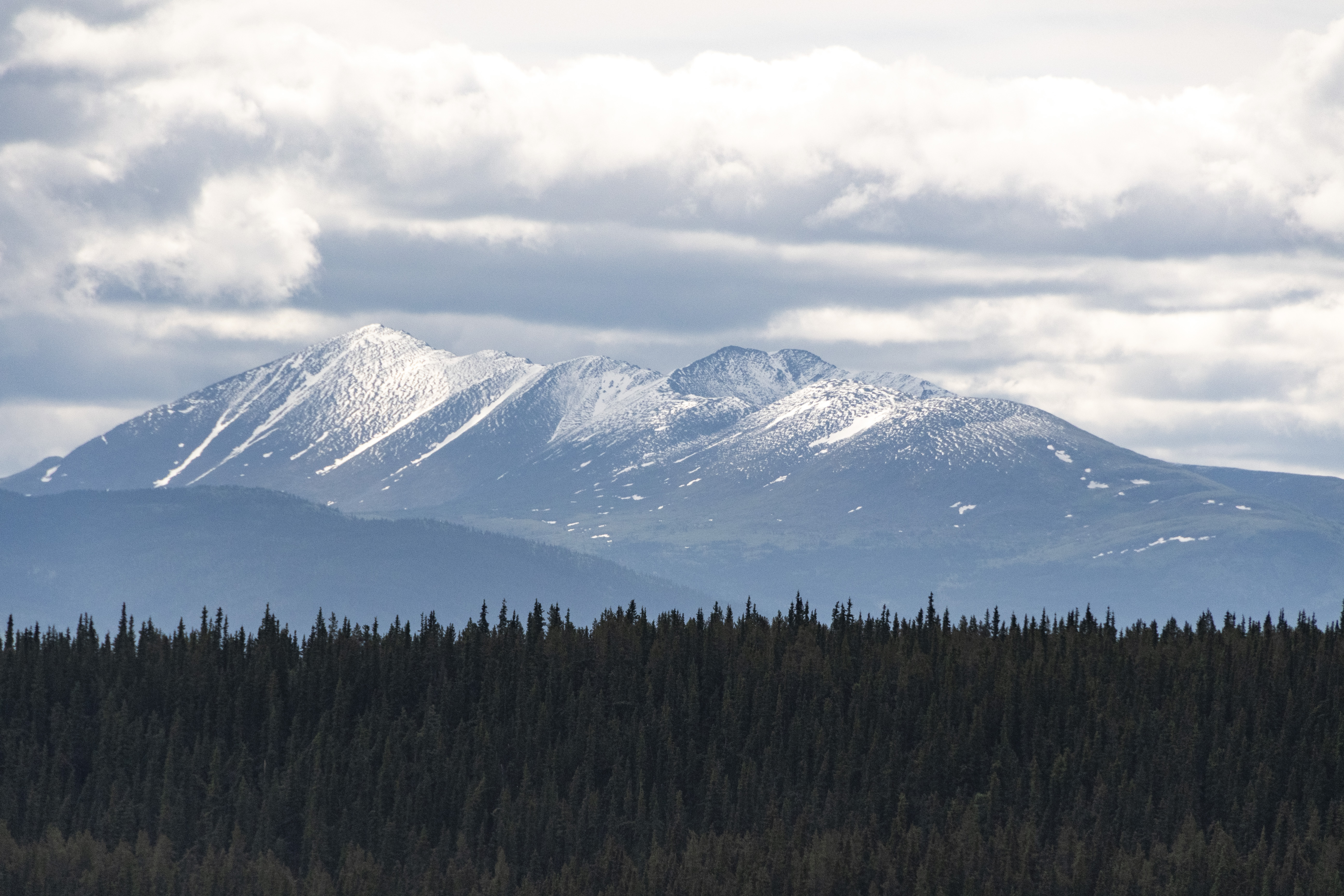
Next morning; which was the 4th of July, we headed to Whitehorse. Along the way we kept getting glimpses of this snow capped mountain. It had snowed in the mountains around Whitehorse the night before.

Day 34 Teslin to Whitehorse YTYukon_Panorama-1

Not far from arriving in Whitehorse we stopped at this bridge (named the “Big Blue Bridge”) and walked up to an overlook. This is the beginning of The Yukon River. We will see much more of the Yukon River as it winds almost 2,000 miles from here in the Yukon to cross Alaska and empty into the Bering Sea.

Day 34 Teslin to Whitehorse YT_DAD7527

Our RV and tow car looking lonely at the Yukon River.

Day 34 Teslin to Whitehorse YT_DAD7526
Day 34 Teslin to Whitehorse YT_DAD7525
Day 34 Teslin to Whitehorse YT_DAD7536

Information and wildflowers from the overlook.

Day 34 Teslin to Whitehorse YTIMG_0384

We arrived in Whitehorse and got settled at Pioneer RV Park. This park was unique because they also had gas and diesel tanks so we filled up with their discounted gas at $5.24/gallon (calculated from liters). That afternoon we had a tour of the “Yukon Beringia Interpretative Centre”

Day 34 Teslin to Whitehorse YT_DAD7547
Day 34 Teslin to Whitehorse YT_DAD7546
Day 34 Teslin to Whitehorse YTIMG_0383

Several maps of “Beringia” show the land that was exposed above sea level during the last Ice Age when sea levels were much lower. The Canadian interpreter leading our tour explained that there was no Yukon at that time because most of it was buried under miles of ice. The “land bridge” that is now partially submerged in the Bering Strait allowed passage between the continents.

Day 34 Teslin to Whitehorse YTIMG_0382
Day 34 Teslin to Whitehorse YTIMG_0380

Another view of Beringia and I don’t know what prehistoric animal that was but it had cool horns.

Day 34 Teslin to Whitehorse YT_DAD7550

Sculpture at Beringia.

Day 34 Teslin to Whitehorse YT_DAD7549
Day 34 Teslin to Whitehorse YTIMG_0376

We had a hands-on demonstration and practice of using a spear throwing stick called an “atlatl”. It was fun but apparently takes a lot more than one time to practice. But the scenery was nice. We aimed at cutouts of prehistoric animals with snow capped mountains behind them.

Day 34 Teslin to Whitehorse YTIMG_0385
Day 34 Teslin to Whitehorse YTIMG_0386

The Wooly Mammoth and the Giant Beaver became extinct around 10,000 years ago. I had heard of the Wooly Mammoth but was not (until now) familiar with the Giant Beaver. Up to 8′ long and 480 lbs they were about the size of today’s black bears!

Day 35 Whitehorse YT_DAD7554

The next morning we visited the Whitehorse Visitors Center where we learned about the steam powered paddle-boats that navigated the Yukon and other rivers in the area bringing supplies to the frontier. They had a short 3-4 month season when the lakes and rivers were not frozen. The gold rush, and after that the silver ore mining, made Whitehorse an important hub in the Yukon.

Day 35 Whitehorse YT2026_0704_142239_014680F
Day 35 Whitehorse YTIMG_0390

“No grizzly bear hunting” sign along the Alaska Highway. The fine print says “…within 100 meters of either side of the road…” so no shooting from your car windows… but, if you are at least a football field away from the highway, it’s ok. Rules are different here.

Day 35 Whitehorse YT_DAD7555
Day 35 Whitehorse YT_DAD7556

Totem pole near the Visitor Center and some info on it.

Day 35 Whitehorse YT_DAD7552

14 First Nations hold land in the Yukon Territory that cover the entire Territory. Most have modern treaties with self-governance and specific land boundaries called Final Agreements. It is not like in the States where there are much smaller set aside reservations.

Day 35 Whitehorse YT_DAD7572

Visitors Center photo shows how the paddlewheeler (or sternwheelers) were winched up out of the water for winter and slid back down into the Yukon River in the spring. Each boat would burn a cord of wood each hour. The forests along the river were being cut back each year to supply the steam boilers. From the 1860’s to the 1950’s the paddlewheelers were the primary means of transportation for the Yukon area. The Klondike was the biggest paddlewheeler and was built in Whitehorse in 1829. The original boat hit a rock wall going around a bend then struck a sandbar. It was salvaged and rebuilt as The Klondike II and was initially used to carry freight for the building of the ALCAN road. Very photogenic so here’s a bunch of pics.

Day 35 Whitehorse YT_DAD7558
Day 35 Whitehorse YT_DAD7560
Day 35 Whitehorse YT_DAD7568
Day 35 Whitehorse YT_DAD7569
Day 35 Whitehorse YTUntitled_Panorama-1

The Yukon River at Whitehorse. Becky and I are pinching ourselves when we stand and look out at the Yukon River streaming past. Sort of in disbelief that we are really here. The Yukon River has always been like a fabled river far from where we would ever be. We feel really blessed by God to be able to see this.

Day 35 Whitehorse YT_DAD7566
Day 35 Whitehorse YTUntitled_Panorama-2

Miles Canyon Overlook. The Yukon River shoots through a volcanic basalt rock canyon that was difficult for paddlewheelers to navigate.

Day 35 Whitehorse YTUntitled_Panorama-5
Day 35 Whitehorse YTUntitled_Panorama-4

Miles Canyon, looking both ways from the suspension bridge.

Miles Canyon video.

Day 35 Whitehorse YT_DAD7576

Info on Miles Canyon and the Whitehorse Rapids.

Day 35 Whitehorse YT_DAD7600

21yr old Jack London ran Miles Canyon and Whitehorse Rapids (now gone from a dam built for power generation and flood control).

Day 35 Whitehorse YT_DAD7602

We did not get a chance to get inside but this log church built in 1900 had an interesting history and is still sitting on it’s original site in what is now downtown Whitehorse.

Day 35 Whitehorse YTUntitled_Panorama-6
Day 35 Whitehorse YT_DAD7608
Day 35 Whitehorse YT_DAD7607

One last photo from Whitehorse. Our last day in Whitehorse was a laundry day and getting ready to travel again. I tried to replace a windshield wiper today. After an hour I threw it away and went to buy a different one that went on easily. We also bought more black poster board to put in the bedroom windows. Hopefully it will make the room darker and we will sleep better tonight. We leave Whitehorse tomorrow morning for Haines, ALASKA and stay there for 3 nights. Next post will probably be about Haines and a ferry boat trip to Juneau and back to Haines.

Favorite Bible reading verses today: Luke 6:46-49

“Why do you call me, ‘Lord, Lord,’ and do not do what I say? As for everyone who comes to me and hears my words and puts them into practice, I will show you what they are like. They are like a man building a house, who dug down deep and laid the foundation on rock. When a flood came, the torrent struck that house but could not shake it, because it was well built. But the one who hears my words and does not put them into practice is like a man who built a house on the ground without a foundation. The moment the torrent struck that house, it collapsed and its destruction was complete.”