St. Anthony, Newfoundland

We stayed in St. Anthony several nights. This was the place “farthest from home” of the trip. It is 2,271 miles from Indianapolis.

Gros Morne to St Anthony_Labrador_20220812LABRADOR_PANORAMA-1
That’s Newfoundland coast in the foreground, and Labrador over on the other side.
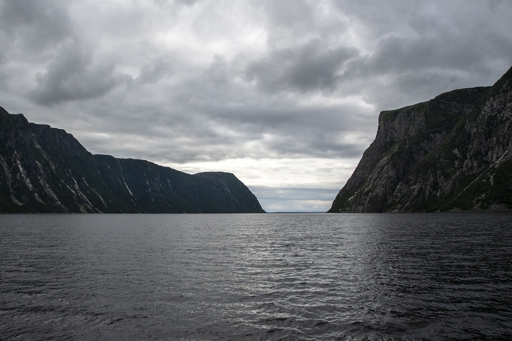
We traveled from Gros Morne National Park, up the western coast of Newfoundland to St. Anthony which is out near the northern tip of the island.
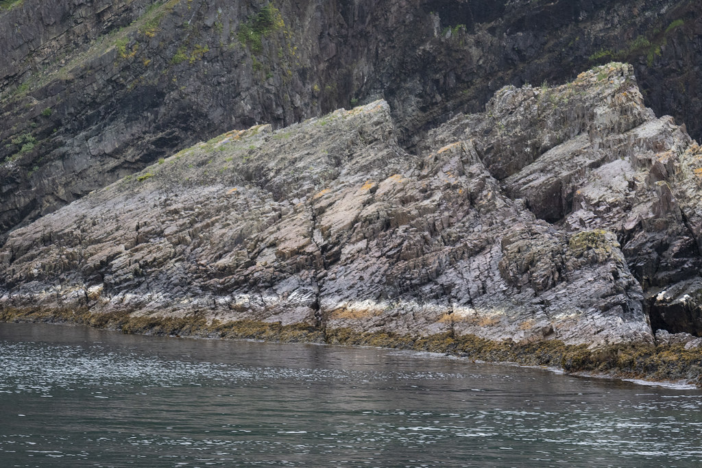
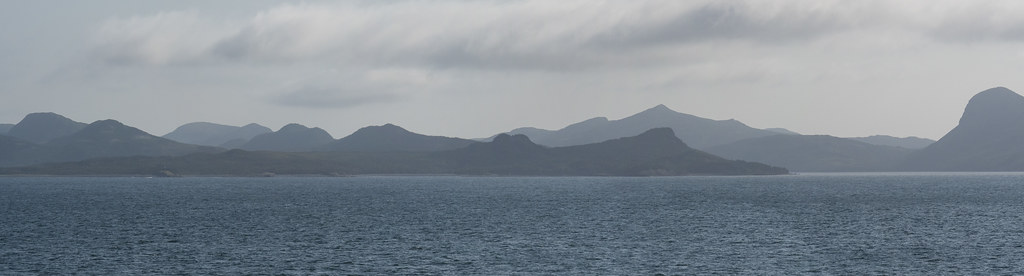
The picture above was taken where Newfoundland and Labrador are closest together across the Strait of Belle Isle in the Gulf of St Lawrence – a distance of about 10 miles at it’s narrowest.

St Anthony Whale Tour_20220813_DAD3783
We took a boat tour to find a whale. It was a windy day and not a very big boat… it reminded me of the infamous “Minnow” as we headed out for a 3hr tour… hoping we would not be lost.
St Anthony Whale Tour_20220813_DAD4121
Thanks to our persistently searching Captain, and our fearless crew, we did see whales! The boat was bobbing wildly on the waves and this was a lucky shot.
St Anthony Whale Tour_20220813_DAD3957
St Anthony Whale Tour_20220813_DAD3924
Rugged Coast
St Anthony Whale Tour_20220813UNTITLED_PANORAMA-1_1
St Anthony Whale Tour_20220813_DAD4159
Fox Point Lighthouse as we were returning back to dock at Northland Discovery Iceberg & Whale Tours.
St Anthony Whale Tour_20220813UNTITLED_PANORAMA-4
Above: Fox Point Lighthouse and “Haul Up Cove”. There is a wonderful little restaurant near the lighthouse called “Lightkeepers Seafood”. We hung out there several times. We enjoyed the food and the Wi-Fi (which is hard to find in Newfoundland). There is also a nearby thing called the “Great Viking Feast”. We recommend avoiding that.

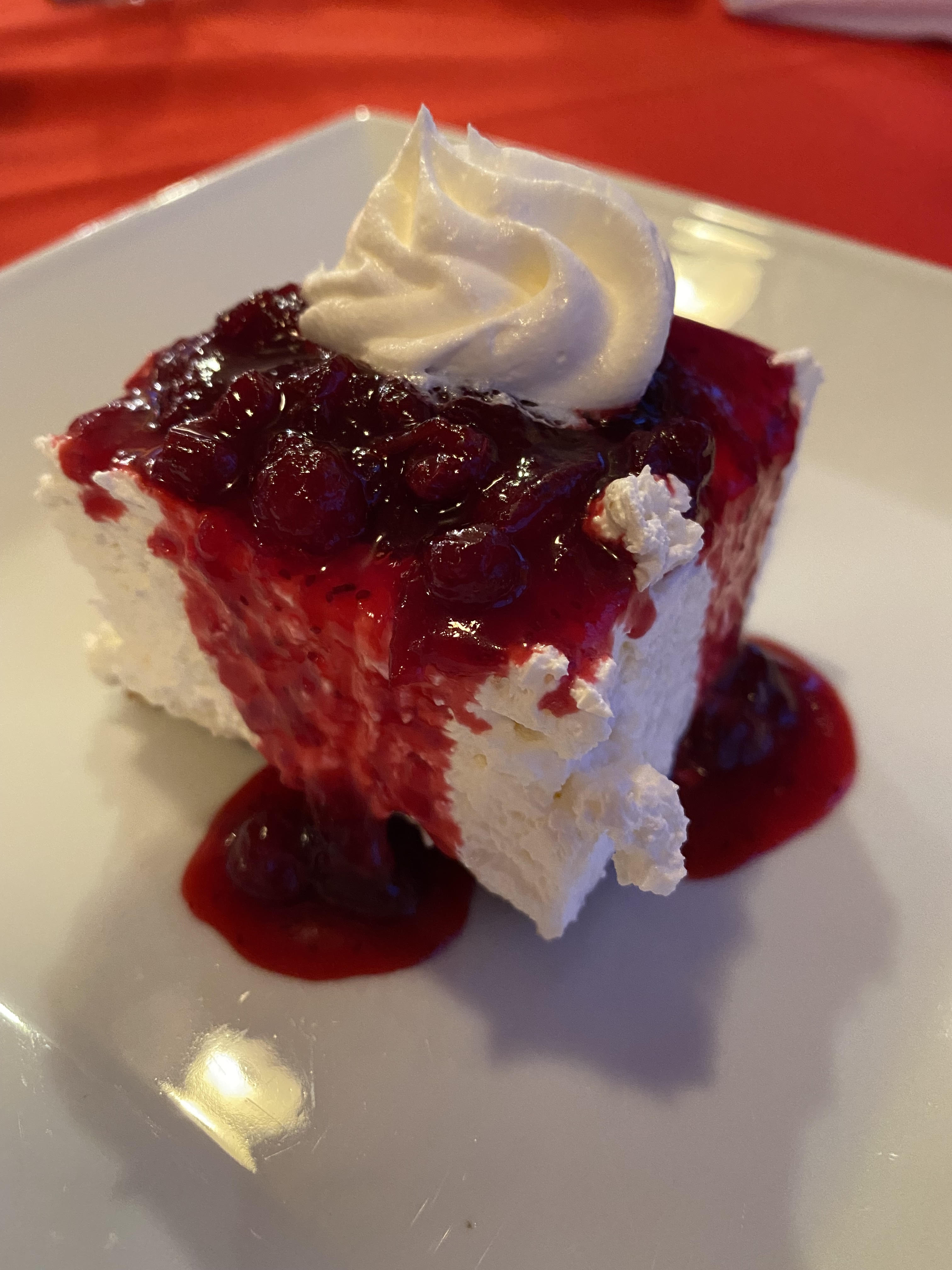
Above: Partridgeberry Cheesecake: Lightkeepers Seafood Restaurant.
Trivia: Partridgeberry picking season was in full swing. Partridgeberries are the same as what other countries call “Lingonberries”. They are a relative of the cranberry but more mild. In Newfoundland, they grow in a low evergreen shrub in the dry acidic soils of Newfoundland and Labrador’s coastal barrens and headlands. Newfoundland and Labrador are the largest harvester of Partridge/Lingonberries in North America.

Cod Tongues
Fried Cod Tongue. I thought it was delicious. Didn’t get much help from the rest of the group. It is considered a Newfoundland delicacy. Also at Lightkeepers Seafood Restaurant. We really enjoyed this restaurant. We really did not enjoy the Great Viking Feast.

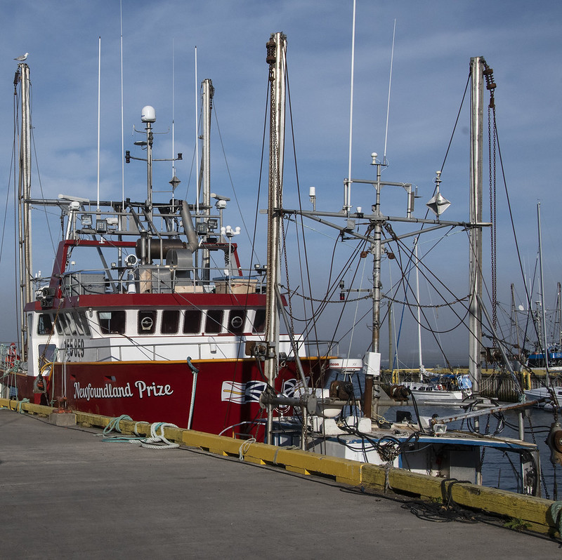
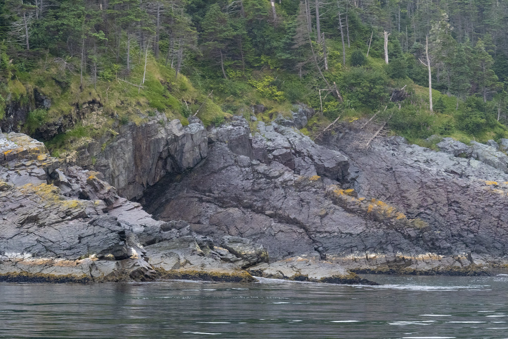
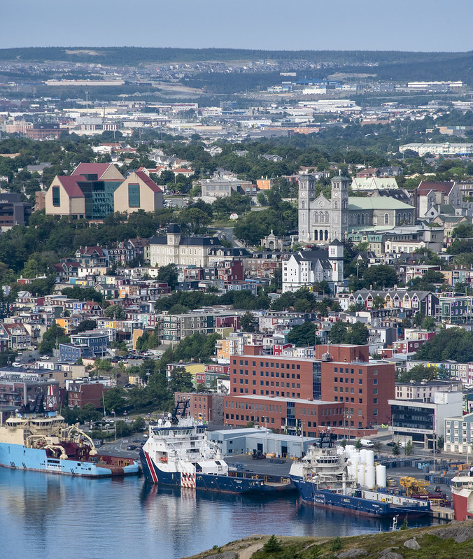
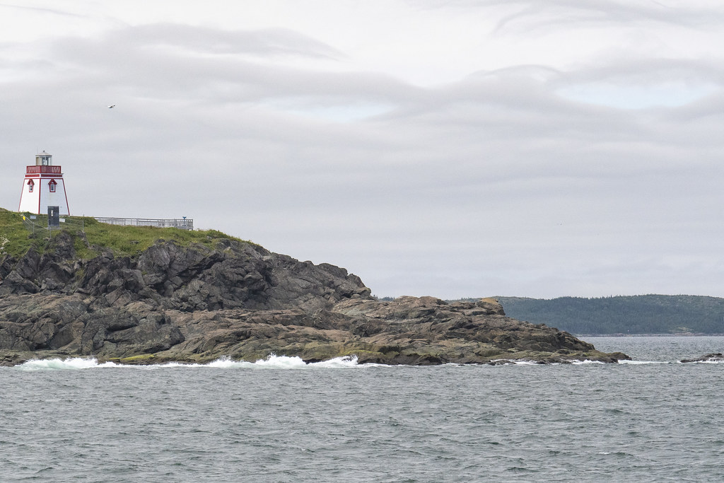
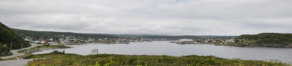
Below: Scenes from around the boat dock.

St Anthony Whale Tour_20220813_DAD4185
St Anthony Whale Tour_20220813_DAD4184
St Anthony Whale Tour_20220813_DAD3782
St Anthony Whale Tour_20220813_DAD3768
Above: Green coastal rocks

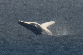
Below: Really far out from shore the whales were jumping way out of the water-looked like they were having a great time. These were taken from the little front porch of the Lightkeepers Seafood Restaurant where lots of visitors stood watching the whales play.

St Anthony Whale Tour_20220813_DAD4226
St Anthony Whale Tour_20220813_DAD4220
St Anthony Whale Tour_20220813_DAD4190
St Anthony Whale Tour_20220813UNTITLED_PANORAMA-2
Panorama from Fox Point area looking back at town of St Anthony and Marguerite Bay
Screenshot of Google Maps location.
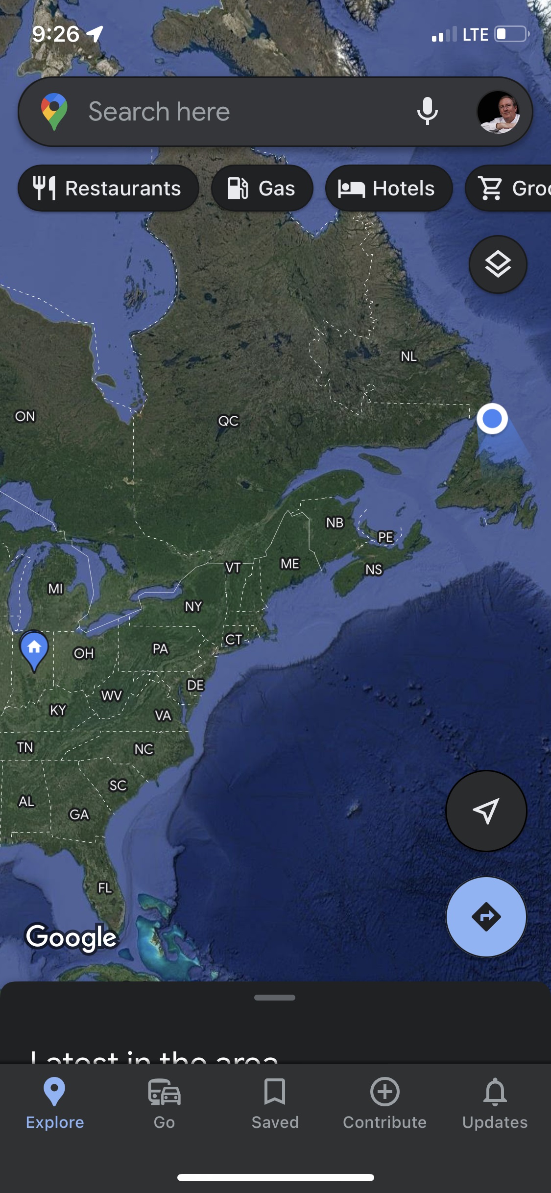
2,282 driving/ferry miles from home to L’Anse aux Meadows National Historic Site at the very northern tip of the peninsula was the next days visit.

Gros Morne National Park: Western Brook Pond

A UNESCO World Heritage Site: Amazing place on earth, go here if you ever get a chance.

Gros Morne Western Brook Pond_20220811_DAD3718

We stayed at Gros Morne National Park two times. This first time we visited “Western Brook Pond”.

Parking out by the road, we walked about an hour across flat coastal lowlands to reach the entry to the 540 foot deep “Pond” (we would call this a lake). The glacier carved pond is 10 miles long and the surrounding cliffs tower 2,200 feet high. The weather was sunny a few moments but mostly overcast and threatening rain. We were grateful to get finished without getting more than a few sprinkles.

The mountain range (in photo below) that rises up along the western edge of Newfoundland is called the “Long Range Mountains”. It is an extension of the same mountain range we in the United States call the “Appalachian Mountains”. I had no idea that the Appalachian Mountain Range continued that far north into Canada.

Following are a bunch of photos – none of which really capture the grandeur of the place – but they bring back good memories. I hope they inspire others to visit Gros Morne.

Gros Morne Western Brook Pond_20220811_DAD3739
Gros Morne Western Brook Pond_20220811_DAD3740
Gros Morne Western Brook Pond_20220811_DAD3485
My kids hate it when I stop to read markers but it helps to understand how this unique place ‘happened’. Feel free to skip this if you are like my kids.
Gros Morne Western Brook Pond_20220811_DAD3479
Jennie & Becky headed to Western Brook Pond for the boat ride
Gros Morne Western Brook Pond_20220811UNTITLED_PANORAMA-15
Gros Morne Western Brook Pond_20220811_DAD3452
Gros Morne Western Brook Pond_20220811_DAD3471
Scenes along the trail
Gros Morne Western Brook Pond_20220811_DAD3453
Gros Morne Western Brook Pond_20220811_DAD3481
Gros Morne Western Brook Pond_20220811_DAD3713
Gros Morne Western Brook Pond_20220811UNTITLED_PANORAMA-2
Gros Morne Western Brook Pond_20220811UNTITLED_PANORAMA-1
Gros Morne Western Brook Pond_20220811UNTITLED_PANORAMA-14
Gros Morne Western Brook Pond_20220811UNTITLED_PANORAMA-3
Gros Morne Western Brook Pond_20220811UNTITLED_PANORAMA-4
Gros Morne Western Brook Pond_20220811UNTITLED_PANORAMA-7
Gros Morne Western Brook Pond_20220811UNTITLED_PANORAMA-8
Gros Morne Western Brook Pond_20220811_DAD3621
Gros Morne Western Brook Pond_20220811_DAD3597
Gros Morne Western Brook Pond_20220811_DAD3574
Gros Morne Western Brook Pond_20220811_DAD3575

Lots of waterfalls off the surrounding cliffs fill the pond with fresh water.

Gros Morne Western Brook Pond_20220811_DAD3672
Gros Morne Western Brook Pond_20220811_DAD3665

Two examples of lava forced upward through cracks then exposed by glaciers. I think that is called a “diabase dyke” and according to Gros Morne geology the cracks formed when the supercontinent began breaking apart.

Gros Morne Western Brook Pond_20220811UNTITLED_PANORAMA-12
Gros Morne Western Brook Pond_20220811_DAD3668
On the boat returning back to the dock the pond looked like an infinity pool.
Gros Morne Western Brook Pond_20220811_DAD3726
Looking back toward the pond as we walked to the car we saw this glorious rainbow.
Gros Morne_20220816GROS MORNE ESCARPMENT_PANORAMA22-9
Panarama of the Long Range Mountains; the end of the Appalachian Mountains

Twillingate to Gros Morne

Sometimes there is time to kill on travel days because you cannot arrive at the next destination until late afternoon.

We stopped at “The Newfoundland Insectarium” while traveling from Twillingate to our next stop at Gros Morne National Park.

It’s a nice insect collection but it could be anywhere, not particularly Newfoundland’ish. I enjoyed the live exhibits more than the dead ones. I don’t have a photo but it was fun watching a whole bunch of live leaf-cutter ants carry leaves around.

Twillingate to Gros Morne_20220810_DAD3368
Twillingate to Gros Morne_20220810_DAD3370
Twillingate to Gros Morne_20220810_DAD3381
Twillingate to Gros Morne_20220810_DAD3442
Twillingate to Gros Morne_20220810_DAD3365
Twillingate to Gros Morne_20220810_DAD3363
Twillingate to Gros Morne_20220810_DAD3367
Twillingate to Gros Morne_20220810_DAD3349
Another stop was at: “Salmonid Interpretation Centre” on the Exploits River near Grand Falls. This is the fish ladder bypass
Twillingate to Gros Morne_20220810_DAD3353
This is looking below the falls and fish ladder
Twillingate to Gros Morne_20220810_DAD3358
The fish ladders lets the fish (salmon) go up the gentle ladder instead of this set of treacherous rocky falls
Twillingate to Gros Morne_20220810_DAD3360
Twillingate to Gros Morne_20220810_DAD3354

Around Twillingate

We camped at Back Bay for 3 nights

Twillingate_20220808_DAD2898
Long’s Point Lighthouse
Twillingate_20220808LONGS POINT LIGHTHOUSE_PANORAMA-1
Twillingate_20220808_DAD2905
Birds mobbing fishermen
Twillingate_20220808_DAD2910
Whale spouting (that little bit of mist in center)
Twillingate_20220808_DAD2924
Bad photo of a Whale’s Tale (but proof we saw them)
Twillingate_20220808UNTITLED_PANORAMA-2
Panoramic view from Long’s Point Lighthouse
Twillingate_20220808_DAD2964
Twillingate_20220808_DAD2968
Newfoundland Scenes around Twillingate
Twillingate_20220808_DAD2974
Twillingate_20220808_DAD3219
We chartered a boat from “Captain Dave’s Boat Tours” and went Cod “fishing” (really “jigging”). Those are whale bones! Captain Dave himself skippered the boat (David Boyd). His family history is closely linked to Cod fishing and he is passionate to pass along the history.
Twillingate_20220808_DAD2976
Jellyfish at Captain Dave’s. Captain Dave’s is also the location of “Prime Birth Twillingate Fishery & Heritage Centre” which has an interesting museum of all things fishing…
Twillingate_20220808_DAD3241
Whale Baleen
Twillingate_20220808_DAD3227

This gentleman cleaned all the Cod for us

That bucket of gook is full of Cod Liver Oil. He was very good at fileting fish. Glad I didn’t have to do it.
Twillingate_20220808_DAD2995
Twillingate_20220808_DAD3037
We saw coastal scenes of rocks and seabirds while getting out to where we fished
Twillingate_20220808_DAD3147
We caught lots of Cod and one iridescently colored Mackerel
Twillingate_20220808_DAD3151
One Mackerel in a tub full of Cod
Twillingate_20220808_DAD3145

Twillingate, Newfoundland

Twillingate was one of our favorite stops. The RV Park was on North Twillingate Island. It was an easy walk from the RV Park to the water at “Back Harbor”. Back Harbor faced west so we saw some beautiful sunsets. Back Harbor had the ubiquitous and iconic brightly colored “fishing rooms” around the harbor.

Twillingate is called “The Iceberg Capital of the World” because icebergs drift south on ocean currents from Greenland and Labrador. They often get “stuck” around Twillingate when their bottoms hit the shallower bays. We were too late in the summer to see icebergs (but we did see Humpback Whales). This post is about the area where we were camped. The next page will be about places nearby we traveled to on day trips.

Trivia: Twillingate residents must use extra caution in the spring because Polar Bears and Seals often arrive on the icebergs!
Here is a link to a beautiful blog about Newfoundland: Seasons, Icebergs, Capelin, Whales, and Berries: https://newfoundsander.wordpress.com/icebergs/.

Twillingate_20220809_DAD3324
Twillingate_20220809_DAD3341
Sunset from Back Harbor, North Twillingate Island. I would walk over with morning coffee, sit and enjoy peacefulness
Twillingate_20220809_DAD3327
Twillingate_20220809_DAD3253
Roni & Becky watching me climb up the hill to get a panoramic picture of Back Harbor Bay.
Twillingate_20220809TWILLINGATE BACK BAY_PANORAMA-1
Twillingate_20220809_DAD3249
Twillingate_20220809_DAD3251
Twillingate_20220809_DAD3329
Lupin
Twillingate_20220809_DAD3323
Berries. Not sure what these are but there are low growing “bushes” (maybe 6″ high) growing all along the coastal areas. Blueberries were ripening when we were there. We had handfuls of fresh blueberries on several days.
Blueberries – Newfoundland Style. Not like the big bushes in Indiana at all.
Twillingate_20220809_DAD3306
Rock with section of purple stone (possibly purple quartz?)
Twillingate_20220809_DAD3326
Lobster Traps, waiting for next season
Twillingate_20220809_DAD3242
Salt Box Home we walked past each day from RV Park to Back Harbor Bay.

I don’t have a photo but it’s worth mentioning the “Split Peas” at “Twillingate-New World Island Dinner Theatre”. The local ‘actors’ and fantastic musicians put on a hilarious show of all things Newfoundland’ish. We enjoyed it, the food was good too. https://vacationintheisles.com/dinnertheatre/

We’ll end this post with more sunset pics – We didn’t want to leave Twillingate…

Twillingate Sunset_20220807_DAD2790
Twillingate Sunset_20220807_DAD2811
Twillingate Sunset_20220807_DAD2822
Twillingate_20220809_DAD3346

Trinity, Newfoundland

The Town of Trinity on Trinity Bay. This town was not on the official ‘agenda’ for the caravan group but was a nice day trip.

Local Trivia: The smallpox vaccine was first introduced to North America in 1799 here in the little fishing village of Trinity by Rev. Dr. John Clinch. Dr. Edward Jenner discovered the vaccine and was a close boyhood friend of Clinch. Jenner had developed the first smallpox vaccine in England using a less dangerous virus derived from cowpox in 1796. Newfoundland was a British colony at the time and Clinch moved to Trinity. He began inoculating his own family then 700 villagers. When nearby Bonavista was being ravaged with smallpox, Trinity proved immune. About 3 years later the vaccine was introduced in the United States.

Trinity Bay_20220806UNTITLED_PANORAMA-1
Trinity Bay_20220806UNTITLED_PANORAMA-5
Gothic Revival: St. Paul’s Anglican Church
Trinity Bay_20220806UNTITLED_PANORAMA-4
Trinity Bay_20220806_DAD2744
Trinity Bay_20220806UNTITLED_PANORAMA-3
Trinity Bay_20220806_DAD2750
Trinity Bay_20220806_DAD2740
Trinity Bay_20220806_DAD2732
Above: Lester-Garland Premises (originally a fish processing station) which is now a local theatre called Rising Tide Theatre

Below: Many of the Salt Box style homes in Trinity are historically restored/preserved. We enjoyed the morning walking around town.

Trinity Bay_20220806_DAD2767
Trinity Bay_20220806_DAD2766
Trinity Bay_20220806_DAD2741
Trinity Bay_20220806_DAD2762
Trinity Bay_20220806_DAD2754
Trinity Bay_20220806_DAD2757
Fort Point Lighthouse
Trinity Bay_20220806_DAD2768
Trinity Bay_20220806_DAD2770
Leaving Trinity we had a nice lunch here at Port Rexton Brewing Company

Catalina Harbour

We visited the Catalina area and enjoyed a walk along a rugged area of Atlantic Coast. Catalina is on the Bonavista Peninsula which is unique for being relatively flat; without cliffs along the shore. When we arrived there was a thick mist coming in and almost a whiteout situation. We walked on narrow paths through a low, mossy/spongy carpet of berries, grasses, and wildflowers.

Bonavista_20220805CATILINA_PANORAMA-1
Catalina_20220804_DAD1810
Catalina_20220804_DAD1805
Catalina_20220804_DAD1834
Manuel Island Lighthouse. A tiny lighthouse on a tiny island in the harbour
Catalina_20220804_DAD1827
Where the moose outnumber the people; they take moose-plows seriously
Catalina_20220804_DAD1813
Roni, Jennie, and Becky; walking in the mist rolling off the Atlantic
Catalina_20220804_DAD1826
Catalina_20220804_DAD1817
Catalina is a ‘working’ fishing town. Not very touristy which was refreshing

Puffins – Witless Bay Ecological Reserve

We took a boat tour from “Gatherall’s Puffin and Whale Watch” of Witless Bay which turned out to be just awesome. The boat took us out to several islands comprising the Witless Bay Ecological Reserve. This is the largest Atlantic puffin colony in North America.

Witless Bay Puffins_20220803_DAD1501
Puffin Colony: each white dot is a cute little puffin on a nest. The puffins prefer grassy areas.
Witless Bay Puffins_20220803_DAD1500
Photos above, closeup of puffins.
Witless Bay Puffins_20220803_DAD1481
Photos below, puffins taking off & landing.
Witless Bay Puffins_20220803_DAD1444
Witless Bay Puffins_20220803_DAD1433
Witless Bay Puffins_20220803_DAD1432
Witless Bay Puffins_20220803_DAD1436
Witless Bay Puffins_20220803_DAD1516
Witless Bay Puffins_20220803_DAD1405
Witless Bay Puffins_20220803_DAD1467
Puffins everywhere, on the island, in the water, and in the sky.
Witless Bay Puffins_20220803COLONY_PANORAMA-1
This island was covered in nesting Common Murres/Guillemots. They prefer the bare rock areas.
Witless Bay Puffins_20220803NESTING_PANORAMA-1
Common Murres/Guillemots on the bare rock and puffins in the grassy area.
Witless Bay Puffins_20220803_DAD1587
Witless Bay Puffins_20220803_DAD1588
Witless Bay Puffins_20220803MURS_PANORAMA-1
Witless Bay Puffins_20220803_DAD1784
It clouded up and started raining as we were finishing up. The birds were feeding on the water and ‘parted’ as the boat came through. The puffins often had beaks full of little fish hanging out.

Below are some of the colorful, rugged sea-shore rocks along the coast.

Witless Bay Puffins_20220803_DAD1383
Witless Bay Puffins_20220803_DAD1379
Witless Bay Puffins_20220803_DAD1377
Witless Bay Puffins_20220803_DAD1374

Cape Spear – Easternmost Point in North America

Cape Spear is the ‘easternmost’ point of land in North America. The sun comes up here long before it comes up at the much advertised Acadia National Park, Cadillac Mountain, Maine. It’s difficult to tell how much earlier because Newfoundland is in a different time zone 1-1/2 hours earlier than “Eastern Time”. Most of Canadian Maritime Provinces are 1 hour earlier than Eastern but Newfoundland gets another 1/2 hour earlier.

St Johns_20220802_DAD1317
St Johns_20220802_DAD1310
The Original (now inactive) Cape Spear Lighthouse – 1836
St Johns_20220802_DAD1281
St Johns_20220802_DAD1367
For a sense of scale; this photo is taken from Cape Spear, looking back northwest toward the St. John’s Harbor entrance. That bump on top of Signal Hill is Cabot Tower and the white dot below and left of the tower is the Amherst Lighthouse.
St Johns_20220802UNTITLED_PANORAMA-1
Above: Clear water and rugged coastline. Locals told us this was one of the most calm Atlantic waters they had ever seen.
Below: The nearby “New” (active) Cape Spear Lighthouse was built in 1955.
St Johns_20220802_DAD1287
St Johns_20220802_DAD1324
St Johns_20220802_DAD1320
St Johns_20220802_DAD1256
Looking Down: I enjoyed sitting on the edge of the easternmost cliff of North America. It was a long, long, long, way down and very windy but the breeze was blowing UP the cliff. It was fun to watch seabirds flying along below. Photos just don’t begin to capture the feeling of being there.
Left
Looking Left:
Right
Looking Right:
St Johns_20220802UNTITLED_PANORAMA-2
Photo looking back as we were leaving Cape Spear.
St Johns_20220802_DAD1252

St. John’s & Petty Harbor, Newfoundland

Our first stop was Cabot Tower on Signal Hill: There are many interesting things about this hill and iconic bit of Architecture. One is that this spot is where Guglielmo Marconi received the first trans-Atlantic wireless signal from Cornwall, England in 1901

St Johns_20220802_DAD1147
Cabot Tower
St Johns_20220802_DAD1168
How the Architect drew it…
St Johns_20220802_DAD1163
How it got built…
St Johns_20220802_DAD1156
The world with St. John’s at it’s center. At this point we were as close to Ireland as Indianapolis.
St Johns_20220802_DAD1150
St Johns_20220802_DAD1206
St Johns_20220802ST JOHNS BAY LIGHTHOUSE_PANORAMA-1
Looking down on the entrance to St. John’s Harbor, called “the Narrows”. The Amherst Lighthouse on top of the outcropping is built on some of the old foundations of Fort Amherst below. Here’s a link to some interesting history; https://www.hiddennewfoundland.ca/fort-amherst–chain-rock
St Johns_20220802ST JOHNS_PANORAMA-1
Zoomed in on St. John’s downtown and Harbor. Upper left building is “The Rooms” built to house St. John’s art and culture exhibits. It is an oversized version of traditional “fishing rooms” which is what Newfoundlander’s called the colorful sheds along waterlines. They are brightly colored so fishermen can find them in the fog.
St Johns_20220802_DAD1230
Petty Harbor
St Johns_20220802_DAD1235
Petty Harbor. Newfoundland scenes like this were to become typical as we traveled for the next 30 days around the island.
Mess-O-Moose
“Moose Madness” Moose Sausage, Ground Moose Meat and Moose Gravy on chips (fries) at Chafe’s Landing Restaurant in Petty Harbor.

Ferry to Newfoundland

from : North Sydney, Nova Scotia : to : Marine Atlantic Ferry : to: Argentia, Newfoundland

N Sydney Ferry_20220731_DAD1066
This is the Marine Atlantic Ferry. We loaded all of our RV’s onto the lower level for a 15 hour overnight sail to Newfoundland. We had a small ‘room’ for the night. Nobody can stay below with the vehicles. We just park it and set the brake.
Everyone gets ‘staged’ into loading lanes in a big parking lot. Some were unlucky enough to get staged underneath the lights where cormorants were nesting. Those RV’s were quickly plastered with white cormorant poo. We (and the motorcyclists staged near us) were glad we were far from a light pole…
N Sydney Ferry_20220731_DAD1064
N Sydney Ferry_20220731_DAD1061
Newfoundland_20220801_DAD1141
Newfoundland_20220801_DAD1142
Some nice shoreline as we exited Sydney Harbor.
N Sydney Ferry_20220731_DAD1076
Low Point Lighthouse marks the eastern entrance/exit to Sydney Harbor. Once past this lighthouse we were out into the open North Atlantic.
Newfoundland_20220801N SYDNEY FERRY_20220731NEWFOUNDLAND_PANORAMA-2
The next morning, as we were approaching Argentia, we saw these beautiful haystack-like islands wrapped in mist. We also passed within a few miles of France! Saint Pierre and Miquelon is a group of eight islands that are the most western outpost of Europe. You need a passport to enter this part of France and their currency is the Euro. We did not go there but this was a geographic learning experience for me.
Newfoundland_20220801NEWFOUNDLAND_PANORAMA-5
Newfoundland_20220801NEWFOUNDLAND_PANORAMA-4
More of the surreal misty morning coastline coming into Argentia
Newfoundland_20220801NEWFOUNDLAND_PANORAMA-1
From Argentia, we disembarked our RV’s and drove to St. John, the capital of “Newfoundland and Labrador” (the official name of the Province – which I will now just call Newfoundland)

The Cabot Trail, Cape Breton Highlands

We did the Cabot Trail on a bus (well, ‘motorcoach’) – and I would not recommend that to anyone…
The shoreline is beautiful. In a car, on your own, where you can stop and enjoy the scenery, it could be a nice trip.
In a bus, trying to take pictures through bouncing/swaying tinted glass, it was really disappointing. The tour guide on the bus was great and told some good stories, but 10hrs on a bus was awful.

Cabot Trail_20220728_DAD0983
Cabot Trail_20220728_DAD1019
Cabot Trail_20220728_DAD1018
Black Brook Beach was nice. One stop the bus had to make to let people use the porta potties.
Cabot Trail_20220728_DAD1054
Cabot Trail_20220728CABOT TRAIL_PANORAMA-2