17 of 22 – 2024 Fall Trip West Series. 10/5/24 Saturday-Monday. We left Hurricane, UT and headed south to Flagstaff, AZ where we stayed for two nights.
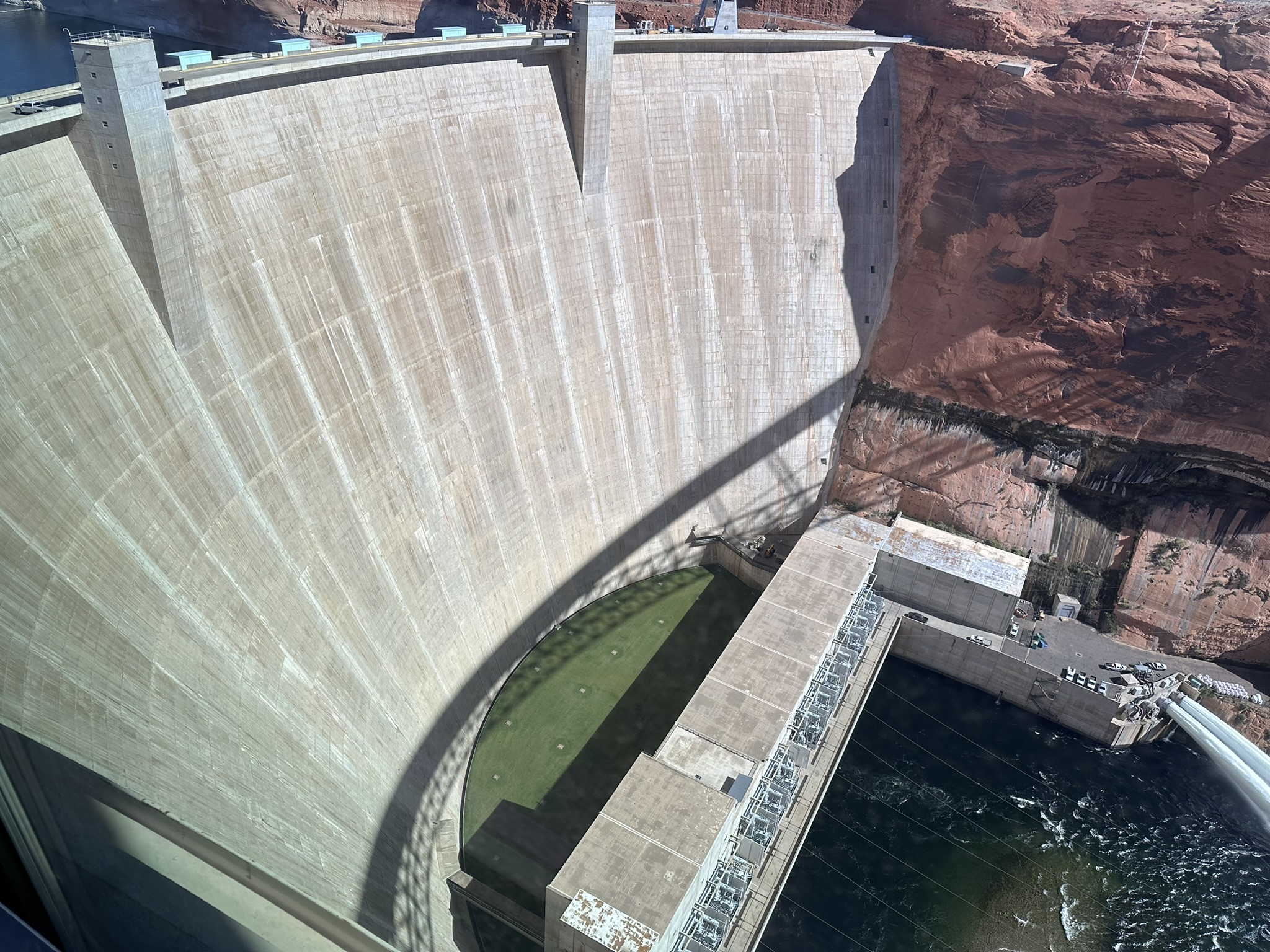
Our first stop on the way was Glen Canyon Dam and Lake Powell. The Visitors Center at Glen Canyon Dam is very nice. It is run by volunteers eager to tell lots of “Dam” this and “Dam” that jokes. This photo is a stitch of 3 iPhone pics taken by holding the phone out and pointing through an opening in a fence. Wonky but best pic I have.
Glen Canyon Dam.
3 pics that Photoshop stitched together to make the composite photo above. I think that’s pretty amazing stuff.
Artists drawing of the canyon location picked to locate the Dam.
Lake Powell. Seems sort of ironic that the lake is named after the guy who is famous for exploring and mapping the whitewater rapids of the Colorado River that the lake now floods… The lake is at about 36% of it’s capacity.
Scenery around Lake Powell.
Got the stamp. It was while getting the stamp I realized how close we were to the Horseshoe Bend and that it was part of the area the stamp included. We decided to head there next.
Horseshoe Bend is down in that hole in an otherwise flat desert. There is a paved .75 mile walk from the parking lot to the overlook. It was brutally HOT when we were there so we didn’t stay to look very long but it was worth the stop.
Lots of people were leaning out and getting better pictures of the full Horseshoe Bend in the Colorado River. I was overheating and getting tipsy being this close to the edge.
Picture of a picture of the whole Horseshoe Bend. People had set up lots of rock cairns.
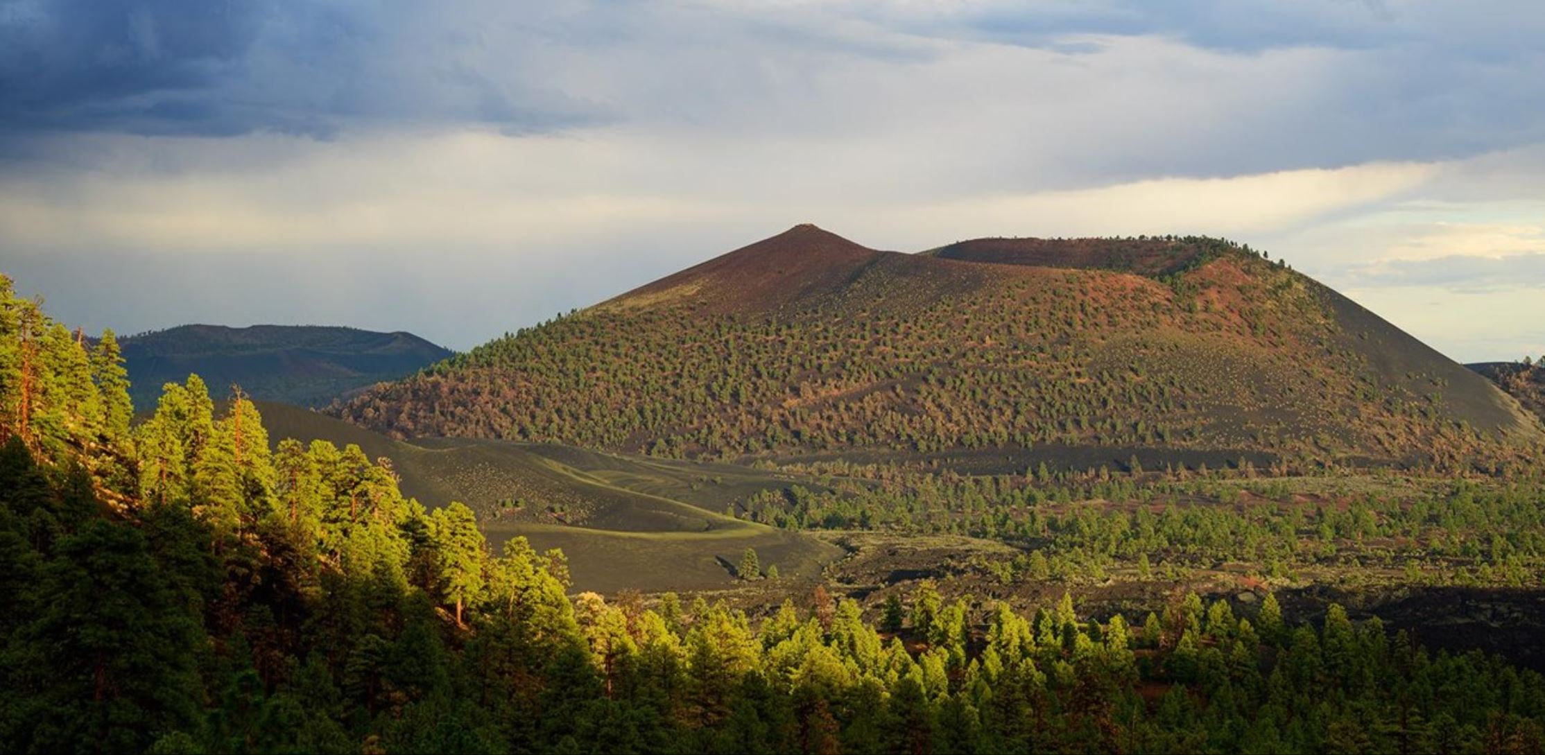
Sunset Crater Volcano National Monument. It is not very impressive to view from down on the road level so here’s a picture from a higher viewpoint from National Park Service website.Our campsite at Flagstaff KOA. After two nights at Flagstaff KOA we headed back East toward Albuquerque on US 40. We would be traveling on US 40 for much of our way back. Out west US 40 parallels or overlays the old Route 66.
Map of old Route 66. We traveled this on what is now US 40 from Flagstaff, AZ to Oklahoma City, OK.
Our first stop after leaving Flagstaff was Walnut Canyon National Monument.
The canyon was formed by Walnut Creek which drains into the Colorado River. Cave dwellers made homes here under the overhanging rock ledges in the 12th and 13th centuries.
Amazing watercolor paintings by Michael Hampshire on display at Visitors Center.
It was fun to watch the ravens soaring in the canyon. Leaving Walnut Canyon National Monument we again headed west to Petrified Forest National Park.