On our last day in Gros Morne National Park we visited the town of Norris Point and we drove around the East and South “Arms” of Bonne Bay to the towns of Bonne Bay and Woody Point. The photo below is from a little roadside gift shop along the way to Norris Point. The foreground is a hedge of rose hips, Bonne Bay in the middle and Tablelands in the background.
A kinetic whirligig sculpture commissioned in 1997 for Gros Morne National Park as part of the Canada 150 Celebration. It is located at the same gift shop. Sculpture originally had movement but tough Newfoundland weather has taken it’s toll… Scenes of local nature, including giant mosquitoes.
The Bakery: We were told there was a bakery we should not miss in Norris Point. We found the bakery and got some fresh rolls. It is the most “Newfoundland’ish” store. This homemade sign hung above the checkout counter. It’s not a joke. It’s just an honest declaration of business hours in the local way of speaking. The place to visit is “C&J Rumbolt Ltd”. It doesn’t look like much on the outside. Go in the door that says “Rumbolt’s Bakery”, you won’t be disappointed. Surprised maybe, but not disappointed.
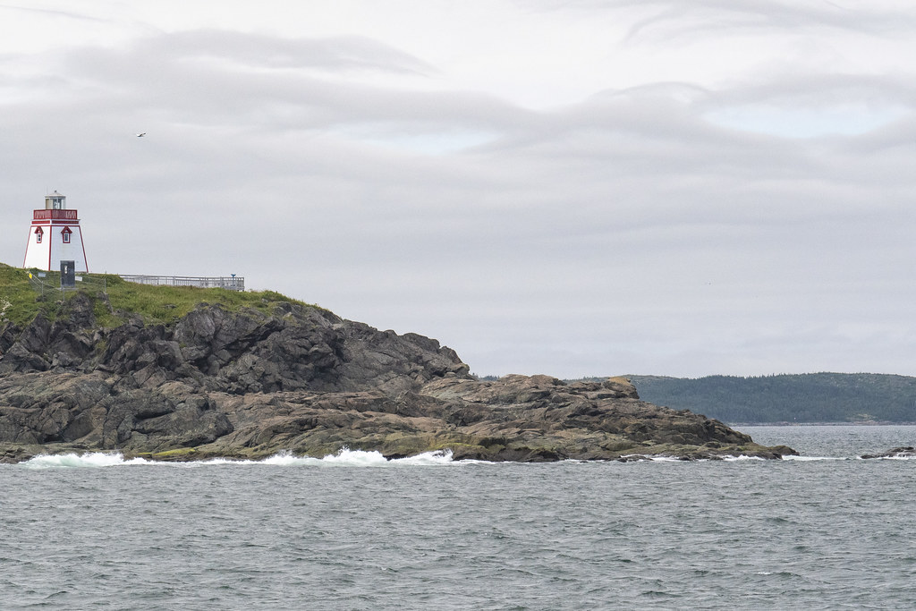
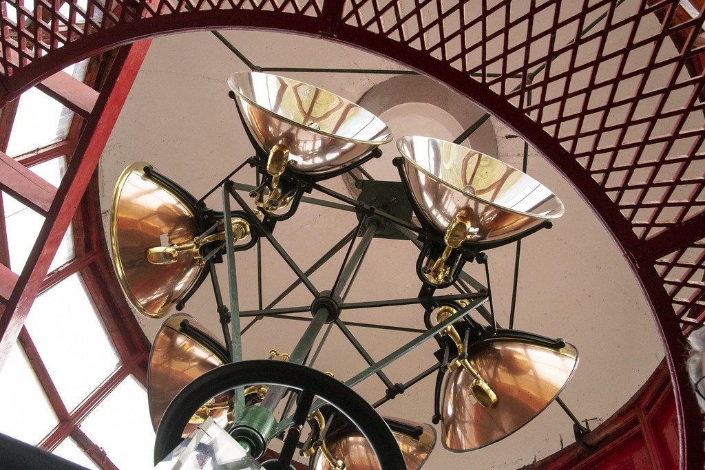
Woody Point Lighthouse
There is a Discovery Center at Woody Point. We learned throughout the trip that Moose Nose was a “thing” to eat in Nova Scotia and Newfoundland. Early settlers in Acadia ate Moose Nose Soup. I was happy to find a recipe at the Discovery Center on how to prepare a moose’s nose for a special family dinner.
Moose were common and natural on the mainland in Nova Scotia but were never on the island of Newfoundland until brought there around 1900. With no natural predators they have flourished and now outnumber the people of Newfoundland.
Above and Below: Gros Morne Mountain towers over all the local landscape.
Gros Morne looming behind the town of Rocky Harbor
Gros Morne from Lobster Cove Head Lighthouse
That’s it for Gros Morne National Park. If you get a chance to visit this awesome place, plan to spend at least a week here.
Our last night “on the rock” of Newfoundland we traveled to a campground near the ferry at Grand Codroy. The following morning we loaded back up on the ferry at Port aux Basque for the much shorter (5 hours) trip back to North Sydney, Nova Scotia.
While at Grand Codroy I tried some sketching and painting of the lighthouse we had seen at the beginning of our trip (Portland Head Light, Fort Williams Park, Maine)
A beaver, dragging a branch of pine tree upstream
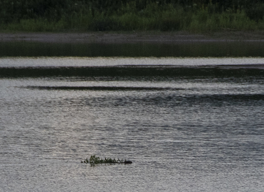
A parting sunset over the Grand Codroy River for our last night in Newfoundland
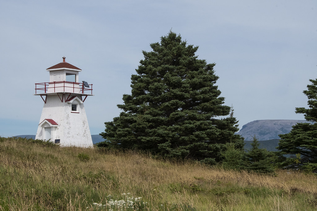
This lighthouse and lightkeepers residence were built in 1897 and are within Gros Morne National Park. It has a museum inside but it was closed when we visited. This place is remarkable. The views from the cliffs are spectacular and it is a great place to get down to the tidewater edges and experience tuckamore forests.
Becky walking down to the cove at low tide
Tuckamore Forest: Here’s a quote from Tuckamore.org “Tuckamores are trees that have been bent and sculpted by constant strong onshore winds. The salt spray kills exposed buds, so growth only occurs on the tree’s sheltered inland side. The shores of Gros Morne National Park in Northern Newfoundland are covered in thick, contorted tuckamore forests”.
We stayed in St. Anthony several nights. This was the place “farthest from home” of the trip. It is 2,271 miles from Indianapolis.
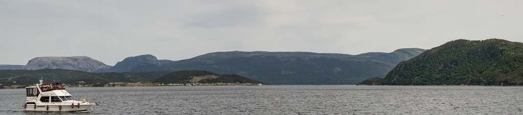
That’s Newfoundland coast in the foreground, and Labrador over on the other side. We traveled from Gros Morne National Park, up the western coast of Newfoundland to St. Anthony which is out near the northern tip of the island. The picture above was taken where Newfoundland and Labrador are closest together across the Strait of Belle Isle in the Gulf of St Lawrence – a distance of about 10 miles at it’s narrowest.
We took a boat tour to find a whale. It was a windy day and not a very big boat… it reminded me of the infamous “Minnow” as we headed out for a 3hr tour… hoping we would not be lost.
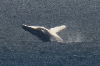
Thanks to our persistently searching Captain, and our fearless crew, we did see whales! The boat was bobbing wildly on the waves and this was a lucky shot.
Rugged Coast
Fox Point Lighthouse as we were returning back to dock at Northland Discovery Iceberg & Whale Tours.
Above: Fox Point Lighthouse and “Haul Up Cove”. There is a wonderful little restaurant near the lighthouse called “Lightkeepers Seafood”. We hung out there several times. We enjoyed the food and the Wi-Fi (which is hard to find in Newfoundland). There is also a nearby thing called the “Great Viking Feast”. We recommend avoiding that.
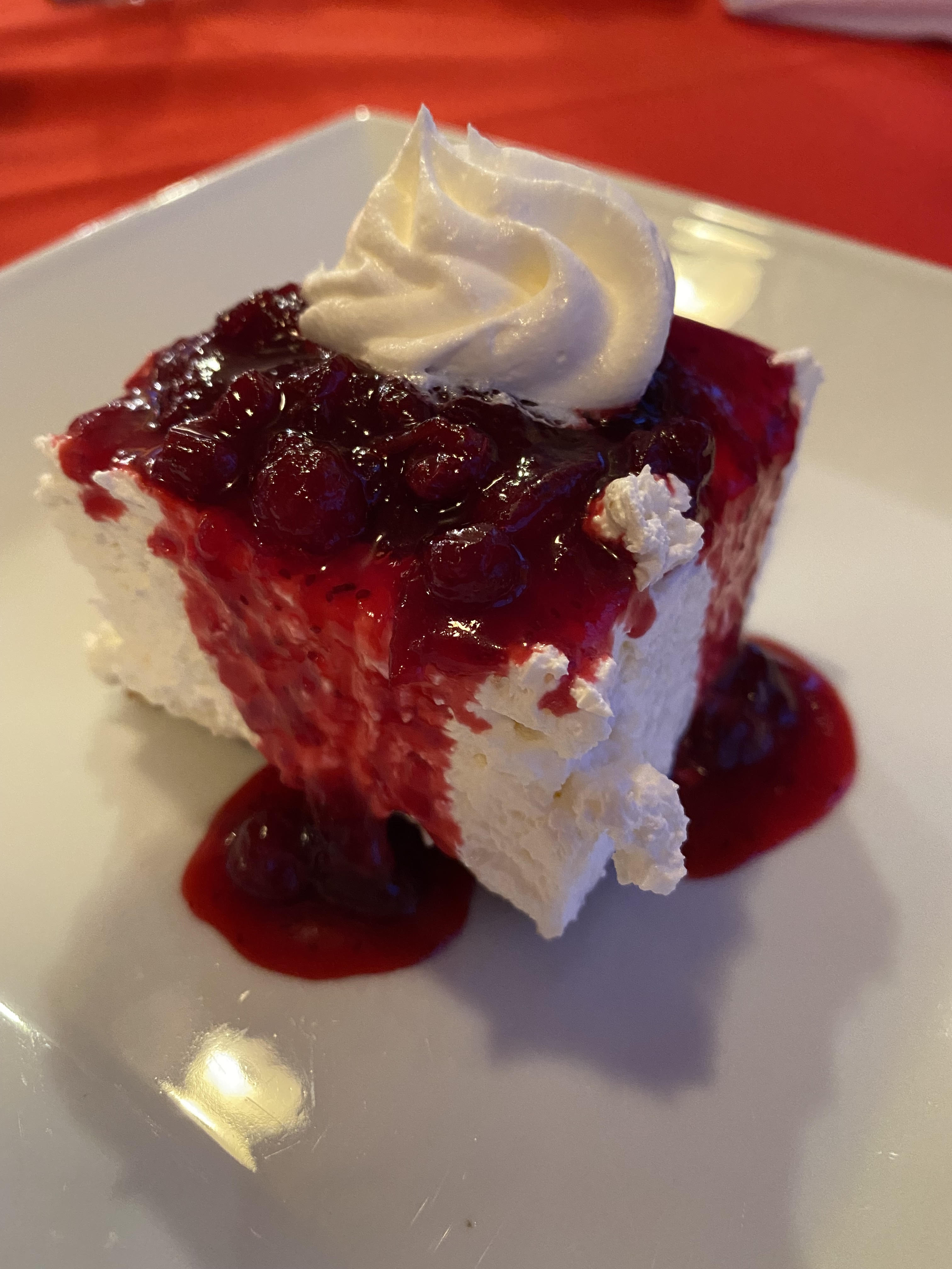
Above: Partridgeberry Cheesecake: Lightkeepers Seafood Restaurant. Trivia: Partridgeberry picking season was in full swing. Partridgeberries are the same as what other countries call “Lingonberries”. They are a relative of the cranberry but more mild. In Newfoundland, they grow in a low evergreen shrub in the dry acidic soils of Newfoundland and Labrador’s coastal barrens and headlands. Newfoundland and Labrador are the largest harvester of Partridge/Lingonberries in North America.
Fried Cod Tongue. I thought it was delicious. Didn’t get much help from the rest of the group. It is considered a Newfoundland delicacy. Also at Lightkeepers Seafood Restaurant. We really enjoyed this restaurant. We really did not enjoy the Great Viking Feast.
Below: Scenes from around the boat dock.
Above: Green coastal rocks
Below: Really far out from shore the whales were jumping way out of the water-looked like they were having a great time. These were taken from the little front porch of the Lightkeepers Seafood Restaurant where lots of visitors stood watching the whales play.
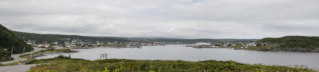
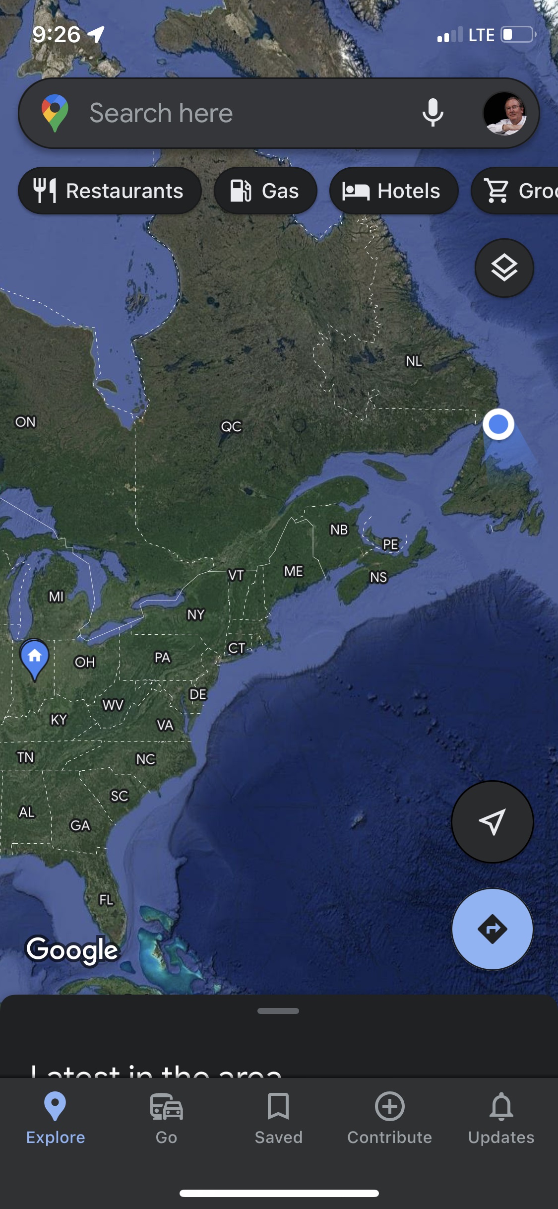
Panorama from Fox Point area looking back at town of St Anthony and Marguerite BayScreenshot of Google Maps location. 2,282 driving/ferry miles from home to L’Anse aux Meadows National Historic Site at the very northern tip of the peninsula was the next days visit.
Whale spouting (that little bit of mist in center)
Bad photo of a Whale’s Tale (but proof we saw them)
Panoramic view from Long’s Point Lighthouse
Newfoundland Scenes around Twillingate
We chartered a boat from “Captain Dave’s Boat Tours” and went Cod “fishing” (really “jigging”). Those are whale bones! Captain Dave himself skippered the boat (David Boyd). His family history is closely linked to Cod fishing and he is passionate to pass along the history.
Jellyfish at Captain Dave’s. Captain Dave’s is also the location of “Prime Birth Twillingate Fishery & Heritage Centre” which has an interesting museum of all things fishing…
Whale Baleen
This gentleman cleaned all the Cod for us
That bucket of gook is full of Cod Liver Oil. He was very good at fileting fish. Glad I didn’t have to do it.
We saw coastal scenes of rocks and seabirds while getting out to where we fished
We caught lots of Cod and one iridescently colored Mackerel
Twillingate was one of our favorite stops. The RV Park was on North Twillingate Island. It was an easy walk from the RV Park to the water at “Back Harbor”. Back Harbor faced west so we saw some beautiful sunsets. Back Harbor had the ubiquitous and iconic brightly colored “fishing rooms” around the harbor.
Twillingate is called “The Iceberg Capital of the World” because icebergs drift south on ocean currents from Greenland and Labrador. They often get “stuck” around Twillingate when their bottoms hit the shallower bays. We were too late in the summer to see icebergs (but we did see Humpback Whales). This post is about the area where we were camped. The next page will be about places nearby we traveled to on day trips.
Trivia: Twillingate residents must use extra caution in the spring because Polar Bears and Seals often arrive on the icebergs! Here is a link to a beautiful blog about Newfoundland: Seasons, Icebergs, Capelin, Whales, and Berries: https://newfoundsander.wordpress.com/icebergs/.
Sunset from Back Harbor, North Twillingate Island. I would walk over with morning coffee, sit and enjoy peacefulness
Roni & Becky watching me climb up the hill to get a panoramic picture of Back Harbor Bay.
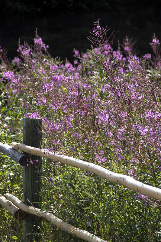
Lupin
Berries. Not sure what these are but there are low growing “bushes” (maybe 6″ high) growing all along the coastal areas. Blueberries were ripening when we were there. We had handfuls of fresh blueberries on several days.Blueberries – Newfoundland Style. Not like the big bushes in Indiana at all.
Rock with section of purple stone (possibly purple quartz?)
Lobster Traps, waiting for next season
Salt Box Home we walked past each day from RV Park to Back Harbor Bay.
I don’t have a photo but it’s worth mentioning the “Split Peas” at “Twillingate-New World Island Dinner Theatre”. The local ‘actors’ and fantastic musicians put on a hilarious show of all things Newfoundland’ish. We enjoyed it, the food was good too. https://vacationintheisles.com/dinnertheatre/
We’ll end this post with more sunset pics – We didn’t want to leave Twillingate…
The Town of Trinity on Trinity Bay. This town was not on the official ‘agenda’ for the caravan group but was a nice day trip.
Local Trivia: The smallpox vaccine was first introduced to North America in 1799 here in the little fishing village of Trinity by Rev. Dr. John Clinch. Dr. Edward Jenner discovered the vaccine and was a close boyhood friend of Clinch. Jenner had developed the first smallpox vaccine in England using a less dangerous virus derived from cowpox in 1796. Newfoundland was a British colony at the time and Clinch moved to Trinity. He began inoculating his own family then 700 villagers. When nearby Bonavista was being ravaged with smallpox, Trinity proved immune. About 3 years later the vaccine was introduced in the United States.
Gothic Revival: St. Paul’s Anglican Church
Above: Lester-Garland Premises (originally a fish processing station) which is now a local theatre called Rising Tide Theatre
Below: Many of the Salt Box style homes in Trinity are historically restored/preserved. We enjoyed the morning walking around town.
Fort Point Lighthouse
Leaving Trinity we had a nice lunch here at Port Rexton Brewing Company
Bonavista is one of the oldest towns in Newfoundland. “Discovered” (it would be better to say “claimed”) in 1497 by Italian explorer John Cabot (Giovanni Caboto).
Cape Bonavista Lighthouse 1843 is one of the oldest in Newfoundland
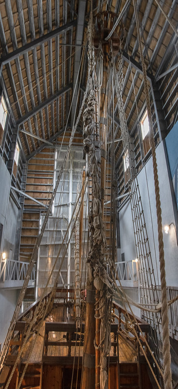
A replica of John Cabot’s ship; “Matthew” is housed in the tall blue building for repairs and over winter. Inside the building, there is a history exhibit called “The Matthew Legacy”
The Matthew
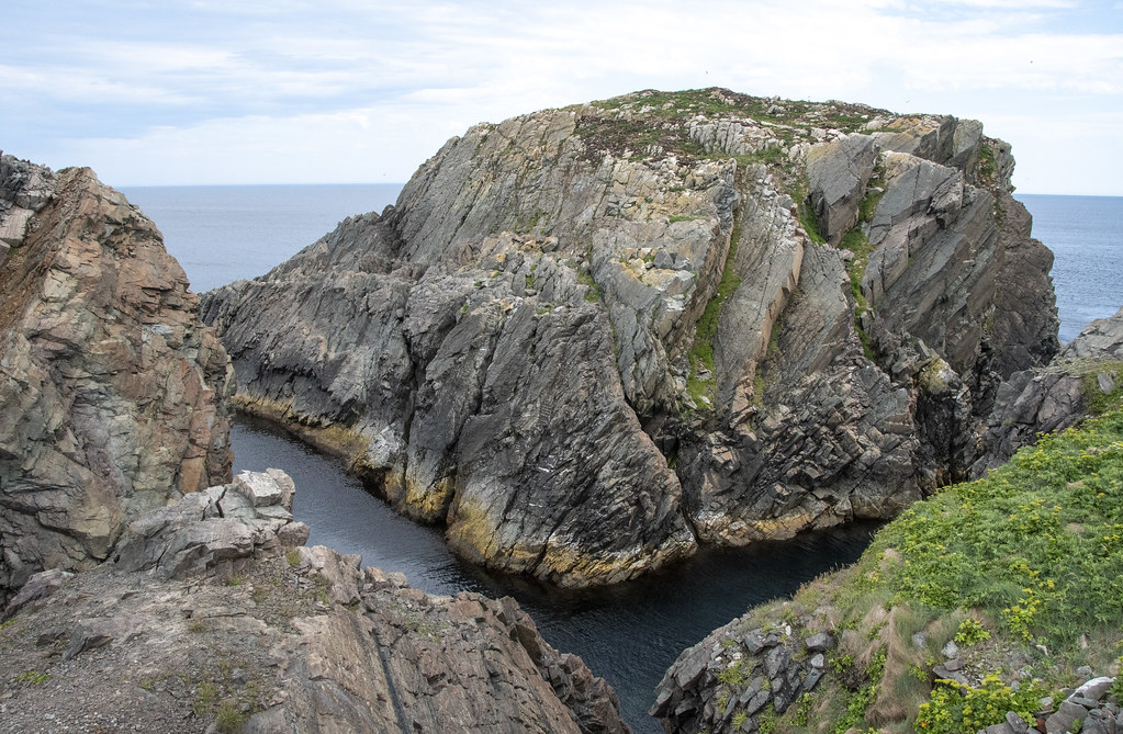
This is “The Dungeon” at Dungeon Provincial State Park. It is a huge collapsed sea cave (called a “gloup”). Clear greenish-blue seawater sloshes in and out of this hole through two archways to the Atlantic. For scale, there are a couple people on the path at upper right.
One of the great things about Newfoundland is that is is still very ‘natural’. There is a dirt road and a gravel parking lot to this natural wonder. There are no guardrails or concession stands or other developments to distract from the moment and just enjoying ‘being there’. We found this to be the case throughout Newfoundland and enjoyed it very much.
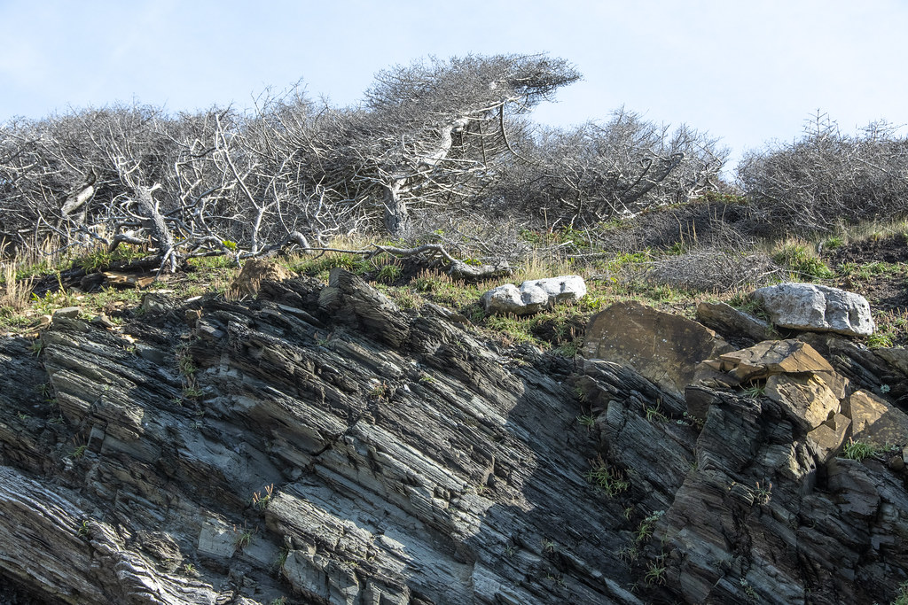
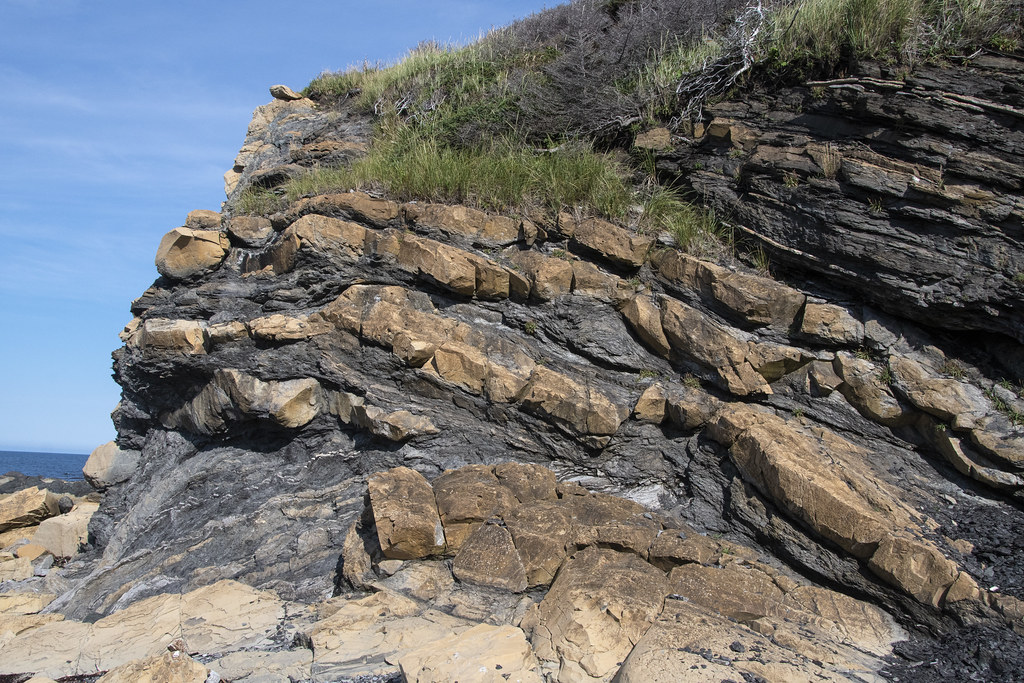
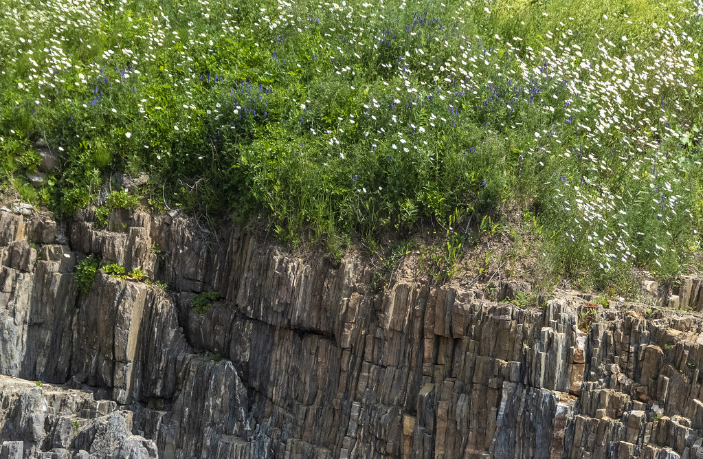
Colorful, enormous, slabs of rock tilted on edge were a common sight in Newfoundland
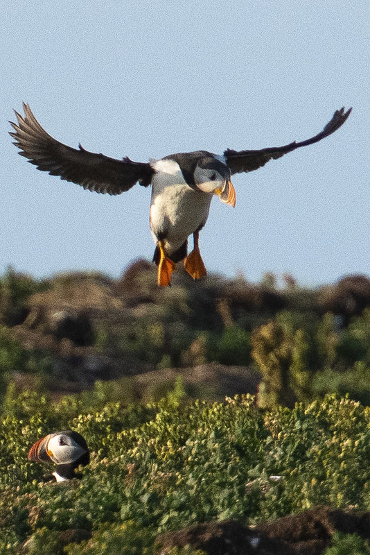
Each evening we went to see the nesting puffins at “Ellison Puffin Sanctuary & Root Cellars”. They nest on islands just off the coast.
We visited the Catalina area and enjoyed a walk along a rugged area of Atlantic Coast. Catalina is on the Bonavista Peninsula which is unique for being relatively flat; without cliffs along the shore. When we arrived there was a thick mist coming in and almost a whiteout situation. We walked on narrow paths through a low, mossy/spongy carpet of berries, grasses, and wildflowers.
Manuel Island Lighthouse. A tiny lighthouse on a tiny island in the harbour
Where the moose outnumber the people; they take moose-plows seriously
Roni, Jennie, and Becky; walking in the mist rolling off the Atlantic
Catalina is a ‘working’ fishing town. Not very touristy which was refreshing
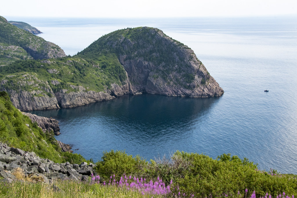
Cape Spear is the ‘easternmost’ point of land in North America. The sun comes up here long before it comes up at the much advertised Acadia National Park, Cadillac Mountain, Maine. It’s difficult to tell how much earlier because Newfoundland is in a different time zone 1-1/2 hours earlier than “Eastern Time”. Most of Canadian Maritime Provinces are 1 hour earlier than Eastern but Newfoundland gets another 1/2 hour earlier.
The Original (now inactive) Cape Spear Lighthouse – 1836
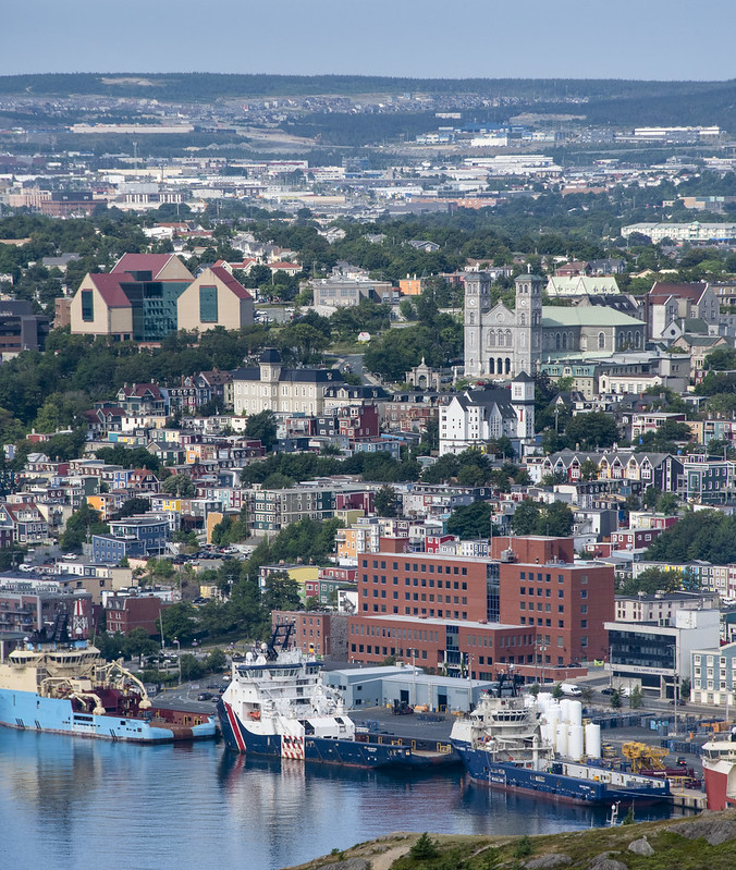
For a sense of scale; this photo is taken from Cape Spear, looking back northwest toward the St. John’s Harbor entrance. That bump on top of Signal Hill is Cabot Tower and the white dot below and left of the tower is the Amherst Lighthouse.
Above: Clear water and rugged coastline. Locals told us this was one of the most calm Atlantic waters they had ever seen. Below: The nearby “New” (active) Cape Spear Lighthouse was built in 1955.
Looking Down: I enjoyed sitting on the edge of the easternmost cliff of North America. It was a long, long, long, way down and very windy but the breeze was blowing UP the cliff. It was fun to watch seabirds flying along below. Photos just don’t begin to capture the feeling of being there.
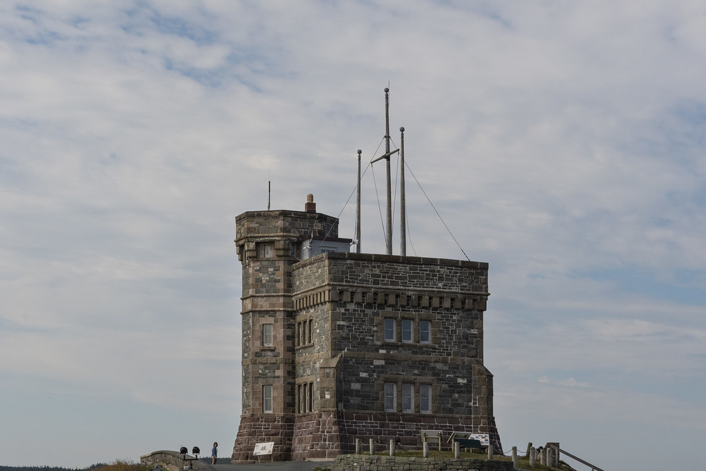
Our first stop was Cabot Tower on Signal Hill: There are many interesting things about this hill and iconic bit of Architecture. One is that this spot is where Guglielmo Marconi received the first trans-Atlantic wireless signal from Cornwall, England in 1901
Cabot Tower
How the Architect drew it…
How it got built…
The world with St. John’s at it’s center. At this point we were as close to Ireland as Indianapolis.
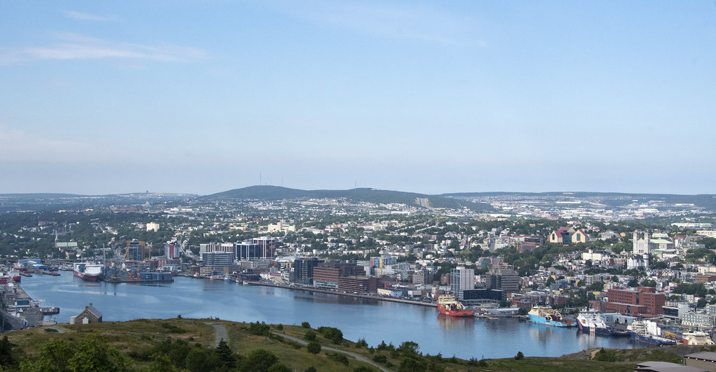
Looking down on the entrance to St. John’s Harbor, called “the Narrows”. The Amherst Lighthouse on top of the outcropping is built on some of the old foundations of Fort Amherst below. Here’s a link to some interesting history; https://www.hiddennewfoundland.ca/fort-amherst–chain-rock
Zoomed in on St. John’s downtown and Harbor. Upper left building is “The Rooms” built to house St. John’s art and culture exhibits. It is an oversized version of traditional “fishing rooms” which is what Newfoundlander’s called the colorful sheds along waterlines. They are brightly colored so fishermen can find them in the fog.
Petty Harbor
Petty Harbor. Newfoundland scenes like this were to become typical as we traveled for the next 30 days around the island.
“Moose Madness” Moose Sausage, Ground Moose Meat and Moose Gravy on chips (fries) at Chafe’s Landing Restaurant in Petty Harbor.
We visited Peggy’s Cove, Swissair Flight 111 Memorial, and the “Titanic Cemetery” (Fairview Lawn)
Peggy’s Point Lighthouse
Goofy pic of Duane and Becky with desserts at Peggy’s Cove “Sou’Wester Gift & Restaurant Company”. It’s a tourist trap but the meal was part of the Adventure Caravan package. The bolo tie strings we are wearing are the Adventure Caravan name tags we had to wear for admission.
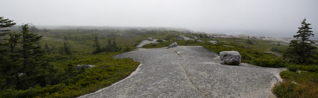
Swissair Flight 111 Memorial. This was a sobering stop on the way to visit Peggy’s Cove. The morning weather was cool and foggy; a dreamlike setting memorializing the loss of 229 lives on September 2, 1998. The flat face of the memorial is aligned with where the plane crashed about 5 miles offshore.
The landscape that we walked through to get to the memorial included wide areas of smooth stone and stunted/dwarf sized pine trees trying to survive the harsh Atlantic weather.
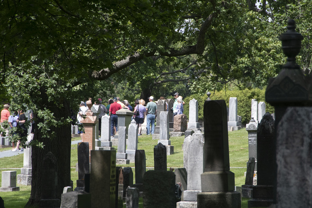
We visited Fairview Lawn Cemetery in Halifax. 121 victims of HMS Titanic are buried here.
The Acadian Historic Village was an interesting visit and rather picturesque. I don’t have much to say about this stop so I’ll just leave it at pictures. The history of the Acadians is interesting and rather tragic. You can read about it here if interested: https://en.wikipedia.org/wiki/History_of_the_Acadians