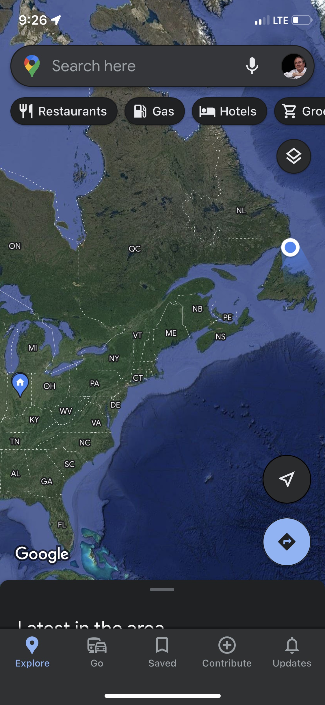
Seven years ago (2016), while Becky and I were still working, we flew to Spokane, WA. for a whirlwind visit to Glacier National Park and the Canadian Rockies. We met up with Becky’s sisters Jennie and Deanne and Jennie’s partner Roni. That trip was breathtakingly majestic. We all wanted to go back someday. This more leisurely trip with our friends John and Pam Hanson was to be “the longed-for relaxing return visit.” The main goal was to enjoy an extended, unhurried time in the beautiful Jasper (#11 on the map), Kootenay (#12), and Banff areas (#13).
This was the Route map we planned for this trip. We left August 20 and planned to return October 15. We followed the plan up to stop #11 at Jasper National Park. The map below shows the route we took home.The trip to Jasper was as planned up to Jasper National Park (where we were staying at Hinton KOA – #11 on the map). However, after 20 days, including five days at Jasper National Park, we got the terrible news that our son Daniel had died. We left John and Pam and headed straight home to Indianapolis from Jasper; as fast as we could. This revised map shows what we actually did and the sad, anxious 4 day trip back home to family and friends. There is so much that could be said, so many thoughts and prayers on that day and the days since; so much tension between ‘we don’t want to think about it’ and ‘we don’t want to forget’. It has taken so long to get back to this post that many things are jumbled and forgotten. But, up to that point, it had been a good trip with memories we do not want to forget so what follows are photos and memories of the first 20 days.
Part 1 – FROM INDY TO JASPER NATIONAL PARK
First stop – Indiana Dunes National Park/State Park (the campground and nearby areas are a State Park within the larger National Park). This was a stop we added at the last minute when we learned that our friends Bob and Lisa were going to be there and we could visit with them. I was looking forward to visiting Indiana Dunes. I thought I would enjoy lots of memories and ‘Deja-vu’ moments from childhood family weekend visits and camping trips in the sandy campground. Turns out I was wrong. My memories were from the Michigan “Tower Hill” Warren Dunes State Park which is closer to South Bend where I grew up. We stopped on our way to the campground at the National Park Visitors Center to get the stamp for one of America’s newest National Parks. We enjoyed the day and discovered a park I had absolutely no memories of. Unfortunately, on Monday night I began to feel poorly. Tuesday morning I tested for covid and was negative. Two days later I would test positive for covid. The weather started to really get hot so we looked forward to quickly getting further north and cooler temps. To finish the covid saga of the next two weeks; I got it, then when I started feeling better, Becky got it. Providentially, we were both over it by the time we met up with John and Pam in Canada.
Monday, August 21, 2023. All road trips seem to start with a stop at Walmart. In northern Indiana Amish country that includes a horse and buggy with railing to tie-up on.
It was going to be a really hot day so first thing Tuesday morning we went for a walk to the beach with Bob. We followed the “Beach Trail” from the campground to the beach.
Arriving from the trail this is the first view of the beach area. If I had ever seen this before I had completely forgotten.
This building, called The Dunes Pavilion, was originally a bathhouse with a restaurant, concessions, and a rooftop observation deck. It was built in 1929 for $100,000. The history of the “Dunes” area is interesting as the shoreline has been jerked back and forth between industrialization (think Gary steel mills) and conservation. Back in 1899, Stephen Mather, first envisioned a “Sand Dunes National Park” but it took 120 years for it to happen. Indiana Dunes received National Park designation in 2020 as the 61st National Park and the 1st National Park in Indiana.
Propeller from steamship that sank nearby in 1911
J.D. Marshall steamship signage
Becky and Bob exploring the Beach and Dunes
In the foreground is “Dunes Creek” which flows through the campground and out into Lake Michigan. In the background is the restored “Dunes Pavilion”. After our morning walk we went back to the campground, had lunch, and packed up at our campsite #119. We said goodbyes to Bob & Lisa then left early afternoon for Ludington, MI where it was about 10 degrees cooler.
The steep steps down to Lake Michigan from Buttersville Campground in Ludington, MI. We saw some colorful reddish sunsets from this campground which we later figured out were mostly due to the beginning stages of Canadian wildfire smoke in the air. The smoky air would get much worse as we traveled further north.Sunset over Lake Michigan.
Leaving Ludington we headed north, crossing Mackinac Bridge to the Upper Peninsula. No photos but we stayed one night at Fayette Historic State Park, and another night at Frontier Bar & Campground. The UP of Michigan is deeply wooded and beautiful to drive through. We especially enjoyed passing through the town of Escanaba.
Becky driving. She took over as I was feeling pretty sick at this point.
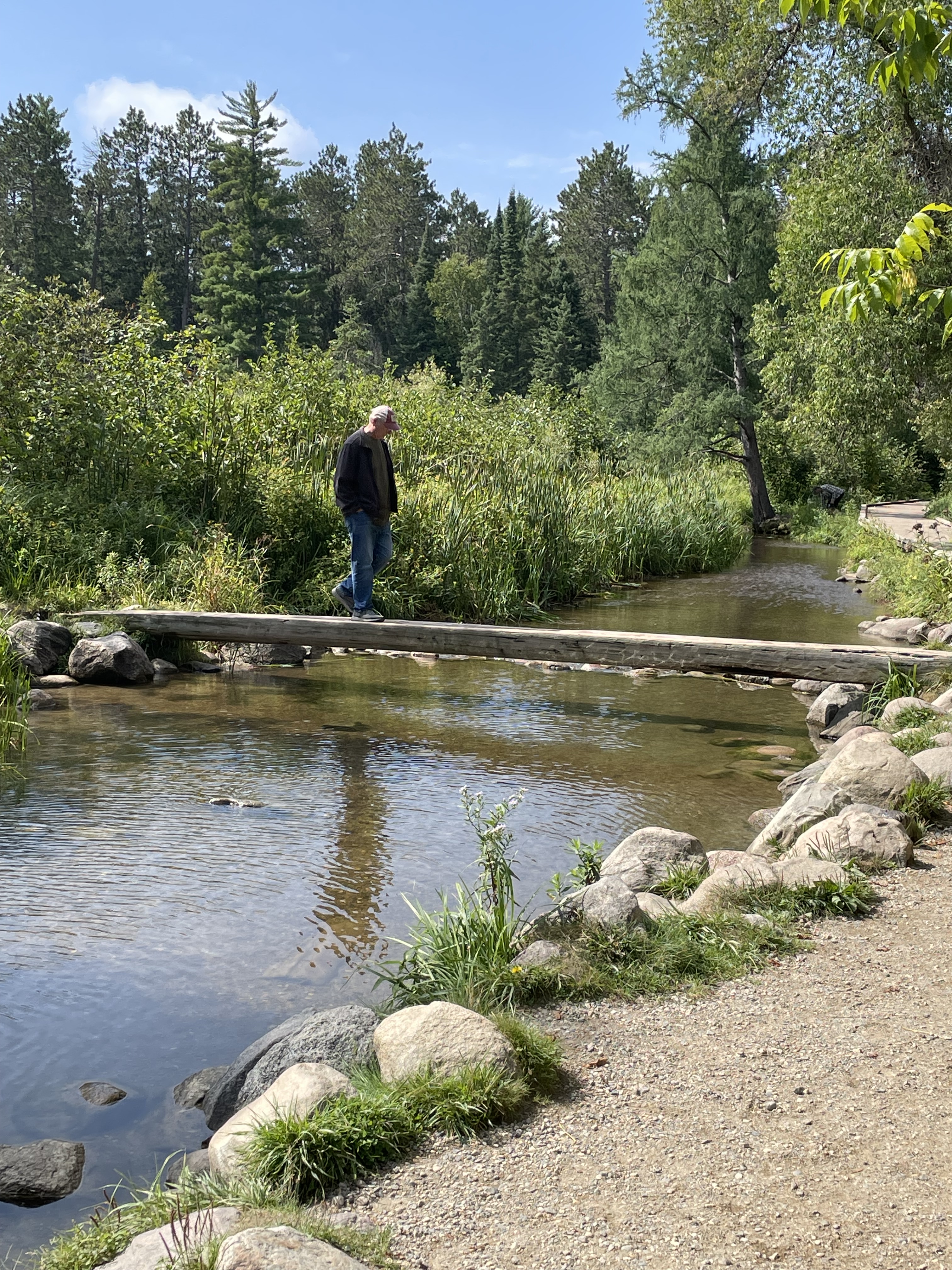
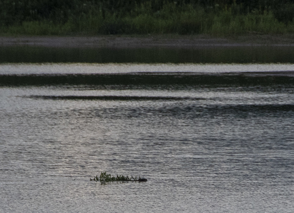
Saturday, August 26 we arrived at Itasca State Park, Minnesota. This is the shallow stream exiting the lake where Lake Itasca becomes the headwaters of the Mississippi River. Hard to imagine this little stream eventually drains 40% of the continental United States (all or part of 31 States).I walked across the Mississippi on a log.
The 1783 Treaty of Paris (signed by Benjamin Franklin, John Adams, etc.) included establishment of the Northwest Territories described as all the land east of the Mississippi River. As the river gets bigger and well defined that’s easy but at the northern end in Minnesota it was hardly clear but very important.
Not a National Park – so not an official NPS stamp – but in my mind a unique State Park with an interesting historical story. After one night at Itasca we went to nearby Bemidji KOA for two nights where we made last minute preparation to cross into Canada and meet up with John & Pam at Winnipeg West KOA. We did laundry and ate meals to use up things we couldn’t bring across the boarder like eggs, chicken, fruits, and vegetables.
Winnipeg West KOA bathrooms
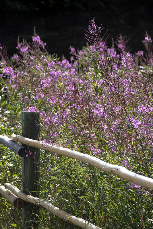
Flowers outside the bathrooms
The land of Ketchup potato chips
Screen capture from my phone showing all the wildfires around where we were heading (Jasper and Banff National Parks are north and west of Calgary on the map). There were no fires directly in the areas we were going but they were all around.
Our motorhome and John & Pam’s travel trailer side-by-side at a rest stop.
River Valley RV Park in Langham, Saskatchewan. This was a really nice stop that we wished we could have stayed another day to enjoy. Beautifully well kept and clean. The only downside was the wildfire smoke was getting really thick so we stayed mostly inside.
Reddish sun seen through dense wildfire smoke.
Doing our part to reduce the Canadian insect population…
Rapeseed fields were abundant in Canada. A genetically modified version of this plant is where Canola oil comes from.
I was reading this book as we traveled. I am convinced this was Providential as it helped prepare my heart to receive news of Daniel’s death.
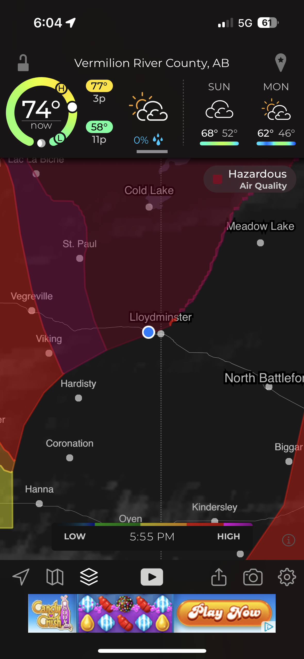
Our last stop before Hinton was “Camp N RV” in Lloydminster. This picture from my phone shows the worst air quality of “Hazardous” that we encountered.
Reddish smoky sky sunset as we arrived at Hinton KOA.
Part 2 – JASPER NATIONAL PARK
Jasper Day 1 – Old Fort Point and Five Lakes Hike
Becky was feeling better but wanted to wait one more day to be certain of not exposing John and Pam to covid. She stayed behind on this first day trip from Hinton KOA into Jasper National Park. The air was still smoky from wild fires but clearer then it had been on the trip into Hinton. The drive each day from Hinton into Jasper National Park (and back) took about an hour but each day the scenery was different and we almost always saw some beautiful sites and lots of wildlife.
The first drive into Jasper resulted in this beautiful bull elk standing majestically along the roadside.
Elk bull and cow showing off for the tourists.
The tourists all stop for the majestic wildlife. The locals get aggravated…
Mountain Goats
We saw Bighorn Sheep on the drive into Jasper. After stopping at the Visitors Center in Jasper and getting some advice on things to see and places to hike we started out to hike to an overlook called Old Fort Point (there was never a fort there).
Stairs at the beginning of hike up to Old Fort Point.
We hiked most of the way up and admired the smoky view of the Athabasca river valley and town of Jasper below. Pam and I were content to stop here but John needed to get to the top so he headed on up. When he came back down I met him and he asked “Where’s Pam?” Seeing she was not where she had been sitting and getting no response to calling out for her, John thought she might have headed up to find him. He hurried up looking for her and I headed down looking for her. Turned out she was just over the hill a little further down so after a bit of panic it all worked out. In that photo: nearly all of the trees in the valley and part of the town of Jasper were burned away in the wildfires summer of 2024.
This is looking up to the top of the overlook. I think that is John talking with a couple other people he met up there. The elevation gain from the bottom of the valley at the stairs to the top is 130 meters (426 feet).
John and Pam reunited and relieved. The next two pics (below) were from across the valley a few days later. They show the ‘hump’ where Pam and I stopped and the top of the overlook where John reached the peak.
Old Fort Point Overlook
Our next stop was the Valley of Five Lakes. We hiked the 9a/9b short loop.
John and Pam taking a break at one of Canada’s “Red Adirondack Chair” scenic locations.
Clear and beautiful lakes.
The lakes are still there but from what I read online the lakes are now muddy and the trees are all burned away after the summer of wildfires in 2024. Grateful to God that we were able to visit Jasper again before the fires.
We saw Bighorn Sheep on our drive back to Hinton.
Jasper Day 2 – Maligne Canyon and Maligne Lake
We were grateful that Becky was with us and the air was less smoky so we could enjoy the Beautiful Mountains and wildlife on the 2nd day.
Up close with Bighorn Sheep.
We really enjoyed Maligne Canyon. This is at the beginning of the canyon where the water is starting to carve down into the rock in smooth pools and eddies.
The next 4 photos show where swirling rocks and water have worn away smooth ‘pot holes’
The canyon hike is beautiful as the water cuts deeper down in waterfalls, sluices, and whirlpools. A series of bridges cross the river. Becky and I hiked to bridge #2 then turned around and returned to the van while John & Pam continued on to bridge #5 where we picked them up.
The name Maligne comes from the French word for ‘wicked’ or ‘evil’. While the English verb maligne is pronounced ‘muh-LINE’, the local Jasper pronunciation of the canyon’s name is ‘muh-LEEN’
Panorama shot stitched together from 10 photos.
View from the “5th Bridge” where we picked up John & Pam.
It had snowed on the mountaintops overnight which just increased the majesty of the surrounding peaks.
Maligne Lake. Becky and I enjoyed the gift shop and restaurant while John & Pam went for a hike.
A storm rolled in and rain started just as they got back from the hike.
Historic Boat House. The Boat House survived the fires of 2024 but much of the surrounding trees and infrastructure did not.
Not sure what bird this is in the bushes by the Boat House but the ‘birder’ lady that pointed it out to me seemed pretty excited about it.
John was driving and said “what else do you want to see?” I said “moose.” A little further down the road John pulls over and says “there you go”…
Mama Moose nursing Baby Moose.
Saw more Elk on the way back through Jasper while returning to Hinton KOA for the night.
King of the road
Jasper Day 3–Athabasca Falls and Sunwapta Falls
More snow during the night on the mountaintops
Saw more Elk along the road coming into the Park.
Athabasca Falls
Incredible amount of water pouring down the canyon.
Tourists
To be so close, to feel the rock foundations vibrate.
And we saw Bears. Up close, probably too close, but they seemed more interested in grazing on leafy greens.
Sunwapta Falls
Sunwapta Falls (means “Turbulent Waters”) is a series of cascading waterfalls.
Jasper Day 4 – Mt. Edith Cavell
The hike from the parking lot is long, steep, and beautiful. A stream follows the path part of the way. Eventually the trees become little short stunted pines above the tree line elevation.
Mount Edith Cavell (3,300 meters=10,800 feet) and Angel Glacier.
Mount Edith Cavell is named after a British nurse executed during World War I for her part in helping Allied prisoners escape occupied Brussels.
Photos below from our visit in summer 2016 compared to 2023.
August 23, 2016
September 7, 2023
Annual lines in glacial ice.
Below: John making careful rock selections (notice the distended pockets) and posing by high elevation pine tree.
John taking a moment to enjoy the mountain views
Stream of meltwater from Angel Glacier
Melting Angel Glacier Waterfalls
We stopped to see a mountainside with lots of bighorn sheep.
A Canadian military plane surprised us as it flew low through the valley on our return trip to Hinton.
Our campsite at Hinton KOA as we prepared to say goodbye to Hanson’s and head home.
Our last drive of the trip as we headed home was back through Jasper National Park and on down the Icefields Parkway, past the Athabasca Glacier, and Banff National Park.
A little post-trip travel analysis: This is all based on only our RV mileage (we traveled lots of other miles in Jasper NP with John & Pam in their van). 4,636 miles according to RVparky route, 4,691 actual miles. 436.25 gallons of gas. Cost – $1,761.77 for average cost/gal $4.04 10.75 miles/gal 22 nights/23 days total = average of 204 miles/day 13 different overnight places/14 days of traveling = 335 average miles per travel day Our longest Travel Days were the days coming home: 1st day: 638 miles from Hinton, British Columbia to Ponderosa Campground, Swift Current, Saskatchewan 2nd day: 362 miles to Old Settlers Park in Burlington, ND (includes border crossing) 3rd day: 623 miles to Stoney Creek RV Resort, Osseo, WI 4th day: 530 miles to Home = 2,153 miles home.
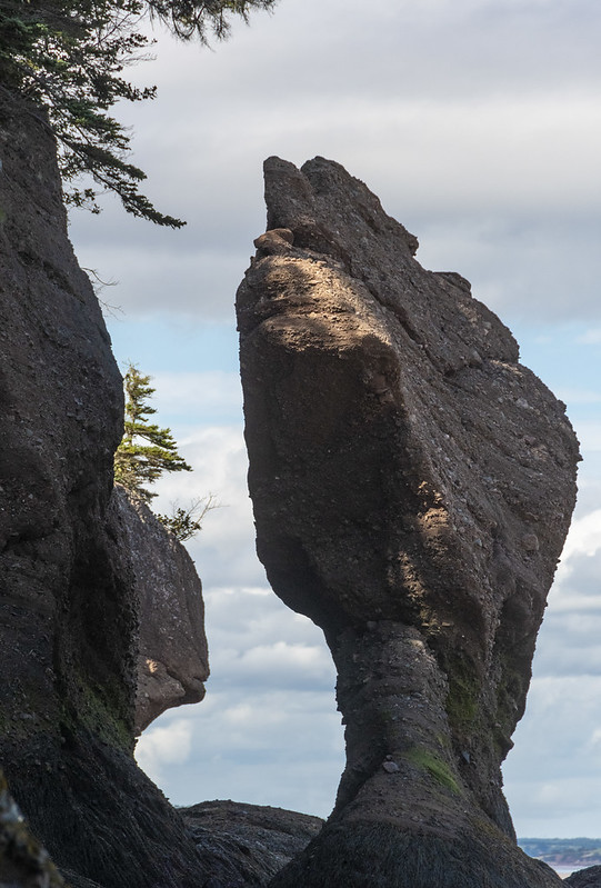
These are sometimes called “Flowerpot Rocks” or “Sea Stacks”. We arrived at Hopewell Rocks on an afternoon when the tide was in (up). After spending the night nearby we returned again in the morning when the tide was out. Tides vary daily but there can be as much as a 52′ difference in the water level from tides in the Bay of Fundy area.
View from our campsite – there were more than a few mosquitoes here
Flowers at Hopewell Rocks and at entrance to our campground
Tide IN
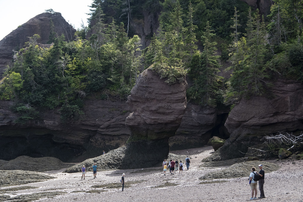
Tide OUT (mostly, this was not full lowest tide)
It’s an odd feeling walking around where you know in a few hours the tide will come back and submerge everything. This happens twice a day (in/out, in/out every 24hrs) so it’s relatively rapid; you can stand and watch the water level change.
Jennie & Roni
Me
When the tide is out, it is Way Out
Kayakers heading out as the tide comes in far enough to float them
That’s all the photos for this trip. We went from Hopewell Rocks to St. John, New Brunswick for the tour “dismount” festivities. However, more than a few of the group had Covid at that point so we said our goodbyes and headed for home.
On our last day in Gros Morne National Park we visited the town of Norris Point and we drove around the East and South “Arms” of Bonne Bay to the towns of Bonne Bay and Woody Point. The photo below is from a little roadside gift shop along the way to Norris Point. The foreground is a hedge of rose hips, Bonne Bay in the middle and Tablelands in the background.
A kinetic whirligig sculpture commissioned in 1997 for Gros Morne National Park as part of the Canada 150 Celebration. It is located at the same gift shop. Sculpture originally had movement but tough Newfoundland weather has taken it’s toll… Scenes of local nature, including giant mosquitoes.
The Bakery: We were told there was a bakery we should not miss in Norris Point. We found the bakery and got some fresh rolls. It is the most “Newfoundland’ish” store. This homemade sign hung above the checkout counter. It’s not a joke. It’s just an honest declaration of business hours in the local way of speaking. The place to visit is “C&J Rumbolt Ltd”. It doesn’t look like much on the outside. Go in the door that says “Rumbolt’s Bakery”, you won’t be disappointed. Surprised maybe, but not disappointed.
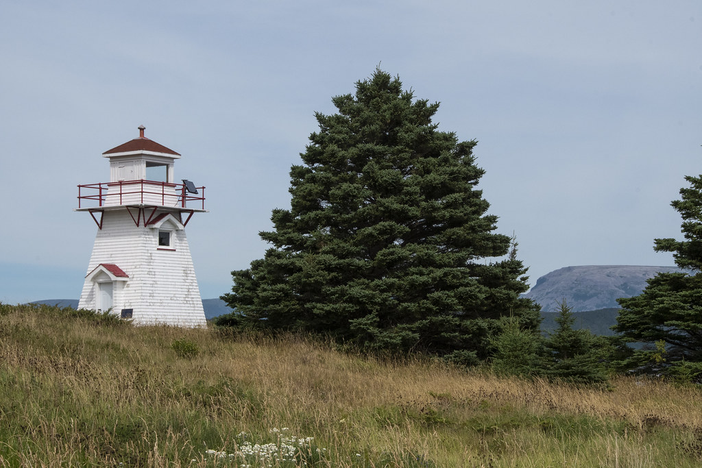
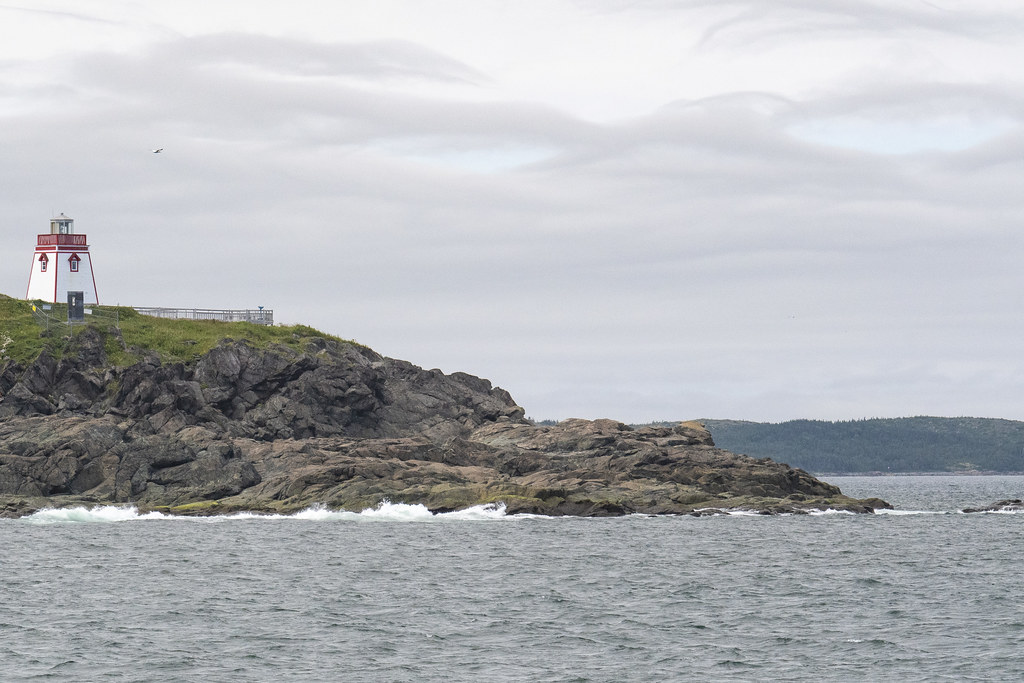
Woody Point Lighthouse
There is a Discovery Center at Woody Point. We learned throughout the trip that Moose Nose was a “thing” to eat in Nova Scotia and Newfoundland. Early settlers in Acadia ate Moose Nose Soup. I was happy to find a recipe at the Discovery Center on how to prepare a moose’s nose for a special family dinner.
Moose were common and natural on the mainland in Nova Scotia but were never on the island of Newfoundland until brought there around 1900. With no natural predators they have flourished and now outnumber the people of Newfoundland.
Above and Below: Gros Morne Mountain towers over all the local landscape.
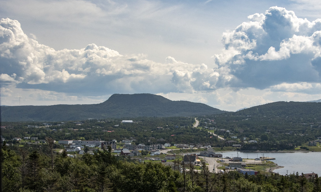
Gros Morne looming behind the town of Rocky Harbor
Gros Morne from Lobster Cove Head Lighthouse
That’s it for Gros Morne National Park. If you get a chance to visit this awesome place, plan to spend at least a week here.
Our last night “on the rock” of Newfoundland we traveled to a campground near the ferry at Grand Codroy. The following morning we loaded back up on the ferry at Port aux Basque for the much shorter (5 hours) trip back to North Sydney, Nova Scotia.
While at Grand Codroy I tried some sketching and painting of the lighthouse we had seen at the beginning of our trip (Portland Head Light, Fort Williams Park, Maine)
A beaver, dragging a branch of pine tree upstream
A parting sunset over the Grand Codroy River for our last night in Newfoundland
We headed back south to Gros Morne. Then we made some day trip visits in and around the park.
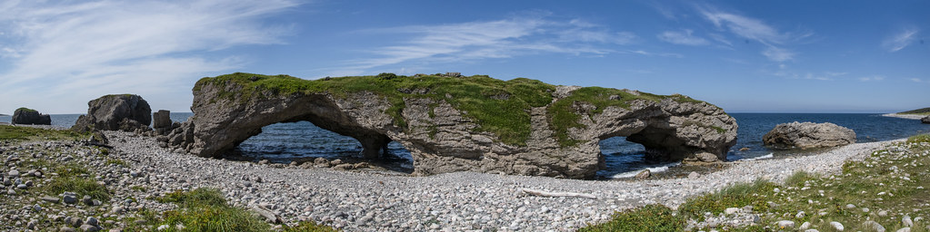
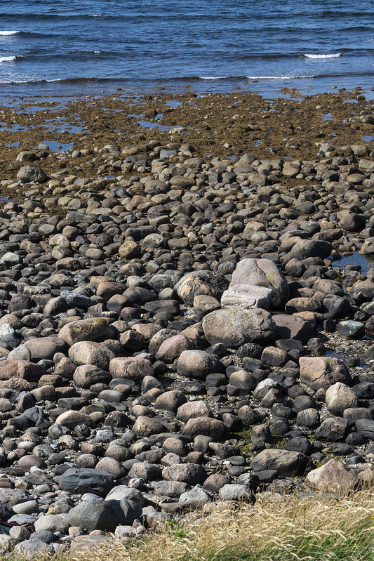
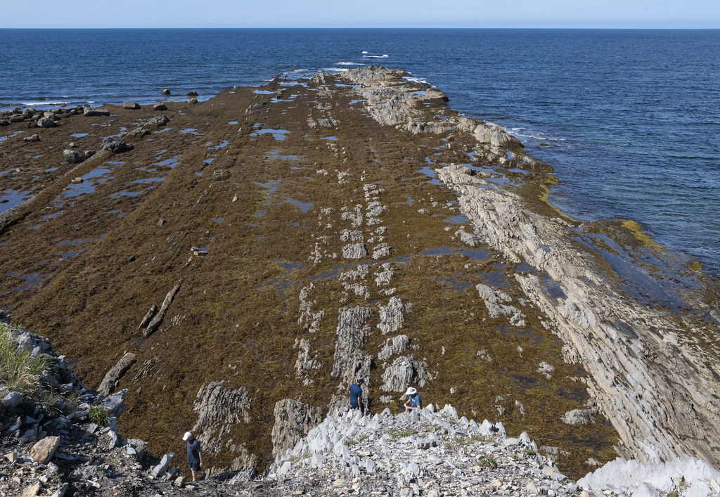
The Arches Provincial Park. A curious rock formation made of dolomite. The rounded boulders that make up the ‘seashore’ were hard to walk on but beautiful.
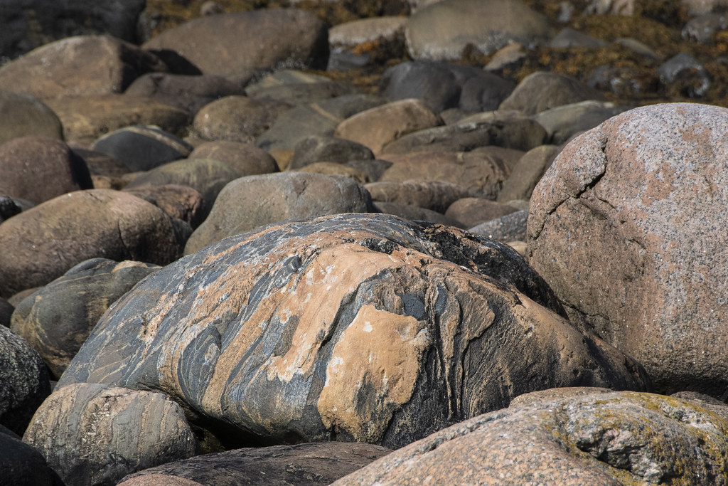
Beautiful rounded boulders on the beach. Too big to bring home…
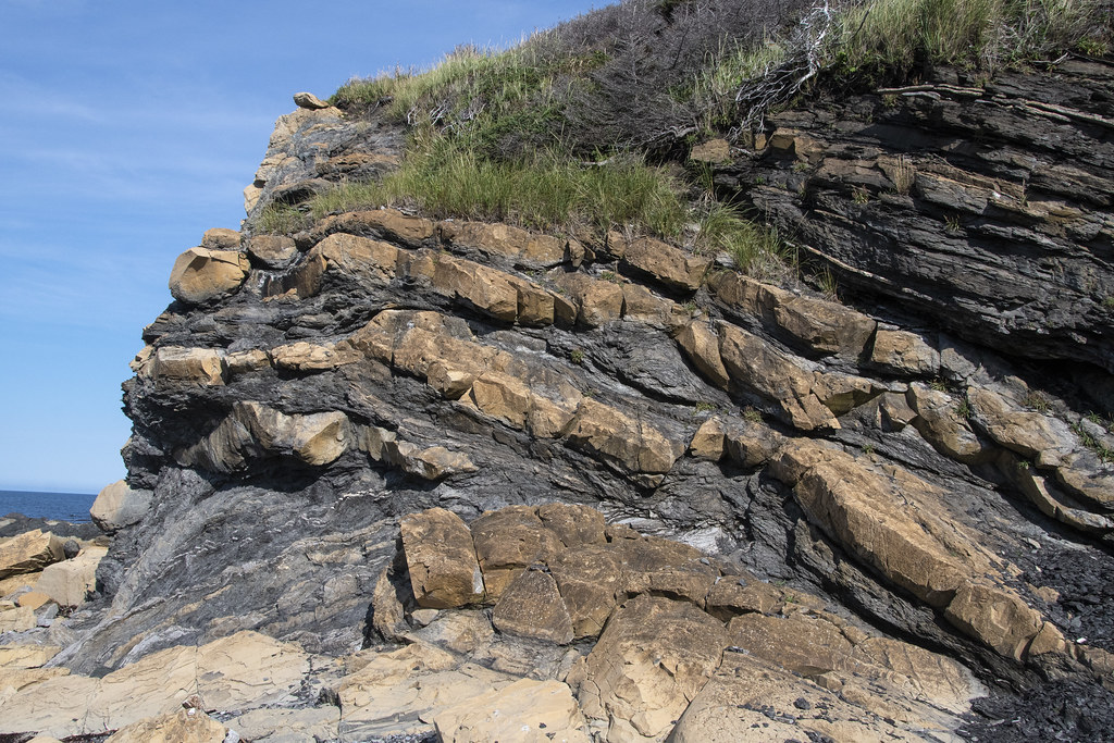
This is the area called “Green Point Geological Site” (that spit of land jutting out in the background). It is part of Gros Morne National Park and is considered a “World Geological Benchmark”. Fossils discovered here define the boundary between the Cambrian and Ordovician periods.
Below: Beach Boulders and Jennie in a Canadian Red Adirondack Chair. “Parks Canada has placed over 200 red Adirondack chairs in peaceful and scenic locations throughout many of the country’s most unique and treasured places”
The view of Green Point from Jennie’s chair
Looking down from the edge
Lobster traps along the coast at Green Point. Labrador is across the water.
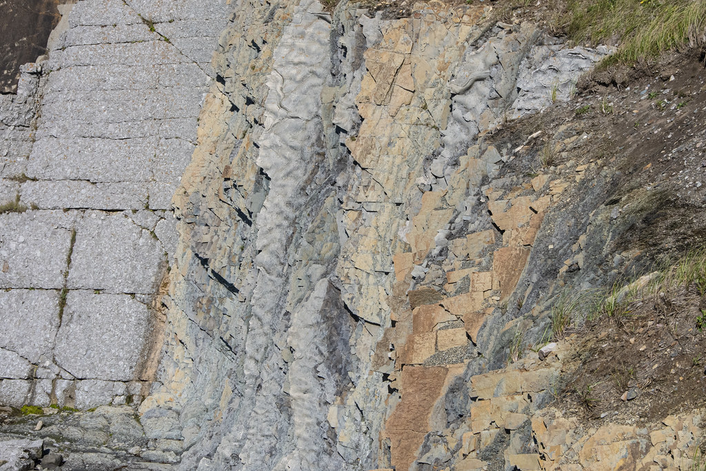
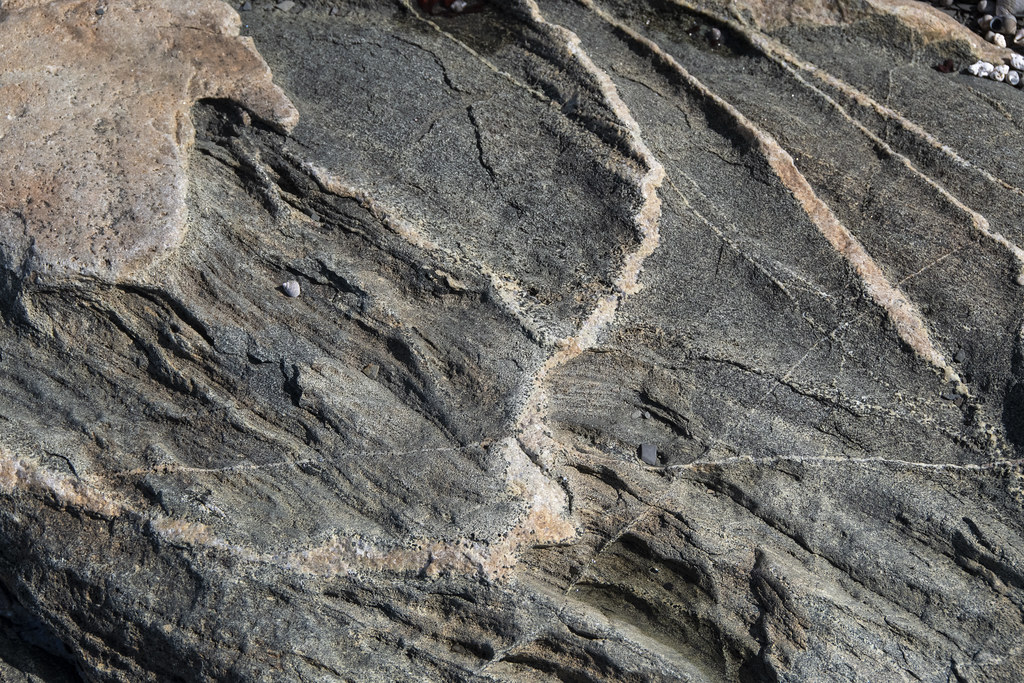
Colorful, Interesting Rocks. Maybe I should have been a geologist…
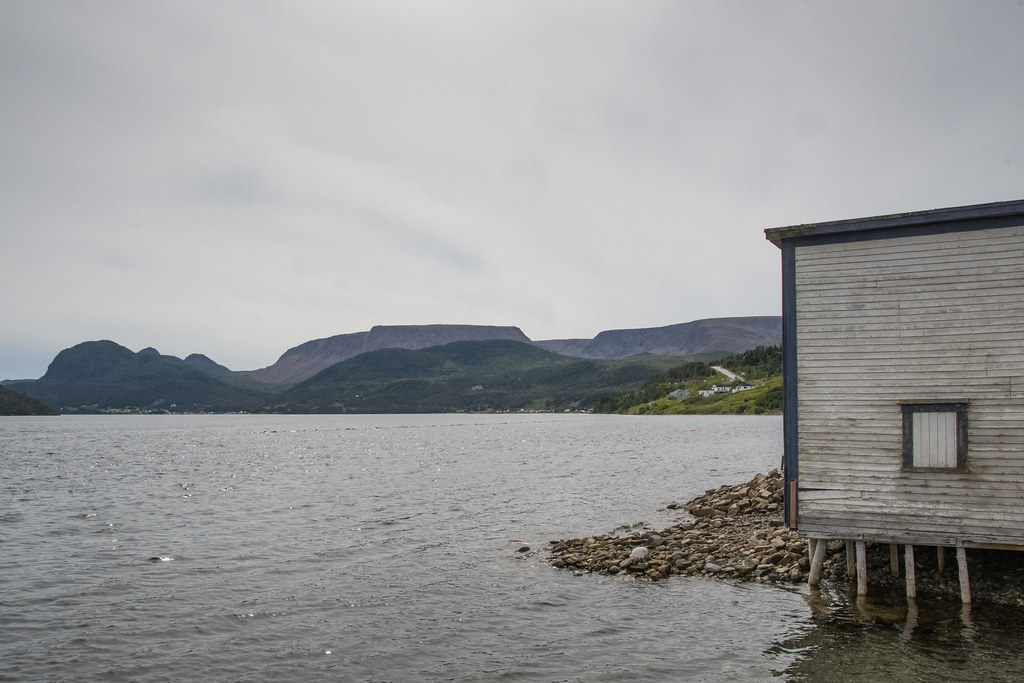
This lighthouse and lightkeepers residence were built in 1897 and are within Gros Morne National Park. It has a museum inside but it was closed when we visited. This place is remarkable. The views from the cliffs are spectacular and it is a great place to get down to the tidewater edges and experience tuckamore forests.
Becky walking down to the cove at low tide
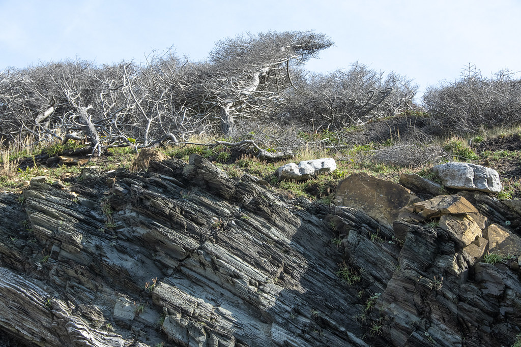
Tuckamore Forest: Here’s a quote from Tuckamore.org “Tuckamores are trees that have been bent and sculpted by constant strong onshore winds. The salt spray kills exposed buds, so growth only occurs on the tree’s sheltered inland side. The shores of Gros Morne National Park in Northern Newfoundland are covered in thick, contorted tuckamore forests”.
There is a nice museum at L’Anse Aux Meadows National Historic Site.
A “How They Got Here” map was helpful
There is a nice ‘path’ with islands to sail across to Iceland.
Very brave sailing the open Atlantic in a ship like this model
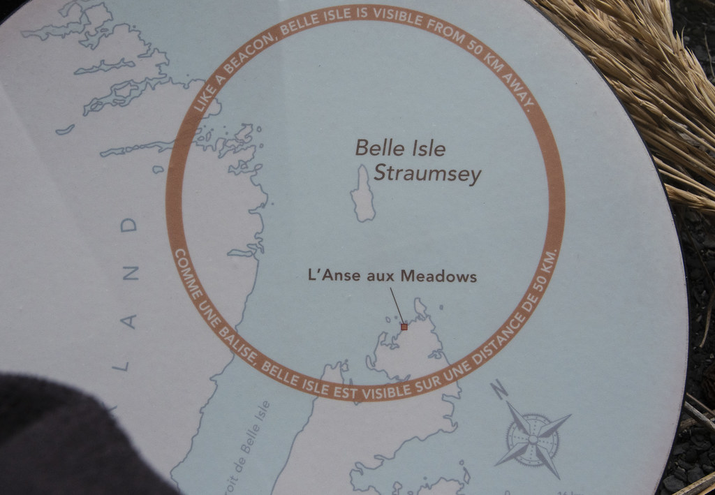
Heading west from Greenland, the sailors would hit what is now the east coast of Labrador, then sail south keeping the coast in view until they sighted Belle Isle which led them straight ahead to L’Anse aux Meadows
This was our “campsite” while at St. Anthony. Our little 26′ RV is parked at the end facing forward. The majority of people on the tour had much larger “Big Rigs”. This was one of the least enjoyable surprises of the Adventure Caravan’s tour. We expected to be staying in more park-like settings, not parking lots. Most of the places we stayed were similar to this. Sometimes gravel, sometimes grass but basically a field with parking spaces, not campsites. Adventure Caravan’s made all the arrangements and honestly we would not have gone to Newfoundland without the planning and organization of Adventure Caravan’s – but be aware that everything is designed around accommodating the Big Rigs. If you have something smaller and more nimble there are nicer places to camp. Not pictured here are two camper vans, a truck-bed camper, a couple class C’s including Jennie’s View, and a few truck-trailer units that were part of our group.
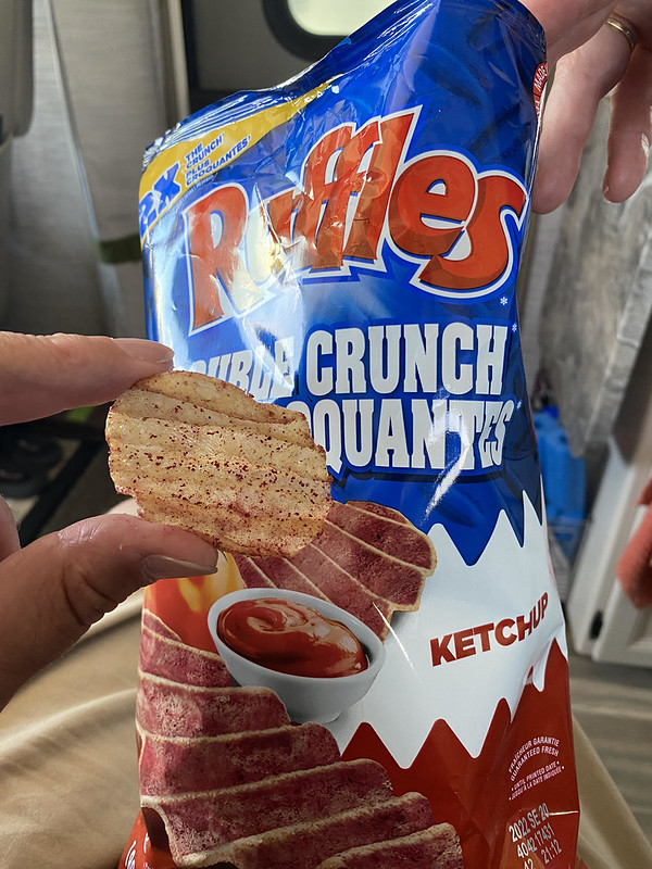
Ketchup Flavored Potato Chips: I did not know such a thing existed. After tasting them I still wonder, why? I tried to like them. Canadians seem to love them as they are everywhere. Maybe an acquired taste but this is one I hope stays in Canada.
Norstead is a reconstruction of a Viking settlement; from around 1,000 AD. Norstead is located near L’Anse aux Meadows (link to Wikipedia if you are interested in the Norse/Viking history of this area). There is so much interesting history about this area; here are two quick ones: 1. The area referred to as “Vinland” in ancient writings was assumed until 1960 to be much further south around Massachusetts until a local farmer on the northern tip of Newfoundland led archeologists to an old “Indian Village” 2. Butternut tree nuts were discovered in excavations. Grape vines and butternut trees grow in similar climate conditions. It seems that 1,000 years ago the climate in this area supported both and helps explain the Vinland reference.
This recreation of a Viking boat (called a Knarr) was sailed in a reenactment from Iceland to L’Anse aux Meadows with 9 person crew in 1998.
Board Games of early settlers
On a dare from Jennie, I sat in the Viking Chieftain’s throne with helmet and sword. Very Chieftain’ish ‘eh
Viking Church at Norstead
Church Interior
Scenes of the coast in area of Norstead and L’Anse aux Meadow
Everywhere there is a mat of Partridgeberry/Lingonberry over soft/squishy peat moss. There are some paths to walk on but where they run out it is wonderful to hike in the soft vegetation.
We stayed in St. Anthony several nights. This was the place “farthest from home” of the trip. It is 2,271 miles from Indianapolis.
That’s Newfoundland coast in the foreground, and Labrador over on the other side. We traveled from Gros Morne National Park, up the western coast of Newfoundland to St. Anthony which is out near the northern tip of the island. The picture above was taken where Newfoundland and Labrador are closest together across the Strait of Belle Isle in the Gulf of St Lawrence – a distance of about 10 miles at it’s narrowest.
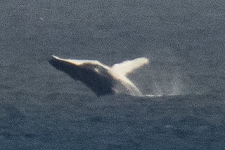
We took a boat tour to find a whale. It was a windy day and not a very big boat… it reminded me of the infamous “Minnow” as we headed out for a 3hr tour… hoping we would not be lost.
Thanks to our persistently searching Captain, and our fearless crew, we did see whales! The boat was bobbing wildly on the waves and this was a lucky shot.
Rugged Coast
Fox Point Lighthouse as we were returning back to dock at Northland Discovery Iceberg & Whale Tours.
Above: Fox Point Lighthouse and “Haul Up Cove”. There is a wonderful little restaurant near the lighthouse called “Lightkeepers Seafood”. We hung out there several times. We enjoyed the food and the Wi-Fi (which is hard to find in Newfoundland). There is also a nearby thing called the “Great Viking Feast”. We recommend avoiding that.
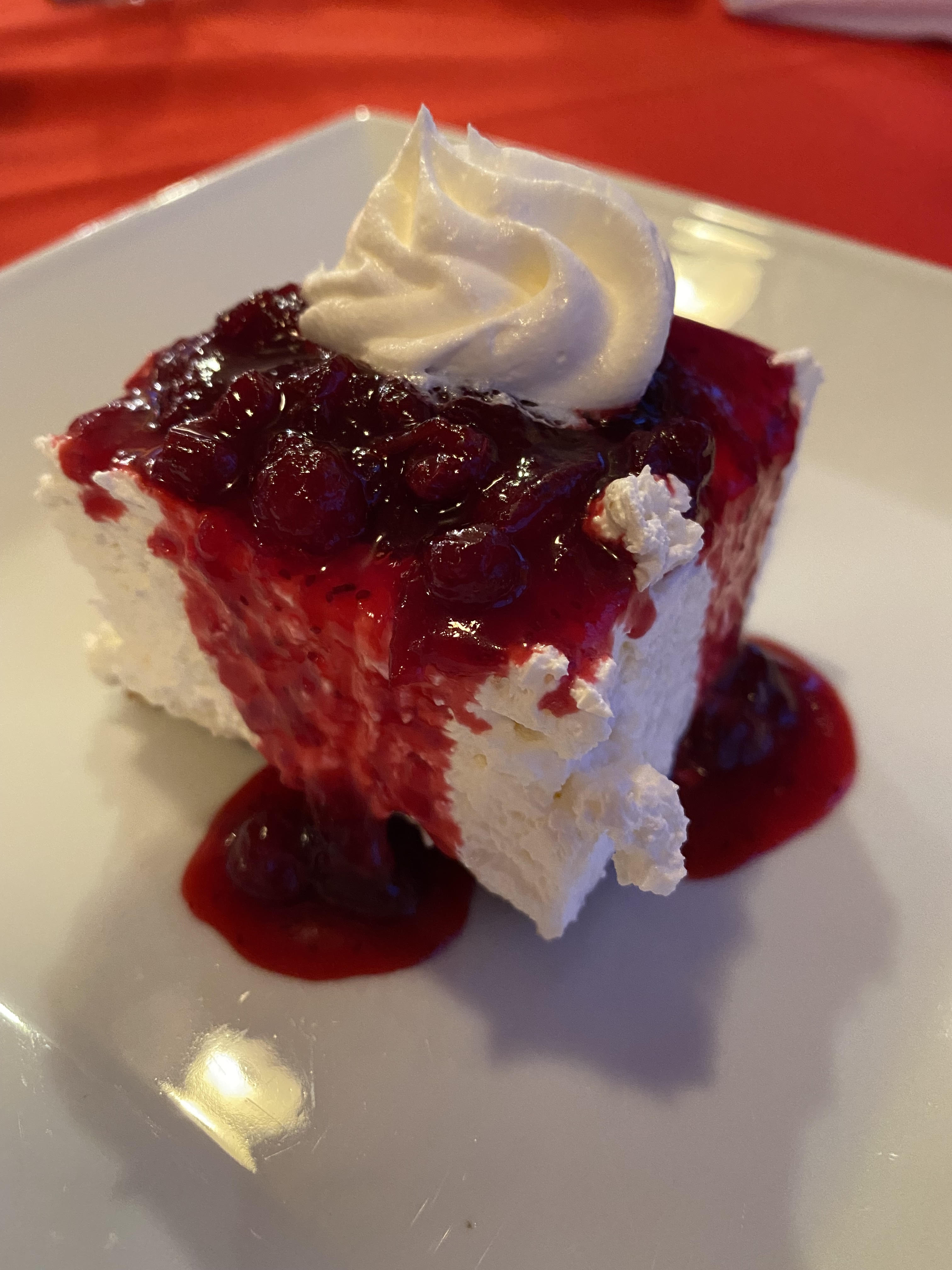
Above: Partridgeberry Cheesecake: Lightkeepers Seafood Restaurant. Trivia: Partridgeberry picking season was in full swing. Partridgeberries are the same as what other countries call “Lingonberries”. They are a relative of the cranberry but more mild. In Newfoundland, they grow in a low evergreen shrub in the dry acidic soils of Newfoundland and Labrador’s coastal barrens and headlands. Newfoundland and Labrador are the largest harvester of Partridge/Lingonberries in North America.
Fried Cod Tongue. I thought it was delicious. Didn’t get much help from the rest of the group. It is considered a Newfoundland delicacy. Also at Lightkeepers Seafood Restaurant. We really enjoyed this restaurant. We really did not enjoy the Great Viking Feast.
Below: Scenes from around the boat dock.
Above: Green coastal rocks
Below: Really far out from shore the whales were jumping way out of the water-looked like they were having a great time. These were taken from the little front porch of the Lightkeepers Seafood Restaurant where lots of visitors stood watching the whales play.
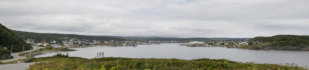
Panorama from Fox Point area looking back at town of St Anthony and Marguerite BayScreenshot of Google Maps location. 2,282 driving/ferry miles from home to L’Anse aux Meadows National Historic Site at the very northern tip of the peninsula was the next days visit.
A UNESCO World Heritage Site: Amazing place on earth, go here if you ever get a chance.
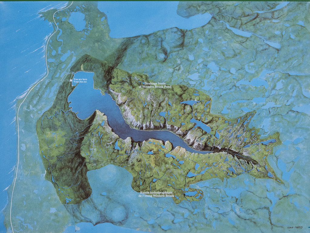
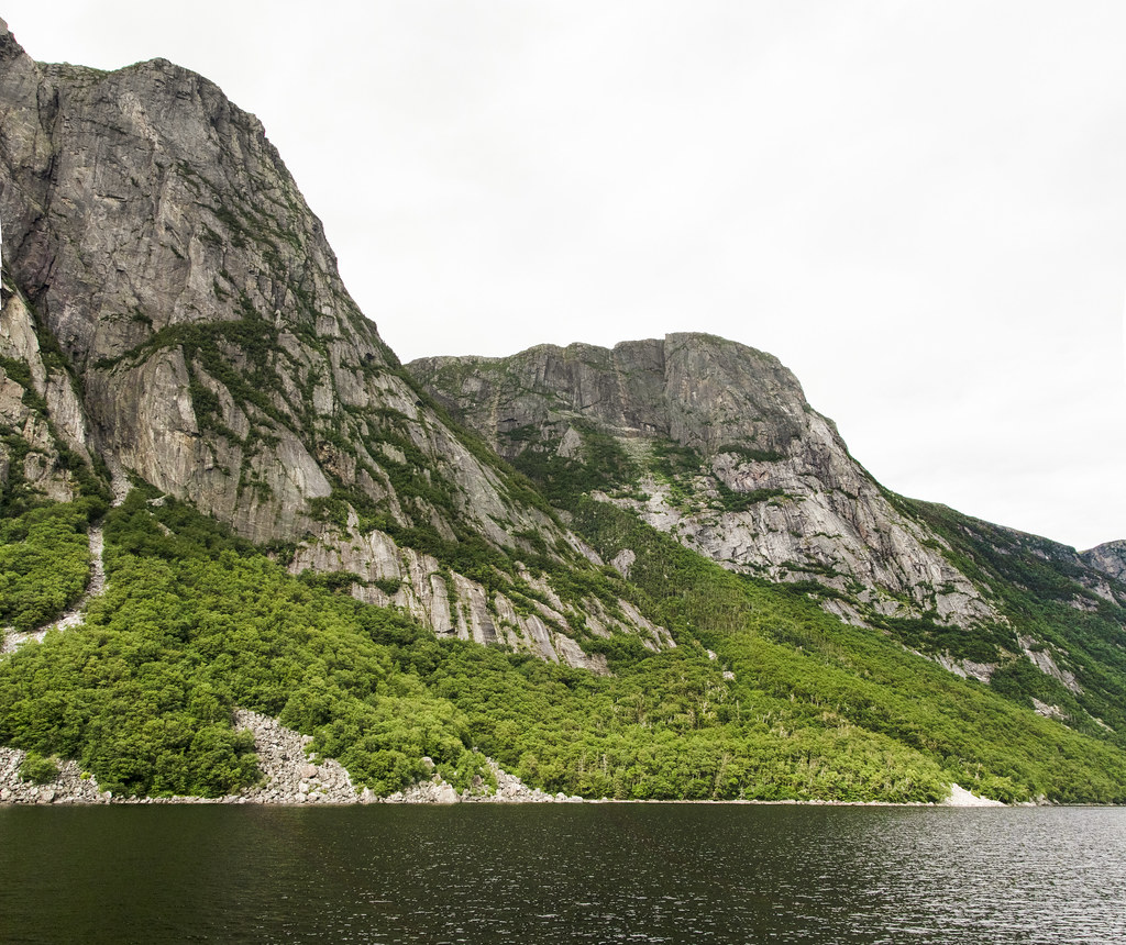
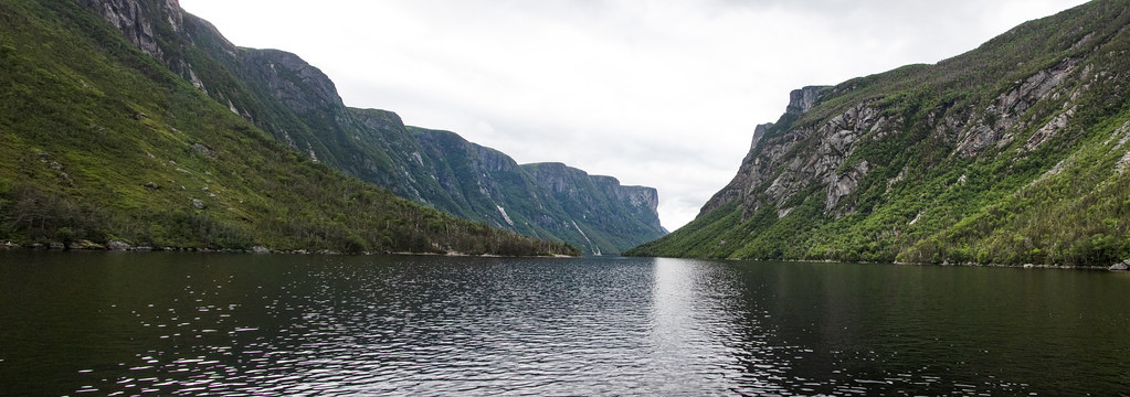
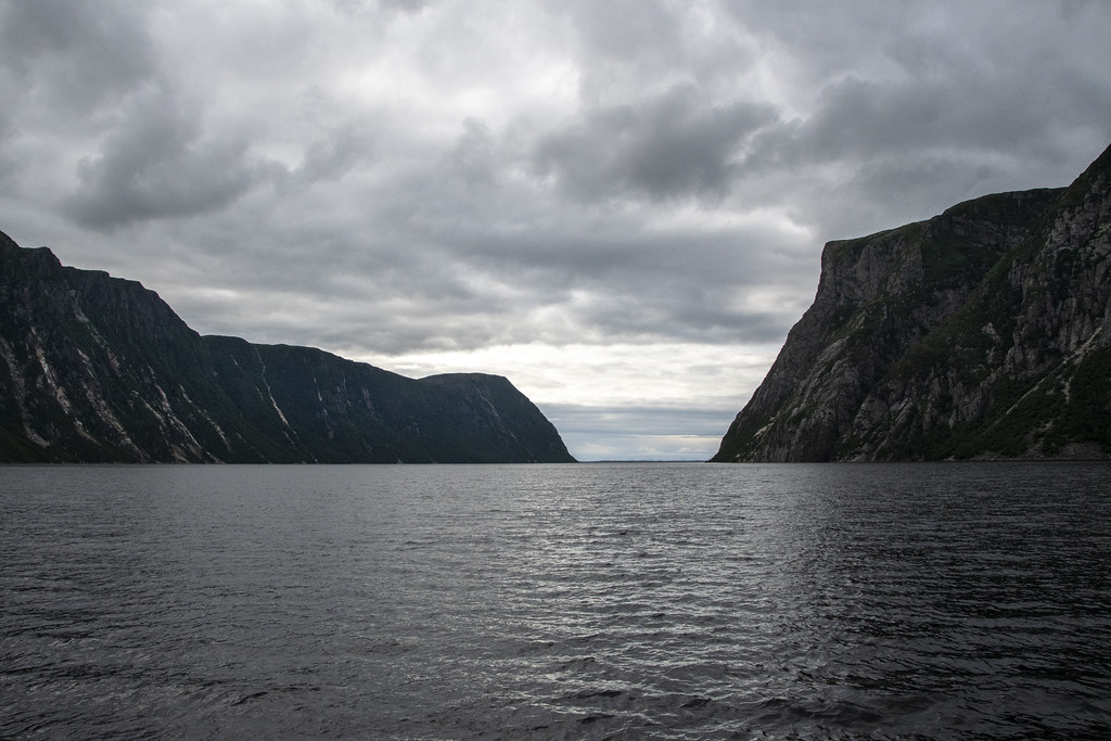
We stayed at Gros Morne National Park two times. This first time we visited “Western Brook Pond”.
Parking out by the road, we walked about an hour across flat coastal lowlands to reach the entry to the 540 foot deep “Pond” (we would call this a lake). The glacier carved pond is 10 miles long and the surrounding cliffs tower 2,200 feet high. The weather was sunny a few moments but mostly overcast and threatening rain. We were grateful to get finished without getting more than a few sprinkles.
The mountain range (in photo below) that rises up along the western edge of Newfoundland is called the “Long Range Mountains”. It is an extension of the same mountain range we in the United States call the “Appalachian Mountains”. I had no idea that the Appalachian Mountain Range continued that far north into Canada.
Following are a bunch of photos – none of which really capture the grandeur of the place – but they bring back good memories. I hope they inspire others to visit Gros Morne.
My kids hate it when I stop to read markers but it helps to understand how this unique place ‘happened’. Feel free to skip this if you are like my kids.
Jennie & Becky headed to Western Brook Pond for the boat ride
Scenes along the trail
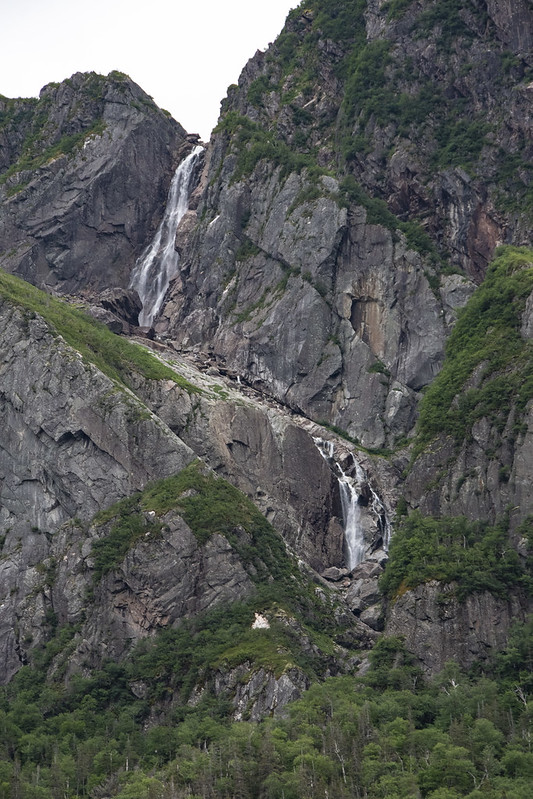
Lots of waterfalls off the surrounding cliffs fill the pond with fresh water.
Two examples of lava forced upward through cracks then exposed by glaciers. I think that is called a “diabase dyke” and according to Gros Morne geology the cracks formed when the supercontinent began breaking apart.
On the boat returning back to the dock the pond looked like an infinity pool.
Looking back toward the pond as we walked to the car we saw this glorious rainbow.
Panarama of the Long Range Mountains; the end of the Appalachian Mountains
Sometimes there is time to kill on travel days because you cannot arrive at the next destination until late afternoon.
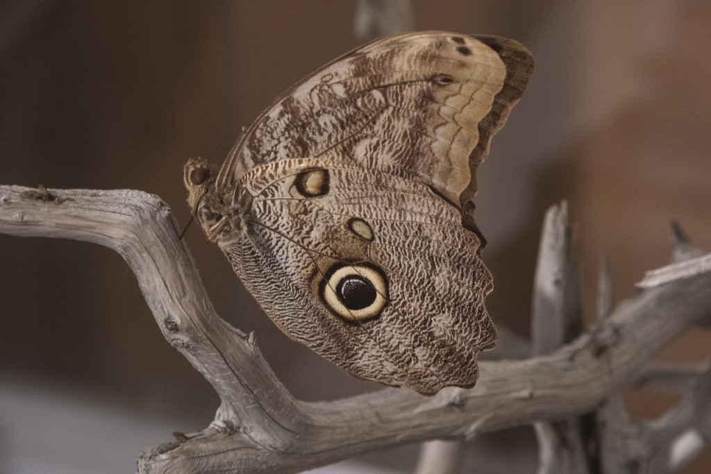
We stopped at “The Newfoundland Insectarium” while traveling from Twillingate to our next stop at Gros Morne National Park.
It’s a nice insect collection but it could be anywhere, not particularly Newfoundland’ish. I enjoyed the live exhibits more than the dead ones. I don’t have a photo but it was fun watching a whole bunch of live leaf-cutter ants carry leaves around.
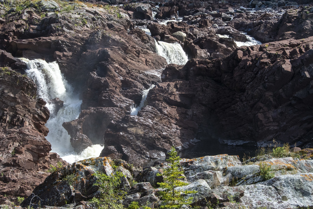
Another stop was at: “Salmonid Interpretation Centre” on the Exploits River near Grand Falls. This is the fish ladder bypass
This is looking below the falls and fish ladder
The fish ladders lets the fish (salmon) go up the gentle ladder instead of this set of treacherous rocky falls
Whale spouting (that little bit of mist in center)
Bad photo of a Whale’s Tale (but proof we saw them)
Panoramic view from Long’s Point Lighthouse
Newfoundland Scenes around Twillingate
We chartered a boat from “Captain Dave’s Boat Tours” and went Cod “fishing” (really “jigging”). Those are whale bones! Captain Dave himself skippered the boat (David Boyd). His family history is closely linked to Cod fishing and he is passionate to pass along the history.
Jellyfish at Captain Dave’s. Captain Dave’s is also the location of “Prime Birth Twillingate Fishery & Heritage Centre” which has an interesting museum of all things fishing…
Whale Baleen
This gentleman cleaned all the Cod for us
That bucket of gook is full of Cod Liver Oil. He was very good at fileting fish. Glad I didn’t have to do it.
We saw coastal scenes of rocks and seabirds while getting out to where we fished
We caught lots of Cod and one iridescently colored Mackerel
Twillingate was one of our favorite stops. The RV Park was on North Twillingate Island. It was an easy walk from the RV Park to the water at “Back Harbor”. Back Harbor faced west so we saw some beautiful sunsets. Back Harbor had the ubiquitous and iconic brightly colored “fishing rooms” around the harbor.
Twillingate is called “The Iceberg Capital of the World” because icebergs drift south on ocean currents from Greenland and Labrador. They often get “stuck” around Twillingate when their bottoms hit the shallower bays. We were too late in the summer to see icebergs (but we did see Humpback Whales). This post is about the area where we were camped. The next page will be about places nearby we traveled to on day trips.
Trivia: Twillingate residents must use extra caution in the spring because Polar Bears and Seals often arrive on the icebergs! Here is a link to a beautiful blog about Newfoundland: Seasons, Icebergs, Capelin, Whales, and Berries: https://newfoundsander.wordpress.com/icebergs/.
Sunset from Back Harbor, North Twillingate Island. I would walk over with morning coffee, sit and enjoy peacefulness
Roni & Becky watching me climb up the hill to get a panoramic picture of Back Harbor Bay.
Lupin
Berries. Not sure what these are but there are low growing “bushes” (maybe 6″ high) growing all along the coastal areas. Blueberries were ripening when we were there. We had handfuls of fresh blueberries on several days.Blueberries – Newfoundland Style. Not like the big bushes in Indiana at all.
Rock with section of purple stone (possibly purple quartz?)
Lobster Traps, waiting for next season
Salt Box Home we walked past each day from RV Park to Back Harbor Bay.
I don’t have a photo but it’s worth mentioning the “Split Peas” at “Twillingate-New World Island Dinner Theatre”. The local ‘actors’ and fantastic musicians put on a hilarious show of all things Newfoundland’ish. We enjoyed it, the food was good too. https://vacationintheisles.com/dinnertheatre/
We’ll end this post with more sunset pics – We didn’t want to leave Twillingate…