Alaskan Adventure: Days 39-42. This post is a combination of several days to catchup with pics and finish the Alaskan Highway portion of the trip. We started out on the “ALCAN” back on June 30th. 12 days later we have traveled 1,422 miles the entire length. We also traveled an additional 304 miles of the Haines Highway (also called the Haines Cutoff, or Haines Road).
Two opposite things happened at Haines Junction. We had turned south there on July 7th and were delighted with the nice road and beautiful snowy mountains along the Haines Highway. We traveled that highway both ways, down to Haines and a few days later back up to Haines Junction on July 10th. Getting back on the Alaskan Highway and heading north from Haines Junction the road took a definite turn for the worse. Over 200 miles of mostly dirt and gravel with lumps, bumps, and potholes. Throw zooming semi’s and pickup trucks in for fun. There was two days of really slow, difficult driving and a third day that was bad in the morning but got much better after crossing the border from Yukon Territory to good old USA roads.

Very shortly after leaving Haines Junction the road turned from asphalt to this. There were occasional sections of bad asphalt but for over 200 miles, most of it was like this.

or worse, with potholes, like this.

or like this, potholes hidden under a light dusting of gravel so you can’t see ’em.

Some sections were nice and had a beautiful “runway bordered with purple wildflowers” look to them.


Lots of purple wildflowers.

The scenes along the way were always changing.

When you could look up from the road there is almost always mountains to be seen and rivers, streams, and ponds everywhere.

We stopped at a Visitors Center at “Sheep Mountain” (we did not see any sheep).

The migration of Salmon from the salt seas to the freshwater streams is fascinating and incredibly designed.

We learned about these “Black Spruce” trees. They grow very slowly in this harsh environment. A hundred year old tree may have only a 2″ diameter trunk so the rings are very tight together. They are sometimes referred to as “Bottle Brush Trees”.

We arrived at our campsite for the night at “Discovery Yukon Lodgings” in Koidern, Yukon Territory. After almost 300 miles of driving, about half of that on dirt/gravel roads, we were beat.

This is a Cottonwood Tree. Not like our Cottonwood Trees with little fluffy floating tufts of feathery stuff. These have big clumps of seeds that fall to the ground and make a mess.

Northern Cottonwood – mess.

The roof of the Office building was covered with Moose antlers.


The next morning revealed the campground is the “graveyard” of machinery abandoned in place when after finishing the ALCAN road in 1942. Most campgrounds don’t have much to see but this one was pretty cool.


This one reminds me of “Mary Anne” from the children’s book “Mike Mulligan and His Steam Shovel”. It was published in 1939 by Houghton Mifflin Publishing. Nathan works for Houghton Mifflin. I loved reading that book and I love how things are connected.
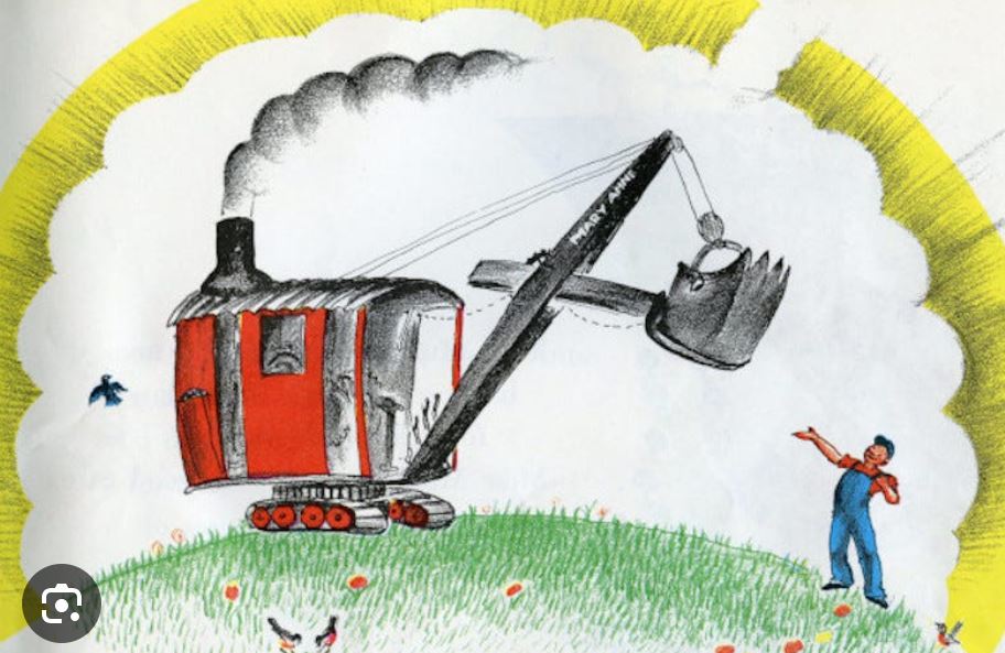

Images clipped from internet in case you’ve forgotten the book…

Flame Throwers, apparently useful in building the ALCAN


Doesn’t look like a comfortable ride in the back of this medical truck.

Sign in the campground describing the nearby White River’s milky white/gray color.

A quirky display of old outboard motors.

Leaving camp, we traveled on more terrible “roads” to the little town of Beaver Creek. The nicest building in town was this Visitors Center.

There are very few “towns” up here. Each one has an interesting story of how and why it came to exist.

This display attempts to explain why the roads are so bad. Based on the graphic it would seem the road is fine from Haines Junction to Destruction Bay. I could tell little difference. And the roads did not get better after Beaver Creek. Destruction Bay is not named for the vehicles destroyed by the road (but it could be). It was a staging area for supplies for the ALCAN when a bad storm hit destroying the supplies.
I expected some sections of dirt and gravel where the road was being repaired. I had read many internet descriptions saying “the entire Alaskan Highway is paved but there are some short sections under construction and some frost heaves to beware of”. I was prepared for that but 2 1/2 days of mostly dirt was an unexpected driving marathon. But, the journey is part of the experience and we are thankful to God that everything made it through in one piece. It was certainly an experience we will remember.

Checking the map on the wall of the Visitors Center before continuing on from Beaver Creek we were reminded that Northern Canada and Alaska are not at all like the USA. This map has ALL the paved roads marked on it. We will travel almost all of them. The smudge marks where we were at Beaver Creek. Continuing North we will soon cross out of Yukon Territory and into Alaska and the town of Tok (pronounced Toke – like Coke. The tune of “…one toke over the line…” helps me remember).

The obligatory border crossing shot. Us and friends Amy and Mike who are part of the RV group.


“The Border” is marked with a 20′ wide cleared section called “The Slash” running along the 141st Meridian between Canada and USA.

Scenery on the way to Tok. The roads are not perfect but they are not dirt after crossing into USA!

This is a map of ALL the roads in Alaska.

This is a list of ALL the Highways in Alaska. There are 12 of them, each with a name. The name (not the number) is how Alaskan’s refer to their roads.
Some other crazy Alaska stats:
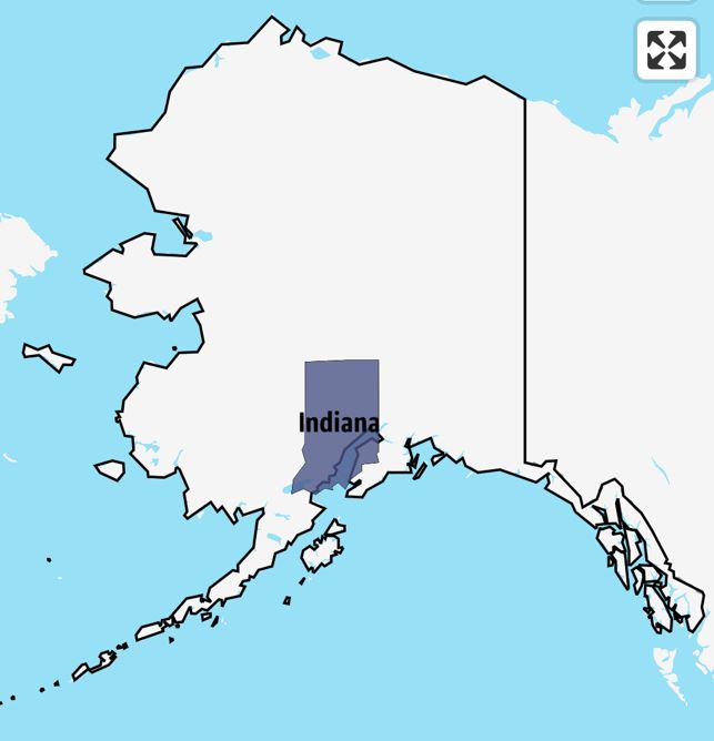
Alaska has 12 State Highways; Indiana has 241
Indiana has 196 people per square mile; Alaska has 1.3
Alaska is the largest State. Alaska is 18 times larger than Indiana.

This was our campsite at Tok for one night. The name of the campground was “Sourdough”. A “Sourdough” is someone who has endured many winters in Northern Alaska. It comes from the days of the Goldrush when 1890’s prospectors carried pouches of sourdough starter and slept with them to keep them from freezing. This custom at this campground is for everyone to gather in the evening and try throwing sourdough pancakes into a bucket. Stupid tricks to keep old people entertained but it was a hoot and I won a wooden “loser” button. Those who hit the bucket got a $10 voucher for a breakfast meal.

Our next stop was “Delta Junction”. This town marks the Northern end of the Alaskan Highway and it’s original 1,700 miles from Dawson Creek. Since it’s original construction it has been significantly shortened by straitening sections, removing curves, and flattening to where it is now about 1,422 miles.

Proof we made it.

Hard to read, it says: Delta Junction, Alaska. Northern Terminus of the ALCAN Highway. This Highway was constructed during WWII as a military supply route for interior Alaska military and airfields in 1942. 7 Army regiments and 42 Contractors and Public Road Administrators working from Delta Junction South and Dawson Creek North completed it when they met at Soldiers Summit at Kluane Lake, Yukon Territory in November 1942. At the peak of construction 77 Contractors employed 1,500 men and 11,000 pieces of road building equipment. The total construction cost for 1,422 miles was $115,000,000.

Display showing diameters of Alaskan Pipelines. We will see much more of the 48″ Crude Oil pipeline from Prudhoe Bay to Valdez.

Leaving the Delta Junction Visitors Center, we continued on towards Tok. This bridge over the Robertson River carries vehicle traffic and was our first sight of the Alaskan Pipeline. I climbed up the RV ladder to get a view over the barbed wire topped fence. There was a guy in a security truck keeping an eye on me…

Continuing on the road – no longer the Alaskan Highway – towards Fairbanks where we will spend the next 6 nights. The road from Delta Junction to Fairbanks was much better. The section of Highway from Delta Junction to Fairbanks turns into Highway 2 called the Elliott Highway.


Fireweed blooms from the bottom up. When blooms reach the top in Alaska it is considered a signal that winter is just 6 weeks away.


Iris along a lake at a rest stop.

Wildflowers at a rest stop.


Beautiful views of the Alaska Range of mountains and the Yukon River on the way to Fairbanks.

Our campground in Fairbanks is the “Northernmost KOA” also called the “Fairbanks/North Pole KOA”.


The RV and car after the Alaskan Highway. It was not worth washing the car back in Haines.
That was a long post covering a lot of ground but it gets us to Fairbanks, the Northernmost “big city’ in Alaska where we will stay for 6 nights.
Favorite Bible reading for today: Luke 16: 16-17
“The Law and the Prophets were proclaimed until John; since that time the gospel of the kingdom of God has been preached, and everyone is forcing his way into it. But it is easier for heaven and earth to pass away than for one stroke of a letter of the Law to fail.

