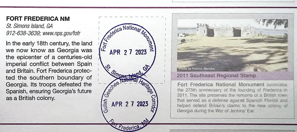
Sad to leave Jekyll Island but now we can look forward to next year. We headed north to Santee but on the way took a trip across the bridge to St. Simon Island and the National Monument at Fort Frederica.
So much history of southern states that was not in our northern textbooks. Lexington, Boston, Paul Revere, we heard about those. I also got the Gullah Geechee stamp because the coastal areas are where the Gullah and the Geechee developed their own subcultures and languages. I need to learn more about them.
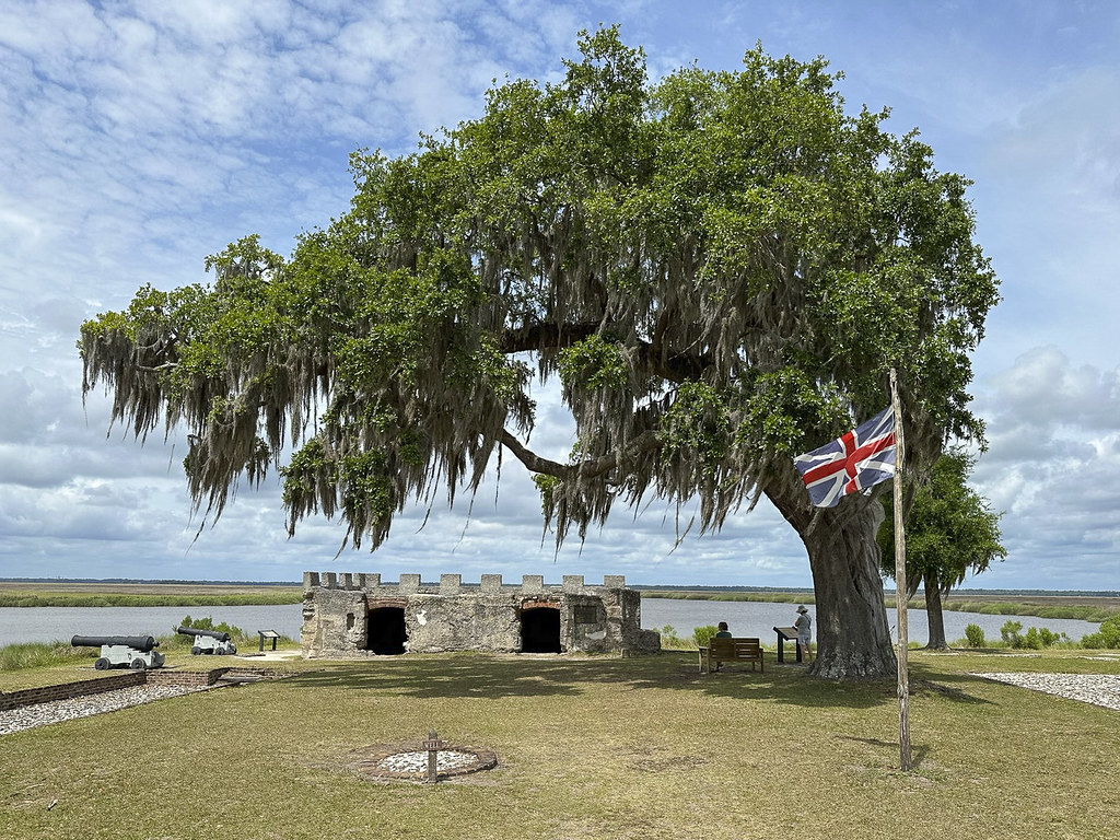
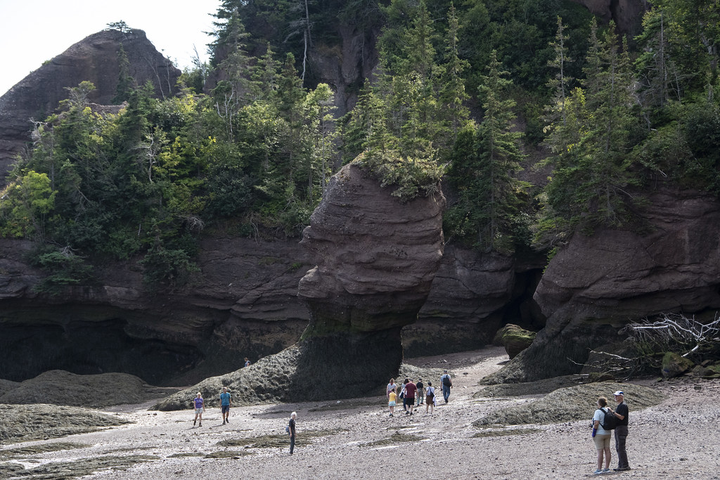
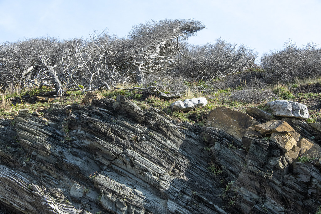
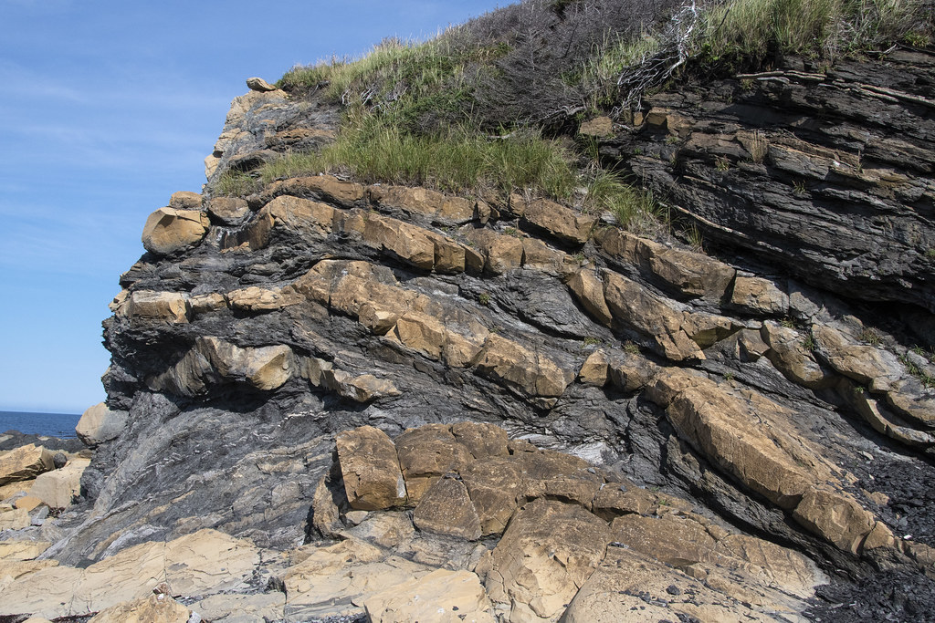
The remains of Fort Frederica. Love the British flag and brooding live oak tree. Easy to imagine troops guarding the “debatable lands” between South Carolina and Florida, against those pesky Spanish in Florida. The cannons guard the Frederica River. Frederica, the town and river got it’s name from Frederick Louis, the Prince of Wales. This remaining fort seems tiny but at the time (1736) it was the strongest fort built by the British in North America. Not seen in this photo is the entire colonial town behind the fort that supported the troops and townspeople. The entire town was enclosed in a palisade wall and raised earthen embattlements with a dry ‘moat’ to repel attack by land.
I was eager to go to Fort Frederica to; 1. Get the stamp for my National Parks Passport book, 2. Learn about history I missed, 3. Visit a place called Frederica… my great grandmother’s name was Esther Frederica Albertina Zigler Dart. I don’t know why that seems like a connection but it’s something…
Plaque mounted on the fort wall. Horton (who settled on the neighboring Jekyll Island) sailed with Oglethorpe.
What’s left of the mounded “Town Wall” is directly in front on this photo. The Town would be to the right and the “dry moat” is to the left.
One last massive spreading live oak tree with Spanish moss before we leave the warm coast and head back inland toward home.
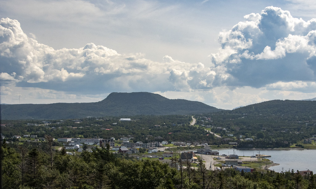
From Fort Frederica we headed due north to Santee Lakes KOA. We didn’t know it but leaving Jekyll Island let us avoid a big rain they got that night. We had a little rain but nothing like the downpour they got.
View of the beach and dock from our campsite. They described this as “on a bluff overlooking the lake”. I guess when you are close to sea level even a few extra feet of elevation qualifies as a bluff.
That’s our RV, up on “the bluff”. This KOA could be nice, but it’s way overpriced and pretty run down. We won’t return but at the time we were making reservations all the State Parks were full. It turned out to be an ok place to sit and read. Becky got a bunch of quilt blocks sewn and I got the four days at Jekyll Island post done.
1. Three Rivers State Park – on Lake Seminole, which is formed by the convergence of the Chattahoochee and Flint rivers.
2. Suwanee River State Park – is THE “Swanee River” of the “Way Down Upon Swanee River…” minstrel song by Stephen Foster in 1851 (also known as “Old Folks at Home”). My dad used to sing that song all the time on family vacations. It has been stuck in head now for about a week.
Taken from the dock at Three Rivers State Park, Florida. That’s Georgia in the fog on the other side of the river.
Not much to photograph at Three Rivers State Park. If you are a fisherman it would be a great place to hang out. Otherwise there’s not much to do here. The trees in the area where decimated by Hurricane Michael in 2018. This is a small campground and the long ‘asphalt’ road back to the campground looked like it had been carpet bombed. Very slow going dodging potholes. We stayed here because Florida cancelled our reservations at Falling Waters State Park. We were happy to move on to Suwannee River State Park.
Suwannee River State Park was a big improvement over Three Rivers. This panorama is of the Suwannee (which is flowing from right to left) at the point where the Withlacoochee River joins with the Suwannee. There is a railroad bridge at the very left of the photo. The railroad bridge and a busy ferry crossing at this strategic location during the Civil War caused an interesting historical feature of the park.
The remains of the Civil War Earthworks. An earthen “fort” is still easy to imagine.
Gears from old paddleboat and old paddleboat “wheel”
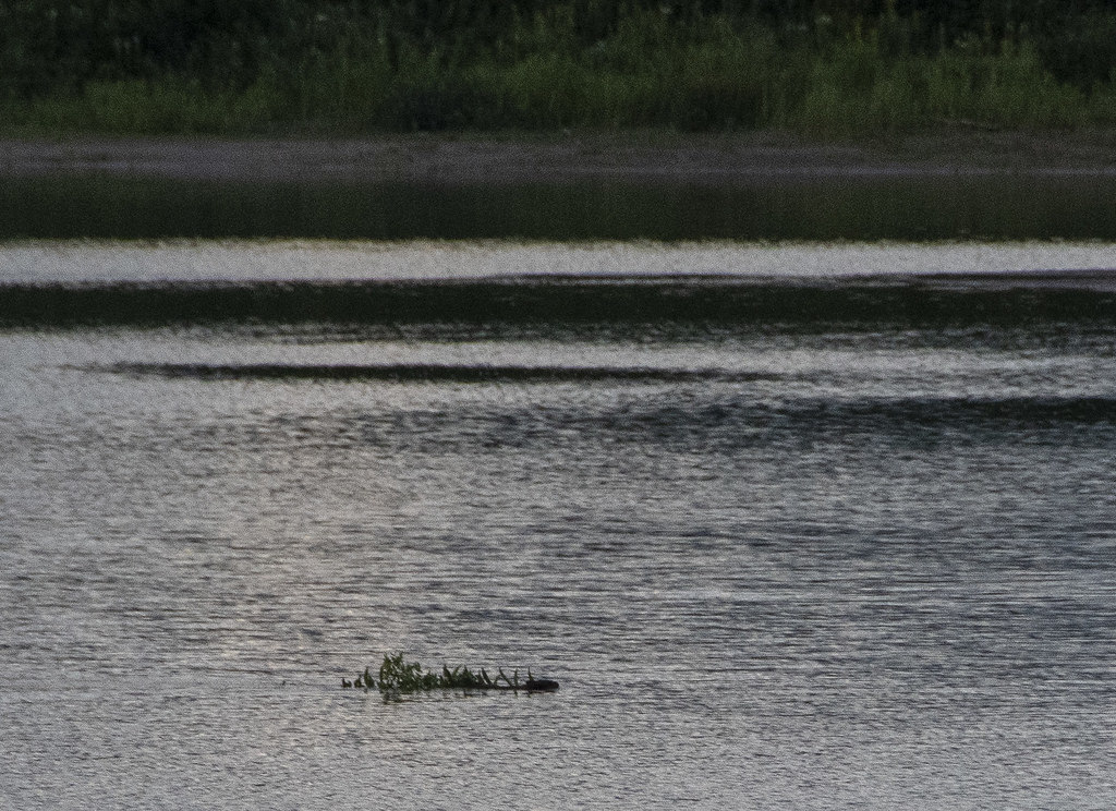
Clear water from Little Gem Spring flows into the Suwannee. Hiking a trail along the river sure is a lot different in Florida than it is in Indiana…
River edge of the Suwannee. As the water gets deeper it turns orange, then red, than dark coffee colored from lots of tannins in the water.
Becky got out her sewing machine and knocked out some quilt blocks
Rich Reflections
Cyprus Knees. This is probably boring stuff to Southern folk; but fascinating to Indiana folk.
Wow, what a campground… The fanciest, most resort’ish campground we have seen.
Our campsite at Topsail. Sites are highly landscaped and semi-private from adjacent sites. Short walk to the bath house. There is also a shuttle to the beach for people like us with no bicycles.
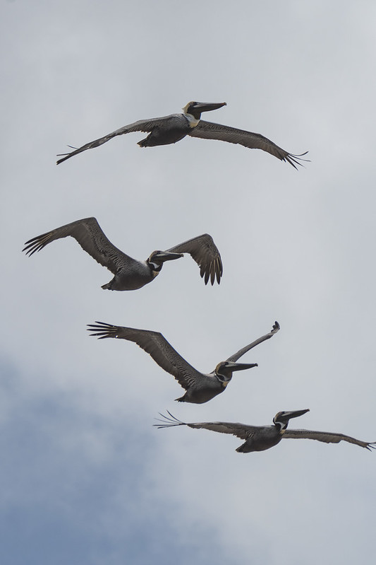
Favorite pic of a Brown Pelican. These are big, majestic birds. The were floating in “squadrons” along the beach; just using the heavy winds to move them along. More pics below. They were fun to photograph…
The beach at Topsail with “double red-flag” blowing. That means don’t get in the water. Dunes are roped off to preserve turtle and bird nesting areas. The waves were coming all the way up the beach occasionally. I was looking up shooting pictures of pelicans flying over when a big wave filled my shoes with sandy water…
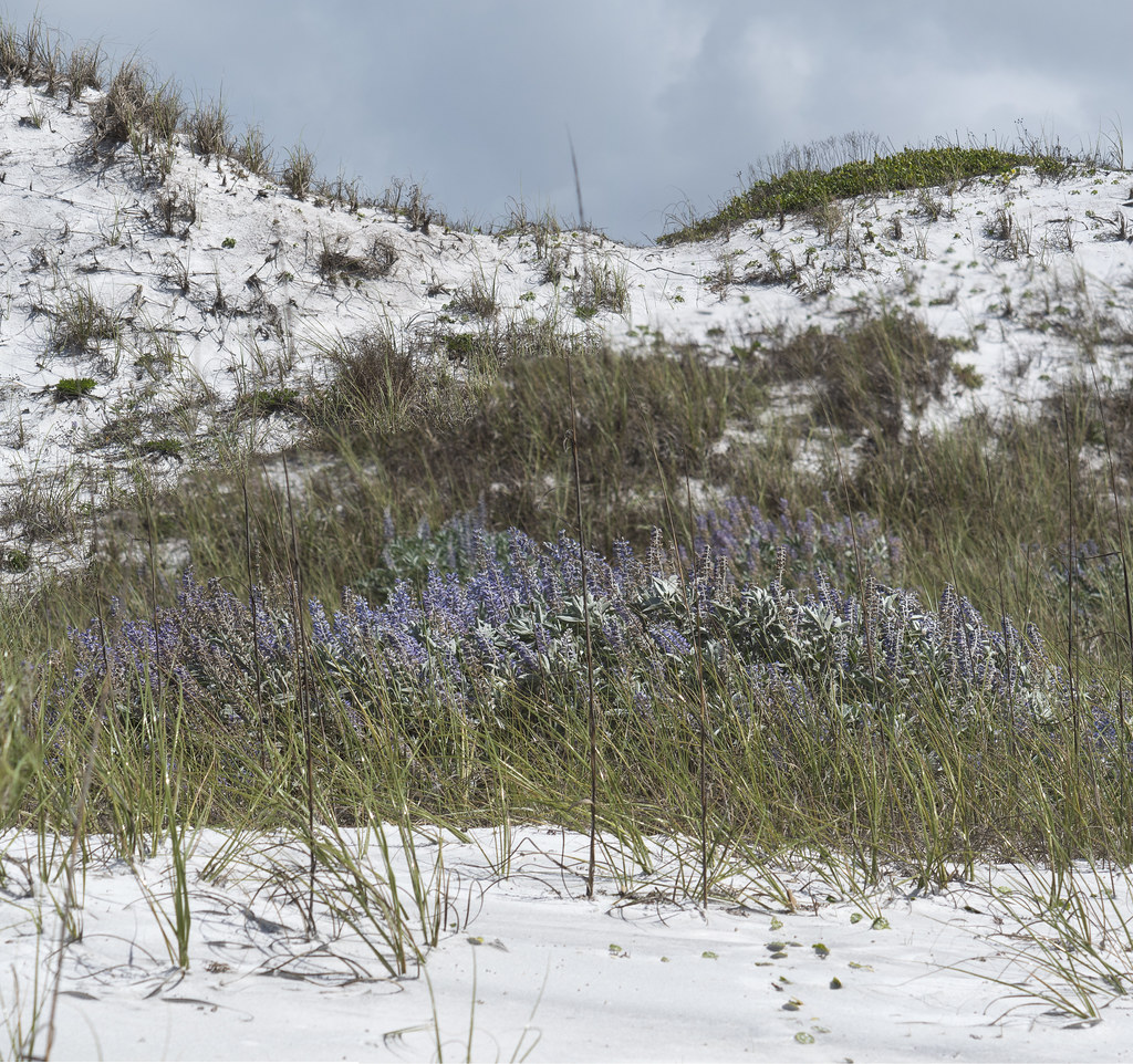
The Dunes
A Least Tern soaring overhead
Ruddy Turnstone’s: so named because they turn over stones looking for yummy stuff
We were excited to be first timers at the Gulf State Park we had heard so much about. We had camped once last year along the Atlantic Coast at Jekyll Island but we had never even been to the Gulf Coast. Everything was great; the campground, campsite, friendly campers, and friendly wildlife including several smallish alligators…
Juvenile Bald Eagle. The nest was nearby. John and Pam had shown us the location of the nest the day before. The next day they let us borrow Pam’s eBike and I rode back to check the nest again when this one appeared. I didn’t carry the big camera on the bike so this is an iPhone shot.
This is the view from the overpass that crosses over the highway between the campground and the beach and pier. The eBike was awesome as it powered up the ramp going over and again coming back from the beach.
Not many photos from this part of the trip but we had a great relaxing time at Gulf State Park. We especially enjoyed visiting with John, Pam, and Tim; sitting around John’s propane campfire pit, the visit to the pier with double-red flag warnings due to high surf, and lunch at “Lambert’s” – home of the throwed rolls!
From here we headed to Topsail Hill Preserve State Park which is also along the Gulf Coast. Just a note that the sandy beach here at Gulf State Park is much ‘wider’ and open to the dunes behind the beach. At Topsail the beach is narrow and the dunes are roped off.
On our way to Topsail we found our way to the Pensacola Beach bridge and Fort Pickens, FL. We stopped at the Visitors Center and got a stamp for the Gulf Islands National Seashore which stretches across eight barrier islands along the Florida and Mississippi coast. It was starting to rain so we didn’t stay to explore the fort. We will come back sometime for that and maybe camp at the nearby Ft Pickens campground. Fort Pickens is at the western tip of Santa Rosa Island. Built by slaves using 22 million bricks and completed in 1834 it was intended to defend Pensacola Harbor. Even during the Civil War it remained a Union fort.
As we hustled back to the RV amid sprinkles we spotted this beautiful Great Blue Heron hanging out in the grass.
Stamp in National Parks Passport book
The US Navy Blue Angels are stationed at Pensacola and practice at Fort Pickens area. We heard them a lot and saw them occasionally as we traveled from Gulf State Park to Topsail Hill Preserve State Park.
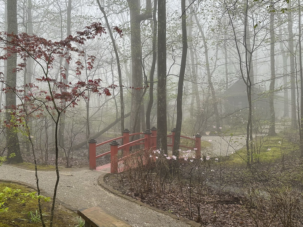
Monte Sano is an interesting park, on top of a mountain, adjacent to Huntsville, Alabama. We enjoyed some relaxing time at Monte Sano even though it rained off and on nearly the entire 2 days we were there. Monte Sano in Spanish means “Mountain of Health”. It was freakishly quiet with just the dripping rain or if it wasn’t raining the drip of mist falling from tree branches. I used the time to finish a series of blog posts from our Newfoundland trip last summer and Becky did some sewing of quilt blocks with her new sewing machine-proving that it can be done in the RV on a rainy day.
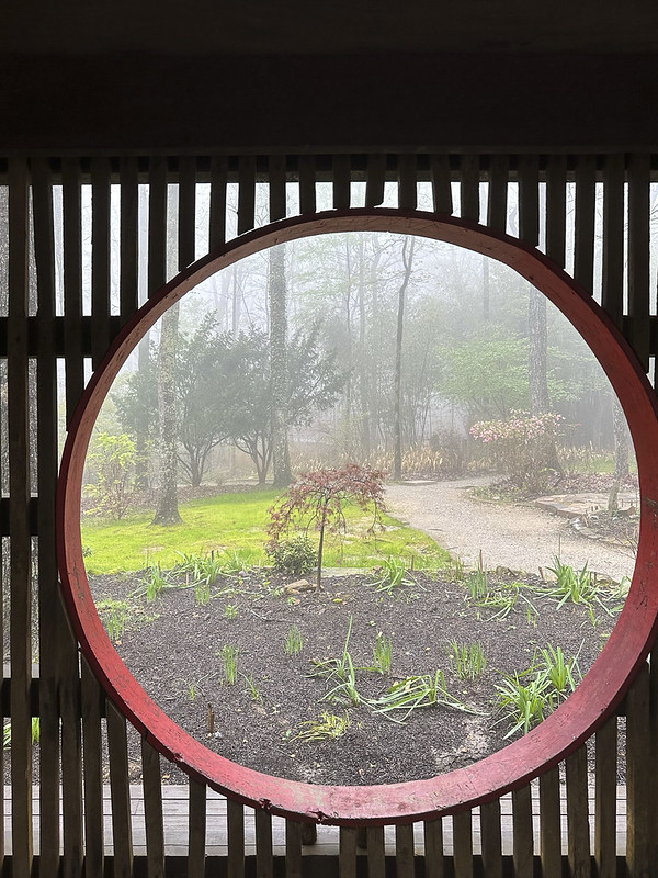
Except walking around the campground we only went on one hike when there was a break in the rain. The hike was an enjoyable, magical, mystical, walk in the mountain mist to a Japanese Garden with a Tea House on the park property. The first photo is of the RV in the mist. All the rest are of the Japanese Garden/Tea House hike. All photos are iPhone.
Bamboo bordered path and Japanese Tea House
Azaleas
We left Monte Sano and again headed south on 65 from Huntsville to Montgomery, Alabama. Turning off at “The Old Selma Road” we arrived at Gunter Hill Campground, a Corp of Engineers campground on the Alabama River.
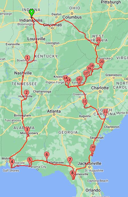
1 of 13 Jekyll Island Trip. Early spring trip April 4th to May 8th. 34 days
A little post-trip analysis: 2,749 miles by RVparky planned routing, 3,025 actual miles (10% additional) 271.26 gallons of gas. $904.27 for avg cost/gal $3.33 10.735 Avg miles/gal
The 2023 Jekyll Island Meetup is the main goal of this trip. Revisiting with friends we met at last year’s inaugural meetup. Last year there were about 24 Axis/Vegas RV’s. This year there will be about double that and a representative of Thor Motor Coach (Anson Adams) will be attending.
We enjoyed it last year. Jekyll Island State Park is a beautiful place and we learned a lot about our new RV from friendly people having similar experiences. Becky’s sister Jennie had done similar meetups with her Winnebago View RV and enjoyed them.
List of Overnights: numbers match the map tags above 1 – Bowling Green KOA, KY – 1 night 2 – Monte Sano State Park, Huntsville, AL – 3 nights 3 – Gunter Hill Park, Montgomery, AL – 1 night 4 – Gulf State Park, Gulf Shores, AL – 3 nights (visit with John & Pam and see the park everyone talks about) 5 – Top Sail Hill Preserve State Park, Santa Rosa Beach, FL – 2 nights 6 – Three Rivers State Park, Sneads, FL – 3 nights 7 – Suwannee River State Park, Live Oak, FL – 3 nights 8 – Manatee Springs State Park, Chiefland, FL – 3 nights 9 – Jekyll Island State Park, Jekyll Island, FL – 4 nights 10 – Fort Frederica National Monument (in-route Passport Stamp) 11 – Santee Lakes KOA, Summerton, SC – 2 nights 12 – Ninety Six National Historical Site (in-route Passport Stamp) 13 – Cherokee/Great Smokies KOA, Cherokee, NC – 2 nights (begin Blue Ridge Parkway) 14 – Oconaluftee Visitors Center-Great Smoky Mountain National Park (in-route Passport Stamp) 15 – Asheville East KOA, Swannanoa, NC – 2 nights 18 – Boone KOA, Blowing Rock, NC – 1 night 20 – Fancy Gap/Blue Ridge Parkway KOA, Fancy Gap, VA – 2 nights (jump off Blue Ridge Parkway) 21 – Babcock State Park, Clifftop, WV – 2 nights (near New River Gorge National Park)
Then keep following the forward arrows (arrows pointing right →) at the bottom (of the white portion) of each page OR: use the Tab: “PLACES: WE’VE WANDERED” at the top of each page.
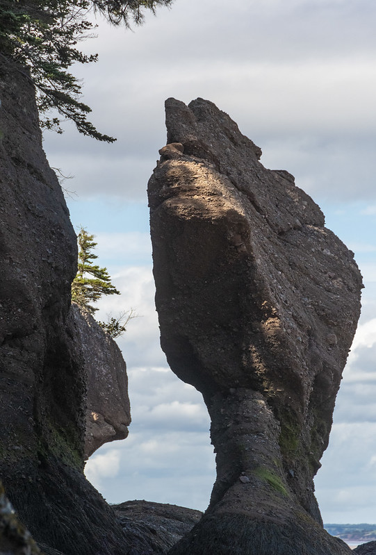
These are sometimes called “Flowerpot Rocks” or “Sea Stacks”. We arrived at Hopewell Rocks on an afternoon when the tide was in (up). After spending the night nearby we returned again in the morning when the tide was out. Tides vary daily but there can be as much as a 52′ difference in the water level from tides in the Bay of Fundy area.
View from our campsite – there were more than a few mosquitoes here
Flowers at Hopewell Rocks and at entrance to our campground
Tide IN
Tide OUT (mostly, this was not full lowest tide)
It’s an odd feeling walking around where you know in a few hours the tide will come back and submerge everything. This happens twice a day (in/out, in/out every 24hrs) so it’s relatively rapid; you can stand and watch the water level change.
Jennie & Roni
Me
When the tide is out, it is Way Out
Kayakers heading out as the tide comes in far enough to float them
That’s all the photos for this trip. We went from Hopewell Rocks to St. John, New Brunswick for the tour “dismount” festivities. However, more than a few of the group had Covid at that point so we said our goodbyes and headed for home.
On our last day in Gros Morne National Park we visited the town of Norris Point and we drove around the East and South “Arms” of Bonne Bay to the towns of Bonne Bay and Woody Point. The photo below is from a little roadside gift shop along the way to Norris Point. The foreground is a hedge of rose hips, Bonne Bay in the middle and Tablelands in the background.
A kinetic whirligig sculpture commissioned in 1997 for Gros Morne National Park as part of the Canada 150 Celebration. It is located at the same gift shop. Sculpture originally had movement but tough Newfoundland weather has taken it’s toll… Scenes of local nature, including giant mosquitoes.
The Bakery: We were told there was a bakery we should not miss in Norris Point. We found the bakery and got some fresh rolls. It is the most “Newfoundland’ish” store. This homemade sign hung above the checkout counter. It’s not a joke. It’s just an honest declaration of business hours in the local way of speaking. The place to visit is “C&J Rumbolt Ltd”. It doesn’t look like much on the outside. Go in the door that says “Rumbolt’s Bakery”, you won’t be disappointed. Surprised maybe, but not disappointed.
Woody Point Lighthouse
There is a Discovery Center at Woody Point. We learned throughout the trip that Moose Nose was a “thing” to eat in Nova Scotia and Newfoundland. Early settlers in Acadia ate Moose Nose Soup. I was happy to find a recipe at the Discovery Center on how to prepare a moose’s nose for a special family dinner.
Moose were common and natural on the mainland in Nova Scotia but were never on the island of Newfoundland until brought there around 1900. With no natural predators they have flourished and now outnumber the people of Newfoundland.
Above and Below: Gros Morne Mountain towers over all the local landscape.
Gros Morne looming behind the town of Rocky Harbor
Gros Morne from Lobster Cove Head Lighthouse
That’s it for Gros Morne National Park. If you get a chance to visit this awesome place, plan to spend at least a week here.
Our last night “on the rock” of Newfoundland we traveled to a campground near the ferry at Grand Codroy. The following morning we loaded back up on the ferry at Port aux Basque for the much shorter (5 hours) trip back to North Sydney, Nova Scotia.
While at Grand Codroy I tried some sketching and painting of the lighthouse we had seen at the beginning of our trip (Portland Head Light, Fort Williams Park, Maine)
A beaver, dragging a branch of pine tree upstream
A parting sunset over the Grand Codroy River for our last night in Newfoundland
We headed back south to Gros Morne. Then we made some day trip visits in and around the park.
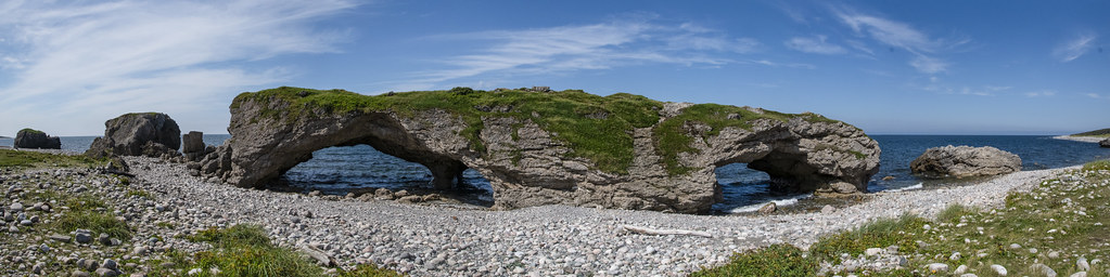
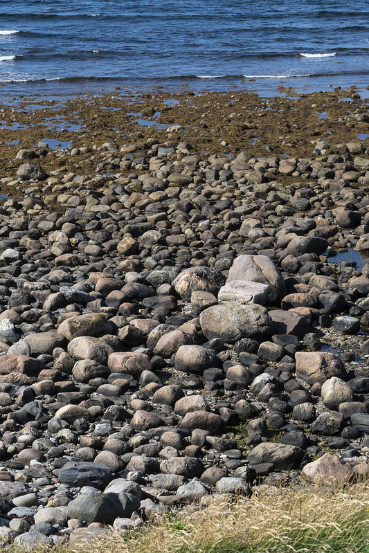
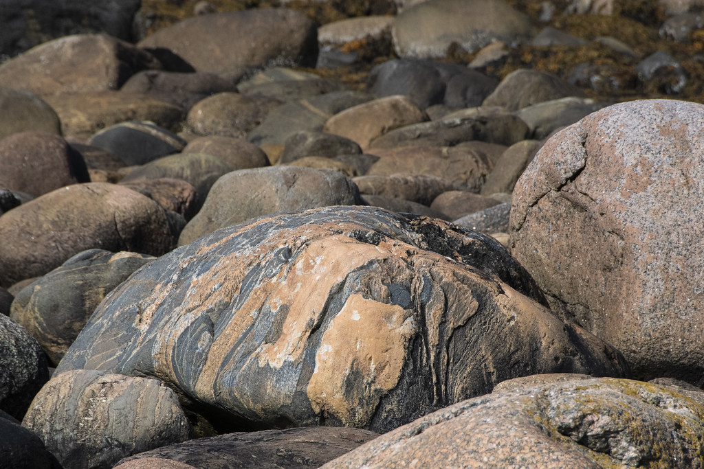
The Arches Provincial Park. A curious rock formation made of dolomite. The rounded boulders that make up the ‘seashore’ were hard to walk on but beautiful.
Beautiful rounded boulders on the beach. Too big to bring home…
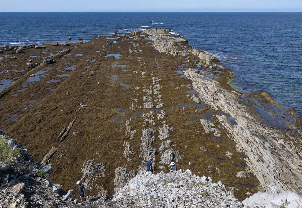
This is the area called “Green Point Geological Site” (that spit of land jutting out in the background). It is part of Gros Morne National Park and is considered a “World Geological Benchmark”. Fossils discovered here define the boundary between the Cambrian and Ordovician periods.
Below: Beach Boulders and Jennie in a Canadian Red Adirondack Chair. “Parks Canada has placed over 200 red Adirondack chairs in peaceful and scenic locations throughout many of the country’s most unique and treasured places”
The view of Green Point from Jennie’s chair
Looking down from the edge
Lobster traps along the coast at Green Point. Labrador is across the water.
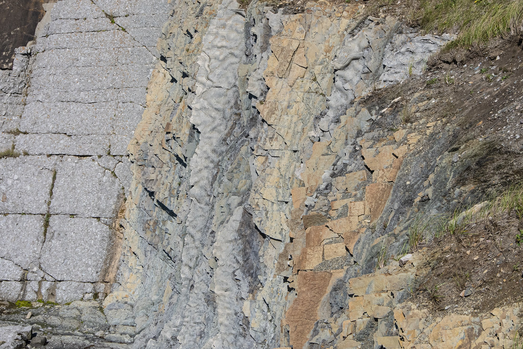
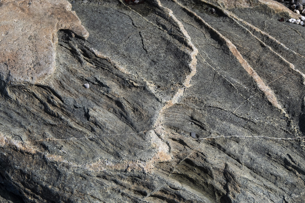
Colorful, Interesting Rocks. Maybe I should have been a geologist…
This lighthouse and lightkeepers residence were built in 1897 and are within Gros Morne National Park. It has a museum inside but it was closed when we visited. This place is remarkable. The views from the cliffs are spectacular and it is a great place to get down to the tidewater edges and experience tuckamore forests.
Becky walking down to the cove at low tide
Tuckamore Forest: Here’s a quote from Tuckamore.org “Tuckamores are trees that have been bent and sculpted by constant strong onshore winds. The salt spray kills exposed buds, so growth only occurs on the tree’s sheltered inland side. The shores of Gros Morne National Park in Northern Newfoundland are covered in thick, contorted tuckamore forests”.
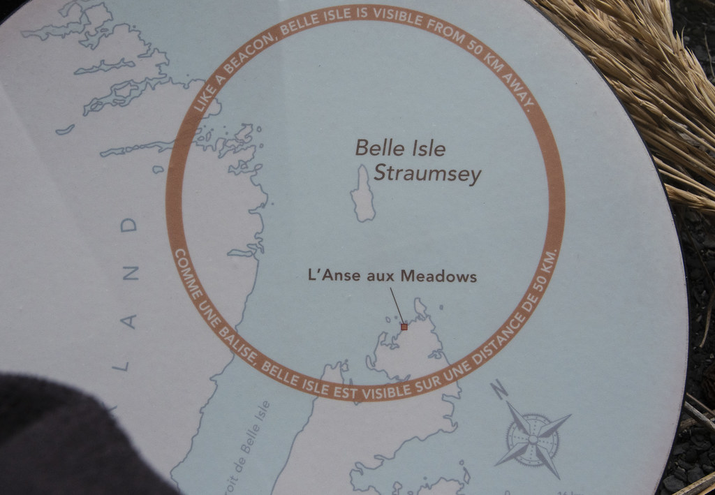
There is a nice museum at L’Anse Aux Meadows National Historic Site.
A “How They Got Here” map was helpful
There is a nice ‘path’ with islands to sail across to Iceland.
Very brave sailing the open Atlantic in a ship like this model
Heading west from Greenland, the sailors would hit what is now the east coast of Labrador, then sail south keeping the coast in view until they sighted Belle Isle which led them straight ahead to L’Anse aux Meadows
This was our “campsite” while at St. Anthony. Our little 26′ RV is parked at the end facing forward. The majority of people on the tour had much larger “Big Rigs”. This was one of the least enjoyable surprises of the Adventure Caravan’s tour. We expected to be staying in more park-like settings, not parking lots. Most of the places we stayed were similar to this. Sometimes gravel, sometimes grass but basically a field with parking spaces, not campsites. Adventure Caravan’s made all the arrangements and honestly we would not have gone to Newfoundland without the planning and organization of Adventure Caravan’s – but be aware that everything is designed around accommodating the Big Rigs. If you have something smaller and more nimble there are nicer places to camp. Not pictured here are two camper vans, a truck-bed camper, a couple class C’s including Jennie’s View, and a few truck-trailer units that were part of our group.
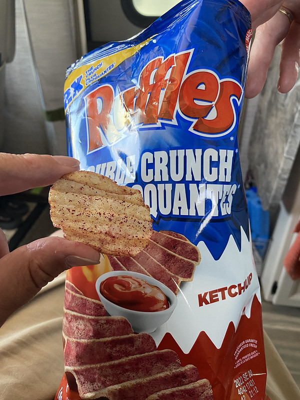
Ketchup Flavored Potato Chips: I did not know such a thing existed. After tasting them I still wonder, why? I tried to like them. Canadians seem to love them as they are everywhere. Maybe an acquired taste but this is one I hope stays in Canada.
Norstead is a reconstruction of a Viking settlement; from around 1,000 AD. Norstead is located near L’Anse aux Meadows (link to Wikipedia if you are interested in the Norse/Viking history of this area). There is so much interesting history about this area; here are two quick ones: 1. The area referred to as “Vinland” in ancient writings was assumed until 1960 to be much further south around Massachusetts until a local farmer on the northern tip of Newfoundland led archeologists to an old “Indian Village” 2. Butternut tree nuts were discovered in excavations. Grape vines and butternut trees grow in similar climate conditions. It seems that 1,000 years ago the climate in this area supported both and helps explain the Vinland reference.
This recreation of a Viking boat (called a Knarr) was sailed in a reenactment from Iceland to L’Anse aux Meadows with 9 person crew in 1998.
Board Games of early settlers
On a dare from Jennie, I sat in the Viking Chieftain’s throne with helmet and sword. Very Chieftain’ish ‘eh
Viking Church at Norstead
Church Interior
Scenes of the coast in area of Norstead and L’Anse aux Meadow
Everywhere there is a mat of Partridgeberry/Lingonberry over soft/squishy peat moss. There are some paths to walk on but where they run out it is wonderful to hike in the soft vegetation.